TopoQuest Logo
Do you find TopoQuest useful?
Help keep TopoQuest running and adding new maps/features by donating!
Bitcoin:  19c7KJd3qBynnjoSw5npx9KScwjBe4ifkT
Litecoin:  LXs6TkuXGGXo1vDsWCkWVdjQX94eUKd6ui
Home View Maps Find Maps Find Places Resources & Links


Baywood, Florida Topographic Map

USGS Map Title: Baywood, FL
USGS Map MRC: 29081F7
DRG (GeoTIFF) Download: o29081f7.tif


Neighboring USGS Topographic Map Quads:


  Gold Head Branch, FL  
29081G8
 

  Rice Creek, FL  
29081G7
 

  Bostwick, FL  
29081G6
 

  Putnam Hall, FL  
29081F8
 

  Baywood, FL  
29081F7
 

  Palatka, FL  
29081F6
 

  Keuka, FL  
29081E8
 

  Rodman, FL  
29081E7
 

  Satsuma, FL  
29081E6


Map MRC Location:

N30°
W82°
N30°
W81°
H8 H7 H6 H5 H4 H3 H2 H1
G8 G7 G6 G5 G4 G3 G2 G1
F8 F7 F6 F5 F4 F3 F2 F1
E8 E7 E6 E5 E4 E3 E2 E1
D8 D7 D6 D5 D4 D3 D2 D1
C8 C7 C6 C5 C4 C3 C2 C1
B8 B7 B6 B5 B4 B3 B2 B1
A8 A7 A6 A5 A4 A3 A2 A1
N29°
W82°
N29°
W81°

Baywood, FL USGS 1:24K Topographic Map Preview:
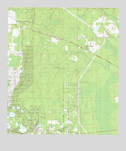
Baywood, FL USGS Topographic Map
Click on map above to begin viewing in our Map Viewer.

This topographic map contains these locations and features:
Feature Name Type Latitude Longitude GNIS ID View Map
BaywoodPopulated PlaceN29.7191°W81.8162°294670View Map
Boll Green LakeLakeN29.6339°W81.8387°279191View Map
CarrawayPopulated PlaceN29.7091°W81.7865°295181View Map
Church LakeLakeN29.6513°W81.8677°280453View Map
First Baptist ChurchChurchN29.6286°W81.8139°2516215View Map
Hickory BranchStreamN29.6525°W81.7920°283949View Map
Hollister Forestry StationTowerN29.6261°W81.7953°2516218View Map
Hollister Post OfficePost OfficeN29.6282°W81.8035°2516216View Map
Hollister Volunteer Fire DepartmentBuildingN29.6265°W81.7983°2516217View Map
Interlachen Lake Estates Volunteer Fire Department Station 17BuildingN29.6717°W81.8608°2644310View Map
Interlachen-Florahome DivisionCivilN29.6318°W81.8719°1935807View Map
Jewel LakeLakeN29.6446°W81.8691°284786View Map
Lake IdaLakeN29.6303°W81.8573°284462View Map
Lake VirginiaLakeN29.6481°W81.8587°307258View Map
Macedonia Missionary Baptist ChurchChurchN29.7119°W81.7850°2516219View Map
MannvillePopulated PlaceN29.6289°W81.8681°295429View Map
Manville Substation Clay Electric Co-opBuildingN29.6281°W81.8350°2516214View Map
Mary Elizabeth CemeteryCemeteryN29.6319°W81.8101°307261View Map
Mary Elizabeth ChurchChurchN29.6322°W81.8101°307263View Map
Mei-Wun CemeteryCemeteryN29.7122°W81.7878°2516221View Map
Mirror LakeLakeN29.6335°W81.8730°286984View Map
Naomi CemeteryCemeteryN29.6325°W81.8245°307260View Map
Naomi ChurchChurchN29.6331°W81.8247°300891View Map
Oldtown BranchStreamN29.6897°W81.7912°288132View Map
Palmetto BranchStreamN29.7019°W81.7851°288431View Map
Pine Lawn CemeteryCemeteryN29.6366°W81.8693°307262View Map
Q I Roberts Middle SchoolSchoolN29.7264°W81.8481°2516222View Map
Rice Creek SwampSwampN29.6587°W81.7616°289664View Map
Sand Hill PondLakeN29.6424°W81.8739°1988422View Map
Seventh Day Adventist ChurchChurchN29.7128°W81.7886°2516220View Map
Up and Down LakeLakeN29.6352°W81.8641°292698View Map
Violet LakeLakeN29.6513°W81.8626°292778View Map
William Panton GrantCivilN29.6775°W81.7640°303951View Map

Note: Coordinates in the location and feature list above are referenced to NAD83 datum.


Copyright (C) 2008-2024 Ryan Niemi / Sunset Dynamics ... All Rights Reserved