TopoQuest Logo
Do you find TopoQuest useful?
Help keep TopoQuest running and adding new maps/features by donating!
Bitcoin:  19c7KJd3qBynnjoSw5npx9KScwjBe4ifkT
Litecoin:  LXs6TkuXGGXo1vDsWCkWVdjQX94eUKd6ui
Home View Maps Find Maps Find Places Resources & Links


Rockport, Washington Topographic Map

USGS Map Title: Rockport, WA
USGS Map MRC: 48121D5
DRG (GeoTIFF) Download: o48121d5.tif


Neighboring USGS Topographic Map Quads:


  Lake Shannon, WA  
48121E6
 

  Sauk Mountain, WA  
48121E5
 

  Marblemount, WA  
48121E4
 

  Finney Peak, WA  
48121D6
 

  Rockport, WA  
48121D5
 

  Illabot Peaks, WA  
48121D4
 

  Fortson, WA  
48121C6
 

  Darrington, WA  
48121C5
 

  Prairie Mountain, WA  
48121C4


Map MRC Location:

N49°
W122°
N49°
W121°
H8 H7 H6 H5 H4 H3 H2 H1
G8 G7 G6 G5 G4 G3 G2 G1
F8 F7 F6 F5 F4 F3 F2 F1
E8 E7 E6 E5 E4 E3 E2 E1
D8 D7 D6 D5 D4 D3 D2 D1
C8 C7 C6 C5 C4 C3 C2 C1
B8 B7 B6 B5 B4 B3 B2 B1
A8 A7 A6 A5 A4 A3 A2 A1
N48°
W122°
N48°
W121°

Rockport, WA USGS 1:24K Topographic Map Preview:
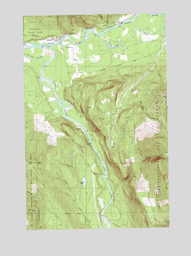
Rockport, WA USGS Topographic Map
Click on map above to begin viewing in our Map Viewer.

This topographic map contains these locations and features:
Feature Name Type Latitude Longitude GNIS ID View Map
Barnaby SloughSwampN48.4819°W121.5510°1516144View Map
Barnaby Slough Number TwoSwampN48.4776°W121.5481°1532129View Map
Barnaby Slough Number Two DamDamN48.4782°W121.5512°1532128View Map
Barr CreekStreamN48.4923°W121.5499°1516159View Map
Caskey LakeLakeN48.4020°W121.5747°1517457View Map
Concrete Sauk Valley Road BridgeBridgeN48.4849°W121.5932°2608023View Map
Flume CreekStreamN48.4057°W121.5599°1519660View Map
Hidden Valley RanchLocaleN48.4340°W121.5787°1520767View Map
Hilt CreekStreamN48.4468°W121.5846°1520813View Map
Hilt LakeLakeN48.4235°W121.5500°1520814View Map
Howard Miller Steelhead Recreational Vehicle ParkLocaleN48.4839°W121.5984°2608268View Map
Illabot CreekStreamN48.4957°W121.5312°1521138View Map
Middle Branch North Fork Stillaguamish RiverStreamN48.3843°W121.6168°1523050View Map
Rinker PointSummitN48.4140°W121.6165°1525063View Map
Rinker RidgeRidgeN48.4140°W121.6165°1525064View Map
RockportPopulated PlaceN48.4857°W121.5976°1525156View Map
Rockport Census Designated PlaceCensusN48.4854°W121.6066°2409196View Map
Rockport Post OfficePost OfficeN48.4850°W121.5982°2607011View Map
Rockport State ParkParkN48.4882°W121.6151°1525157View Map
Sauk RiverStreamN48.4815°W121.6057°1525452View Map
Skagit County Fire District 19 Rockport Fire DepartmentBuildingN48.4865°W121.5973°2643585View Map
Suiattle MountainSummitN48.4007°W121.5015°1526674View Map
Sutter CreekStreamN48.4932°W121.5451°1526809View Map
White CreekStreamN48.3976°W121.5524°1528057View Map

Note: Coordinates in the location and feature list above are referenced to NAD83 datum.


Copyright (C) 2008-2025 Ryan Niemi / Sunset Dynamics ... All Rights Reserved