TopoQuest Logo
Do you find TopoQuest useful?
Help keep TopoQuest running and adding new maps/features by donating!
Bitcoin:  19c7KJd3qBynnjoSw5npx9KScwjBe4ifkT
Litecoin:  LXs6TkuXGGXo1vDsWCkWVdjQX94eUKd6ui
Home View Maps Find Maps Find Places Resources & Links


Marcella, Mississippi Topographic Map

USGS Map Title: Marcella, MS
USGS Map MRC: 33090B3
DRG (GeoTIFF) Download: o33090b3.tif


Neighboring USGS Topographic Map Quads:


  Swiftown, MS  
33090C4
 

  Montgomery, MS  
33090C3
 

  Cruger, MS  
33090C2
 

  Belzoni, MS  
33090B4
 

  Marcella, MS  
33090B3
 

  Tchula, MS  
33090B2
 

  Silver City, MS  
33090A4
 

  Thornton, MS  
33090A3
 

  Howard, MS  
33090A2


Map MRC Location:

N34°
W91°
N34°
W90°
H8 H7 H6 H5 H4 H3 H2 H1
G8 G7 G6 G5 G4 G3 G2 G1
F8 F7 F6 F5 F4 F3 F2 F1
E8 E7 E6 E5 E4 E3 E2 E1
D8 D7 D6 D5 D4 D3 D2 D1
C8 C7 C6 C5 C4 C3 C2 C1
B8 B7 B6 B5 B4 B3 B2 B1
A8 A7 A6 A5 A4 A3 A2 A1
N33°
W91°
N33°
W90°

Marcella, MS USGS 1:24K Topographic Map Preview:
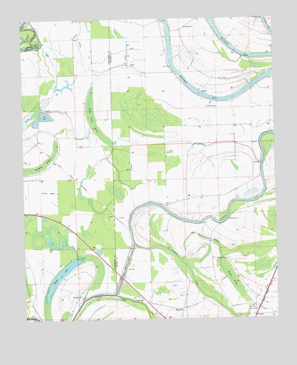
Marcella, MS USGS Topographic Map
Click on map above to begin viewing in our Map Viewer.

This topographic map contains these locations and features:
Feature Name Type Latitude Longitude GNIS ID View Map
Annie York ChurchChurchN33.1293°W90.2604°666277View Map
Belmont Landing (historical)LocaleN33.1676°W90.2820°706586View Map
Blanch ChapelChurchN33.2246°W90.2748°667265View Map
ButlerPopulated PlaceN33.2276°W90.2990°691741View Map
ChoctawPopulated PlaceN33.1729°W90.3045°691766View Map
Choctaw Landing (historical)LocaleN33.1448°W90.2923°706601View Map
Dawson (historical)LocaleN33.1312°W90.2579°684291View Map
Eagle LakeLakeN33.1432°W90.3571°669543View Map
Fannegusha CreekStreamN33.1496°W90.2970°669908View Map
Farm Service Agency Interest of MississippiParkN33.2169°W90.3375°2765294View Map
Grassy LakeLakeN33.1523°W90.3662°670606View Map
Graves Landing (historical)LocaleN33.2001°W90.2573°706630View Map
Holly Bank Landing (historical)LocaleN33.2021°W90.2531°706636View Map
Hookers Woodyard Landing (historical)LocaleN33.1746°W90.3212°706639View Map
Horseshoe ChapelChurchN33.2129°W90.2790°684303View Map
Horseshoe ChurchChurchN33.2465°W90.2937°684304View Map
Horseshoe LakeLakeN33.2217°W90.2914°671505View Map
Kiern and Jones Landing (historical)LocaleN33.2473°W90.2537°706645View Map
Manchester Landing (historical)LocaleN33.1262°W90.3709°707030View Map
MarcellaPopulated PlaceN33.1296°W90.2976°673128View Map
Marcella CemeteryCemeteryN33.1335°W90.3198°673129View Map
Marcella ChurchChurchN33.1335°W90.3198°673130View Map
Marcella Landing (historical)LocaleN33.1518°W90.3012°706652View Map
Marcella Quarters Landing (historical)LocaleN33.1487°W90.2973°706653View Map
Marcella Quarters Landing (historical)LocaleN33.1321°W90.3181°706654View Map
Mathena BrakeSwampN33.1875°W90.3744°673231View Map
Mount Everet ChurchChurchN33.2304°W90.3006°673991View Map
Mount Harmon ChurchChurchN33.1668°W90.2731°674015View Map
Mount Rosies ChurchChurchN33.1790°W90.2640°674257View Map
Mount Sinai ChurchChurchN33.2493°W90.2554°674275View Map
Old Fannegusha CreekStreamN33.1490°W90.2973°684313View Map
Palmatree IslandIslandN33.2432°W90.3709°684222View Map
Pinkerton Lake DamDamN33.1901°W90.3334°681910View Map
Ray Ann Chapel SchoolSchoolN33.2323°W90.2762°676498View Map
RefugePopulated PlaceN33.1371°W90.3345°676589View Map
Snake Creek BrakeSwampN33.2083°W90.3385°677959View Map
Tallequah Landing (historical)LocaleN33.1651°W90.2806°706697View Map
Thornton Place Landing (historical)LocaleN33.1376°W90.2890°706699View Map
Tomes ChapelChurchN33.2337°W90.2765°678810View Map
Watsons Landing (historical)LocaleN33.1282°W90.3504°707052View Map
WestfieldPopulated PlaceN33.1260°W90.2609°679538View Map
Zion City ChurchChurchN33.1729°W90.3045°680003View Map

Note: Coordinates in the location and feature list above are referenced to NAD83 datum.


Copyright (C) 2008-2024 Ryan Niemi / Sunset Dynamics ... All Rights Reserved