TopoQuest Logo
Do you find TopoQuest useful?
Help keep TopoQuest running and adding new maps/features by donating!
Bitcoin:  19c7KJd3qBynnjoSw5npx9KScwjBe4ifkT
Litecoin:  LXs6TkuXGGXo1vDsWCkWVdjQX94eUKd6ui
Home View Maps Find Maps Find Places Resources & Links


Marine City, Michigan Topographic Map

USGS Map Title: Marine City, MI
USGS Map MRC: 42082F5
DRG (GeoTIFF) Download: o42082f5.tif


Neighboring USGS Topographic Map Quads:


  Adair, MI  
42082G6
 

  Rattle Run, MI  
42082G5
 

  St. Clair, MI  
42082G4
 

  New Baltimore, MI  
42082F6
 

  Marine City, MI  
42082F5


  Saint Clair Flats, MI  
42082E6
 

  Algonac, MI  
42082E5


Map MRC Location:

N43°
W83°
N43°
W82°
H8 H7 H6 H5 H4 H3 H2 H1
G8 G7 G6 G5 G4 G3 G2 G1
F8 F7 F6 F5 F4 F3 F2 F1
E8 E7 E6 E5 E4 E3 E2 E1
D8 D7 D6 D5 D4 D3 D2 D1
C8 C7 C6 C5 C4 C3 C2 C1
B8 B7 B6 B5 B4 B3 B2 B1
A8 A7 A6 A5 A4 A3 A2 A1
N42°
W83°
N42°
W82°

Marine City, MI USGS 1:24K Topographic Map Preview:
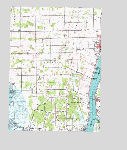
Marine City, MI USGS Topographic Map
Click on map above to begin viewing in our Map Viewer.

This topographic map contains these locations and features:
Feature Name Type Latitude Longitude GNIS ID View Map
Algonac High SchoolSchoolN42.6273°W82.5824°1624343View Map
Algonac State ParkParkN42.6559°W82.5302°1624344View Map
Algonac-Clay LibraryBuildingN42.6272°W82.5233°2582217View Map
Avalon BeachPopulated PlaceN42.6889°W82.5082°1624358View Map
Beaubien CreekStreamN42.6631°W82.6152°1624373View Map
Beaverdam DrainStreamN42.6559°W82.6027°1624376View Map
Belle River Elementary SchoolSchoolN42.7008°W82.5097°2582132View Map
Broadbridge StationPopulated PlaceN42.6786°W82.5119°1624417View Map
Cherry BeachPopulated PlaceN42.6848°W82.5096°1624453View Map
China Belle Oil and Gas FieldOilfieldN42.7406°W82.5346°1624454View Map
China South Gas FieldOilfieldN42.7267°W82.5466°1624455View Map
City of Marine CityCivilN42.7153°W82.5022°1626687View Map
Colony Tower Historical MarkerParkN42.6322°W82.6156°2581672View Map
Copeland CornerPopulated PlaceN42.6725°W82.6224°1624474View Map
Cottrellville Oil and Gas FieldOilfieldN42.7067°W82.6030°1624478View Map
Gleaners HallLocaleN42.7342°W82.5502°1624561View Map
Holy Cross CemeteryCemeteryN42.7084°W82.5082°1624610View Map
Locust PointCapeN42.6281°W82.5180°1624689View Map
Long Land Farm Landing Strip (historical)AirportN42.6700°W82.5219°1624259View Map
Marine City AirportAirportN42.7244°W82.5949°1624323View Map
Marine City DrainStreamN42.6306°W82.5169°1624707View Map
Marine City Fire DepartmentBuildingN42.7191°W82.5010°2582129View Map
Marine City High SchoolSchoolN42.7139°W82.5069°2582133View Map
Marine City LibraryBuildingN42.7169°W82.5008°2582128View Map
Marine City Oil FieldOilfieldN42.7106°W82.5302°1624708View Map
Marine City South Oil and Gas FieldOilfieldN42.6775°W82.5216°1624709View Map
Martindale BeachPopulated PlaceN42.6914°W82.5074°1624714View Map
Pearl BeachPopulated PlaceN42.6267°W82.5977°1624814View Map
Pearl Beach Census Designated PlaceCensusN42.6260°W82.5945°2393181View Map
Pearl Beach Post OfficePost OfficeN42.6267°W82.5978°2581490View Map
Perch PointPopulated PlaceN42.6650°W82.6202°1624817View Map
Roberts LandingLocaleN42.6586°W82.5149°1624260View Map
Roberts LandingPopulated PlaceN42.6598°W82.5157°1624867View Map
Roberts Landing Post Office (historical)Post OfficeN42.6597°W82.5158°2581482View Map
Saint Catherine CemeteryCemeteryN42.6270°W82.5416°1624879View Map
Saint Clair River Historical MarkerParkN42.6470°W82.5139°2581675View Map
Salt Dock LightLocaleN42.6878°W82.5060°1624258View Map
Smith CemeteryCemeteryN42.6967°W82.5455°1624934View Map
Starrville Post Office (historical)Post OfficeN42.6811°W82.5878°2581478View Map
StarvillePopulated PlaceN42.6811°W82.5877°1624954View Map
Starville CemeteryCemeteryN42.6833°W82.5897°2581629View Map
Starville ChurchChurchN42.6828°W82.5883°2582119View Map
Swartout CreekStreamN42.6334°W82.5949°1624974View Map
Tag-A-Long Trailer CourtPopulated PlaceN42.6925°W82.5083°2582130View Map
Township of CottrellvilleCivilN42.6946°W82.5559°1626136View Map
Ward-Cottrell High SchoolSchoolN42.7148°W82.5069°1625001View Map
Willow Point LightLocaleN42.6442°W82.5130°1624261View Map
WSMA-AM (Marine City)TowerN42.7284°W82.5207°1625263View Map

Note: Coordinates in the location and feature list above are referenced to NAD83 datum.


Copyright (C) 2008-2024 Ryan Niemi / Sunset Dynamics ... All Rights Reserved