TopoQuest Logo
Do you find TopoQuest useful?
Help keep TopoQuest running and adding new maps/features by donating!
Bitcoin:  19c7KJd3qBynnjoSw5npx9KScwjBe4ifkT
Litecoin:  LXs6TkuXGGXo1vDsWCkWVdjQX94eUKd6ui
Home View Maps Find Maps Find Places Resources & Links


St. Clair, Michigan Topographic Map

USGS Map Title: St. Clair, MI
USGS Map MRC: 42082G4
DRG (GeoTIFF) Download: o42082g4.tif


Neighboring USGS Topographic Map Quads:


  Smiths Creek, MI  
42082H5
 

  Port Huron, MI  
42082H4


  Rattle Run, MI  
42082G5
 

  St. Clair, MI  
42082G4


  Marine City, MI  
42082F5


Map MRC Location:

N43°
W83°
N43°
W82°
H8 H7 H6 H5 H4 H3 H2 H1
G8 G7 G6 G5 G4 G3 G2 G1
F8 F7 F6 F5 F4 F3 F2 F1
E8 E7 E6 E5 E4 E3 E2 E1
D8 D7 D6 D5 D4 D3 D2 D1
C8 C7 C6 C5 C4 C3 C2 C1
B8 B7 B6 B5 B4 B3 B2 B1
A8 A7 A6 A5 A4 A3 A2 A1
N42°
W83°
N42°
W82°

St. Clair, MI USGS 1:24K Topographic Map Preview:
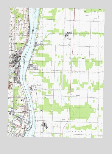
St. Clair, MI USGS Topographic Map
Click on map above to begin viewing in our Map Viewer.

This topographic map contains these locations and features:
Feature Name Type Latitude Longitude GNIS ID View Map
City of Saint ClairCivilN42.8262°W82.4929°1627024View Map
Community Christian AssemblyChurchN42.8597°W82.4800°2582063View Map
Diamond Crystal Salt Company Historical MarkerParkN42.8183°W82.4870°2581703View Map
Dock UpperlightLocaleN42.7650°W82.4713°1624245View Map
East Branch Jordan CreekStreamN42.8384°W82.4927°1624503View Map
East China Fractional District Number Two School Historical MarkerParkN42.7538°W82.4900°2581678View Map
Eddy SchoolSchoolN42.8231°W82.4938°1624506View Map
First Baptist Church of Saint Clair Historical MarkerParkN42.8232°W82.4888°2581696View Map
First Congregational ChurchChurchN42.8250°W82.4875°2582068View Map
First Congregational Church Historical MarkerParkN42.8247°W82.4877°2581697View Map
First United Methodist ChurchChurchN42.8328°W82.4875°2582069View Map
Harts Landing LightLocaleN42.7848°W82.4749°1624246View Map
HawthornePopulated PlaceN42.7734°W82.4727°1624599View Map
Hillside CemeteryCemeteryN42.8081°W82.4907°1624605View Map
Immanuel Lutheran ChurchChurchN42.8278°W82.4936°2582064View Map
Pine RiverStreamN42.8203°W82.4855°1624827View Map
Pine Shore Golf CourseLocaleN42.8125°W82.4927°1624828View Map
Pointe DrainCanalN42.7525°W82.4788°1624257View Map
Recors PointCapeN42.7625°W82.4719°1624225View Map
River District HospitalHospitalN42.7798°W82.4796°1624858View Map
Rivers Edge a Quiet Community Mobile Home ParkPopulated PlaceN42.8067°W82.4878°2582077View Map
Riverview East High SchoolSchoolN42.8264°W82.4908°2582075View Map
Rose Hill CemeteryCemeteryN42.7859°W82.4880°1624872View Map
Saint ClairPopulated PlaceN42.8209°W82.4860°1624881View Map
Saint Clair Area Fire DepartmentBuildingN42.8228°W82.4877°2582073View Map
Saint Clair Church of ChristChurchN42.8233°W82.4928°2582065View Map
Saint Clair Historical MusuemBuildingN42.8236°W82.4892°2582072View Map
Saint Clair Inn Historical MarkerParkN42.8276°W82.4849°2581698View Map
Saint Clair Middle GroundBarN42.8275°W82.4791°1624224View Map
Saint Clair Middle SchoolSchoolN42.8472°W82.4903°2582076View Map
Saint Clair Post OfficePost OfficeN42.8233°W82.4875°2582074View Map
Saint Clair River Country ClubLocaleN42.8361°W82.4766°1624886View Map
Saint Clair Springs Post Office (historical)Post OfficeN42.8000°W82.4833°2581480View Map
Saint Clair StationLocaleN42.8231°W82.4983°2582242View Map
Saint John River District HospitalHospitalN42.7852°W82.4795°2340670View Map
Saint Mary's Catholic ChurchChurchN42.8278°W82.4903°2582070View Map
Saint Mary's Church Historical MarkerParkN42.8273°W82.4903°2581699View Map
Saint Mary's Rectory Historical MarkerParkN42.8274°W82.4903°2581700View Map
Saint Marys CemeteryCemeteryN42.8431°W82.4938°1624898View Map
Saint Marys SchoolSchoolN42.8220°W82.4913°1624900View Map
Saint Paul's Episcopal ChurchChurchN42.8253°W82.4908°2582066View Map
Saint Peter's Lutheran ChurchChurchN42.8247°W82.4908°2582067View Map
Township of East ChinaCivilN42.7645°W82.4892°1626203View Map
Township ParkParkN42.7570°W82.4874°1624296View Map
Tri - Hospital Emergency Medical Services Station 3BuildingN42.7850°W82.4804°2662132View Map
WPHM-AM (Port Huron)TowerN42.8639°W82.4944°1625289View Map
WTTHTowerN42.8639°W82.4935°1624244View Map

Note: Coordinates in the location and feature list above are referenced to NAD83 datum.


Copyright (C) 2008-2024 Ryan Niemi / Sunset Dynamics ... All Rights Reserved