TopoQuest Logo
Do you find TopoQuest useful?
Help keep TopoQuest running and adding new maps/features by donating!
Bitcoin:  19c7KJd3qBynnjoSw5npx9KScwjBe4ifkT
Litecoin:  LXs6TkuXGGXo1vDsWCkWVdjQX94eUKd6ui
Home View Maps Find Maps Find Places Resources & Links


Rattle Run, Michigan Topographic Map

USGS Map Title: Rattle Run, MI
USGS Map MRC: 42082G5
DRG (GeoTIFF) Download: o42082g5.tif


Neighboring USGS Topographic Map Quads:


  Goodells, MI  
42082H6
 

  Smiths Creek, MI  
42082H5
 

  Port Huron, MI  
42082H4
 

  Adair, MI  
42082G6
 

  Rattle Run, MI  
42082G5
 

  St. Clair, MI  
42082G4
 

  New Baltimore, MI  
42082F6
 

  Marine City, MI  
42082F5


Map MRC Location:

N43°
W83°
N43°
W82°
H8 H7 H6 H5 H4 H3 H2 H1
G8 G7 G6 G5 G4 G3 G2 G1
F8 F7 F6 F5 F4 F3 F2 F1
E8 E7 E6 E5 E4 E3 E2 E1
D8 D7 D6 D5 D4 D3 D2 D1
C8 C7 C6 C5 C4 C3 C2 C1
B8 B7 B6 B5 B4 B3 B2 B1
A8 A7 A6 A5 A4 A3 A2 A1
N42°
W83°
N42°
W82°

Rattle Run, MI USGS 1:24K Topographic Map Preview:
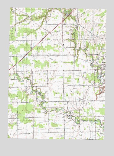
Rattle Run, MI USGS Topographic Map
Click on map above to begin viewing in our Map Viewer.

This topographic map contains these locations and features:
Feature Name Type Latitude Longitude GNIS ID View Map
Adair Gas and Oil FieldOilfieldN42.7895°W82.6158°1624338View Map
Angel CreekStreamN42.8370°W82.5335°1624354View Map
Balfour CemeteryCemeteryN42.7750°W82.5760°1624367View Map
Belle River MillsLocaleN42.7728°W82.5505°1624382View Map
Belle River Mills Gas Storage AreaOilfieldN42.7903°W82.5241°1624383View Map
Big Hand DrainStreamN42.8467°W82.6038°1624301View Map
Bowman CemeteryCemeteryN42.8470°W82.5141°1624407View Map
Bowman DrainStreamN42.8253°W82.5157°1624304View Map
Brandywine CreekStreamN42.8364°W82.5252°1624412View Map
Camp HawthornLocaleN42.8714°W82.6235°1624295View Map
Camp Otsikea (historical)LocaleN42.8492°W82.5385°1624436View Map
Crossroads Community ChurchChurchN42.7986°W82.5128°2582173View Map
Crystal AirportAirportN42.8339°W82.5348°1624330View Map
David's LandingAirportN42.7990°W82.5373°1624329View Map
East China SchoolSchoolN42.7561°W82.5052°1624504View Map
Eschenburg DrainStreamN42.7964°W82.5982°1624305View Map
First Baptist ChurchChurchN42.8300°W82.5006°2582081View Map
Gearing Elementary SchoolSchoolN42.8275°W82.5019°2582083View Map
Harris DrainStreamN42.7675°W82.5127°1624590View Map
Hextell DrainStreamN42.7786°W82.5349°1624306View Map
Hurst DrainStreamN42.8359°W82.5271°1624620View Map
Interchange 262CrossingN42.8631°W82.5569°2581613View Map
Jehovah's WitnessesChurchN42.8153°W82.5736°2582172View Map
Jordan CreekStreamN42.8134°W82.5007°1624635View Map
Kreusel DrainStreamN42.7706°W82.5427°1624307View Map
Mackley DrainStreamN42.8531°W82.5921°1624302View Map
Milton J Gearing SchoolSchoolN42.8270°W82.5019°1624298View Map
Moak DrainStreamN42.8684°W82.5460°1624748View Map
Pauly DrainStreamN42.8414°W82.5491°1624303View Map
Pine River SchoolSchoolN42.8000°W82.5130°1624299View Map
Rattle RunPopulated PlaceN42.8664°W82.5996°1624852View Map
Rattle Run CemeteryCemeteryN42.8647°W82.5985°1624297View Map
Rattlerun Post Office (historical)Post OfficeN42.8664°W82.5997°2581487View Map
Saint Clair City Police DepartmentBuildingN42.8316°W82.5030°2582080View Map
Saint Clair High SchoolSchoolN42.8236°W82.5122°2582082View Map
Saint Clair Landing Shopping CenterLocaleN42.8186°W82.5047°2582079View Map
Saint Clair Landing Shopping CenterLocaleN42.8196°W82.5030°2344698View Map
Saint Clair Place Mobile Home ParkPopulated PlaceN42.8278°W82.5103°2582078View Map
Saint Marys CemeteryCemeteryN42.8222°W82.5171°1624897View Map
Salem ChurchChurchN42.7573°W82.5271°1624908View Map
Schneider China DrainStreamN42.7650°W82.5344°1624918View Map
Sheldon DrainStreamN42.8681°W82.5780°1624927View Map
Township of ChinaCivilN42.7720°W82.5577°1626077View Map
Township of Saint ClairCivilN42.8605°W82.5529°1627025View Map
Wenning Landing AreaAirportN42.7584°W82.5536°1624324View Map
Wolf DrainStreamN42.8539°W82.5419°1624300View Map

Note: Coordinates in the location and feature list above are referenced to NAD83 datum.


Copyright (C) 2008-2025 Ryan Niemi / Sunset Dynamics ... All Rights Reserved