TopoQuest Logo
Do you find TopoQuest useful?
Help keep TopoQuest running and adding new maps/features by donating!
Bitcoin:  19c7KJd3qBynnjoSw5npx9KScwjBe4ifkT
Litecoin:  LXs6TkuXGGXo1vDsWCkWVdjQX94eUKd6ui
Home View Maps Find Maps Find Places Resources & Links


Mariposa Peak, California Topographic Map

USGS Map Title: Mariposa Peak, CA
USGS Map MRC: 36121H2
DRG (GeoTIFF) Download: o36121h2.tif


Neighboring USGS Topographic Map Quads:


  Pacheco Peak, CA  
37121A3
 

  Pacheco Pass, CA  
37121A2
 

  San Luis Dam, CA  
37121A1
 

  Three Sisters, CA  
36121H3
 

  Mariposa Peak, CA  
36121H2
 

  Los Banos Valley, CA  
36121H1
 

  Tres Pinos, CA  
36121G3
 

  Quien Sabe Valley, CA  
36121G2
 

  Ruby Canyon, CA  
36121G1


Map MRC Location:

N37°
W122°
N37°
W121°
H8 H7 H6 H5 H4 H3 H2 H1
G8 G7 G6 G5 G4 G3 G2 G1
F8 F7 F6 F5 F4 F3 F2 F1
E8 E7 E6 E5 E4 E3 E2 E1
D8 D7 D6 D5 D4 D3 D2 D1
C8 C7 C6 C5 C4 C3 C2 C1
B8 B7 B6 B5 B4 B3 B2 B1
A8 A7 A6 A5 A4 A3 A2 A1
N36°
W122°
N36°
W121°

Mariposa Peak, CA USGS 1:24K Topographic Map Preview:
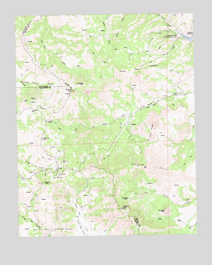
Mariposa Peak, CA USGS Topographic Map
Click on map above to begin viewing in our Map Viewer.

This topographic map contains these locations and features:
Feature Name Type Latitude Longitude GNIS ID View Map
Ambrose MineMineN36.9530°W121.2380°218220View Map
Antimony PeakSummitN36.9302°W121.2338°254569View Map
Buck PassGapN36.9136°W121.1633°220002View Map
Cathedral PeakSummitN36.9608°W121.2041°1658238View Map
Comstock CanyonValleyN36.9613°W121.2444°221436View Map
French RanchLocaleN36.9466°W121.2380°223916View Map
Frenchs PassGapN36.9402°W121.2299°223924View Map
Henrietta PeakSummitN36.9050°W121.2335°225180View Map
Jacks HillSummitN36.9519°W121.2460°226067View Map
Laveaga PeakSummitN36.8905°W121.1780°226961View Map
Log Trough SpringSpringN36.8959°W121.1740°227471View Map
Mariposa MineMineN36.9555°W121.2171°228109View Map
Mariposa PeakSummitN36.9572°W121.2124°228111View Map
Mount AraratSummitN36.9674°W121.1796°218332View Map
Peckham RidgeRidgeN36.9122°W121.1563°230461View Map
Pfeiffer RanchLocaleN36.8822°W121.1366°230589View Map
Portuguese CreekStreamN36.9869°W121.1355°230967View Map
Saint Marys PeakSummitN36.8880°W121.1483°232221View Map
Stayton MineMineN36.9172°W121.2196°235411View Map
Twin PeaksSummitN36.9372°W121.1555°1660055View Map

Note: Coordinates in the location and feature list above are referenced to NAD83 datum.


Copyright (C) 2008-2025 Ryan Niemi / Sunset Dynamics ... All Rights Reserved