TopoQuest Logo
Do you find TopoQuest useful?
Help keep TopoQuest running and adding new maps/features by donating!
Bitcoin:  19c7KJd3qBynnjoSw5npx9KScwjBe4ifkT
Litecoin:  LXs6TkuXGGXo1vDsWCkWVdjQX94eUKd6ui
Home View Maps Find Maps Find Places Resources & Links


Three Sisters, California Topographic Map

USGS Map Title: Three Sisters, CA
USGS Map MRC: 36121H3
DRG (GeoTIFF) Download: o36121h3.tif


Neighboring USGS Topographic Map Quads:


  Gilroy Hot Springs, CA  
37121A4
 

  Pacheco Peak, CA  
37121A3
 

  Pacheco Pass, CA  
37121A2
 

  San Felipe, CA  
36121H4
 

  Three Sisters, CA  
36121H3
 

  Mariposa Peak, CA  
36121H2
 

  Hollister, CA  
36121G4
 

  Tres Pinos, CA  
36121G3
 

  Quien Sabe Valley, CA  
36121G2


Map MRC Location:

N37°
W122°
N37°
W121°
H8 H7 H6 H5 H4 H3 H2 H1
G8 G7 G6 G5 G4 G3 G2 G1
F8 F7 F6 F5 F4 F3 F2 F1
E8 E7 E6 E5 E4 E3 E2 E1
D8 D7 D6 D5 D4 D3 D2 D1
C8 C7 C6 C5 C4 C3 C2 C1
B8 B7 B6 B5 B4 B3 B2 B1
A8 A7 A6 A5 A4 A3 A2 A1
N36°
W122°
N36°
W121°

Three Sisters, CA USGS 1:24K Topographic Map Preview:
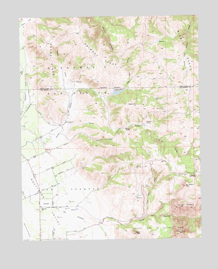
Three Sisters, CA USGS Topographic Map
Click on map above to begin viewing in our Map Viewer.

This topographic map contains these locations and features:
Feature Name Type Latitude Longitude GNIS ID View Map
Ausaymas Y San FelipeCivilN36.9658°W121.3597°218465View Map
Chimney RidgeRidgeN36.9763°W121.3210°221002View Map
Coyote PeakSummitN36.8783°W121.2969°221758View Map
Dunne RidgeRidgeN36.9761°W121.3555°222738View Map
Fairview SchoolSchoolN36.8936°W121.3624°223353View Map
Garcia RanchoLocaleN36.9369°W121.3041°224038View Map
Hawkins 651 DamDamN36.9566°W121.3124°1664003View Map
Hawkins LakeReservoirN36.9575°W121.3084°225036View Map
Hawkins RanchLocaleN36.9402°W121.3460°225037View Map
Hollister ConduitCanalN36.8994°W121.3461°2680161View Map
Little Peak CanyonValleyN36.9594°W121.3035°227325View Map
Lone Tree CreekStreamN36.8877°W121.2891°227524View Map
Messic MountainSummitN36.9499°W121.2977°228539View Map
Rancho Las CimasLocaleN36.9102°W121.2541°231225View Map
San JoaquinCivilN36.9008°W121.3497°232405View Map
San Joaquin PeakSummitN36.9047°W121.2619°232412View Map
Santa Ana MountainSummitN36.8780°W121.2638°232535View Map
Sparling RanchLocaleN36.9402°W121.2888°235172View Map
Spring Grove Elementary SchoolSchoolN36.9148°W121.3592°2518300View Map
Sulfur CreekStreamN36.9558°W121.3419°235690View Map
Three SistersSummitN36.8925°W121.2566°1659997View Map
Wildcat CanyonValleyN36.9652°W121.2508°237773View Map

Note: Coordinates in the location and feature list above are referenced to NAD83 datum.


Copyright (C) 2008-2025 Ryan Niemi / Sunset Dynamics ... All Rights Reserved