TopoQuest Logo
Do you find TopoQuest useful?
Help keep TopoQuest running and adding new maps/features by donating!
Bitcoin:  19c7KJd3qBynnjoSw5npx9KScwjBe4ifkT
Litecoin:  LXs6TkuXGGXo1vDsWCkWVdjQX94eUKd6ui
Home View Maps Find Maps Find Places Resources & Links


Markleeville, California Topographic Map

USGS Map Title: Markleeville, CA
USGS Map MRC: 38119F7
DRG (GeoTIFF) Download: o38119f7.tif


Neighboring USGS Topographic Map Quads:


  Freel Peak, CA  
38119G8
 

  Woodfords, CA  
38119G7
 

  Carters Station, NV  
38119G6
 

  Carson Pass, CA  
38119F8
 

  Markleeville, CA  
38119F7
 

  Heenan Lake, CA  
38119F6
 

  Pacific Valley, CA  
38119E8
 

  Ebbetts Pass, CA  
38119E7
 

  Wolf Creek, CA  
38119E6


Map MRC Location:

N39°
W120°
N39°
W119°
H8 H7 H6 H5 H4 H3 H2 H1
G8 G7 G6 G5 G4 G3 G2 G1
F8 F7 F6 F5 F4 F3 F2 F1
E8 E7 E6 E5 E4 E3 E2 E1
D8 D7 D6 D5 D4 D3 D2 D1
C8 C7 C6 C5 C4 C3 C2 C1
B8 B7 B6 B5 B4 B3 B2 B1
A8 A7 A6 A5 A4 A3 A2 A1
N38°
W120°
N38°
W119°

Markleeville, CA USGS 1:24K Topographic Map Preview:
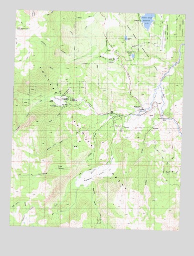
Markleeville, CA USGS Topographic Map
Click on map above to begin viewing in our Map Viewer.

This topographic map contains these locations and features:
Feature Name Type Latitude Longitude GNIS ID View Map
Alpine County AirportAirportN38.7332°W119.7672°1653727View Map
Alpine County CourthouseBuildingN38.6941°W119.7793°1733658View Map
Alpine County Free LibraryBuildingN38.6946°W119.7805°1733659View Map
Alpine County Law LibraryBuildingN38.6941°W119.7793°1733660View Map
Alpine County Sheriff's Office HeadquartersBuildingN38.6946°W119.7789°2755920View Map
Buck CreekStreamN38.6985°W119.8421°257561View Map
Burnside Lake TrailTrailN38.7010°W119.8652°1733663View Map
Charity Valley CreekStreamN38.6996°W119.8749°258214View Map
Curtz LakeLakeN38.7252°W119.7888°258998View Map
Grover Hot SpringsSpringN38.6955°W119.8435°274737View Map
Grover Hot Springs State ParkParkN38.7005°W119.8377°260971View Map
Hangmans BridgeLocaleN38.6896°W119.7649°261064View Map
Hawkins PeakSummitN38.7385°W119.8724°261164View Map
Historical Society of Alpine County MuseumBuildingN38.6949°W119.7807°1733666View Map
Hot Springs CreekStreamN38.6910°W119.7896°1654920View Map
Hot Springs TrailTrailN38.6980°W119.8405°1733667View Map
Hot Springs ValleyValleyN38.6966°W119.8224°1662355View Map
Indian CreekStreamN38.6896°W119.7655°261718View Map
Indian Creek CampgroundLocaleN38.7457°W119.7843°274760View Map
Indian Creek Recreation LandsParkN38.7307°W119.7816°266848View Map
Indian Creek ReservoirReservoirN38.7473°W119.7789°234069View Map
Jeff Davis CreekStreamN38.6341°W119.8621°261916View Map
Marklee VillagePopulated PlaceN38.6896°W119.7982°1733668View Map
MarkleevillePopulated PlaceN38.6949°W119.7802°1659065View Map
Markleeville CampgroundLocaleN38.6977°W119.7741°274761View Map
Markleeville Census Designated PlaceCensusN38.6840°W119.8227°2408184View Map
Markleeville CreekStreamN38.7085°W119.7685°263218View Map
Markleeville Post OfficePost OfficeN38.6951°W119.7801°1733669View Map
Markleeville Volunteer Fire DepartmentBuildingN38.6909°W119.7954°2624088View Map
Millberry CanyonValleyN38.7230°W119.8288°263625View Map
Millberry CreekStreamN38.6946°W119.7780°263626View Map
Musser and Jarvis CreekStreamN38.6902°W119.8091°263990View Map
Pleasant ValleyFlatN38.6563°W119.8157°264845View Map
Pleasant Valley CreekStreamN38.6910°W119.7896°1654948View Map
Poor Boy CreekStreamN38.6816°W119.7527°264941View Map
Quaking Aspen CampgroundLocaleN38.6991°W119.8352°265091View Map
Randall CreekStreamN38.7482°W119.8146°265179View Map
Raymond Canyon CreekStreamN38.6538°W119.8246°265236View Map
Sawmill CreekStreamN38.6960°W119.8574°265865View Map
Sawmill Creek TrailTrailN38.6977°W119.8468°1733673View Map
Shay CreekStreamN38.6971°W119.8363°266060View Map
Shay Creek Summer Home AreaPopulated PlaceN38.6941°W119.8338°274762View Map
Soda SpringSpringN38.6975°W119.8464°267367View Map
Spratt CreekStreamN38.6910°W119.8055°267583View Map
Summit LakeLakeN38.7353°W119.7944°267928View Map
Thornburg CanyonValleyN38.6910°W119.8055°268246View Map
Thornburg PeakSummitN38.6496°W119.8496°1802922View Map
Toiyabe CampgroundLocaleN38.6980°W119.8330°268318View Map
Transition Walk Nature TrailTrailN38.6996°W119.8418°1733674View Map
Turtle Rock CampgroundsLocaleN38.7216°W119.8055°1662356View Map
Turtle Rock County ParkParkN38.7218°W119.8046°268504View Map
United States Forest Service Markleeville Fire StationBuildingN38.6940°W119.7788°2624411View Map

Note: Coordinates in the location and feature list above are referenced to NAD83 datum.


Copyright (C) 2008-2024 Ryan Niemi / Sunset Dynamics ... All Rights Reserved