TopoQuest Logo
Do you find TopoQuest useful?
Help keep TopoQuest running and adding new maps/features by donating!
Bitcoin:  19c7KJd3qBynnjoSw5npx9KScwjBe4ifkT
Litecoin:  LXs6TkuXGGXo1vDsWCkWVdjQX94eUKd6ui
Home View Maps Find Maps Find Places Resources & Links


Heenan Lake, California Topographic Map

USGS Map Title: Heenan Lake, CA
USGS Map MRC: 38119F6
DRG (GeoTIFF) Download: o38119f6.tif


Neighboring USGS Topographic Map Quads:


  Woodfords, CA  
38119G7
 

  Carters Station, NV  
38119G6
 

  Double Spring, NV  
38119G5
 

  Markleeville, CA  
38119F7
 

  Heenan Lake, CA  
38119F6
 

  Topaz Lake, NV  
38119F5
 

  Ebbetts Pass, CA  
38119E7
 

  Wolf Creek, CA  
38119E6
 

  Coleville, CA  
38119E5


Map MRC Location:

N39°
W120°
N39°
W119°
H8 H7 H6 H5 H4 H3 H2 H1
G8 G7 G6 G5 G4 G3 G2 G1
F8 F7 F6 F5 F4 F3 F2 F1
E8 E7 E6 E5 E4 E3 E2 E1
D8 D7 D6 D5 D4 D3 D2 D1
C8 C7 C6 C5 C4 C3 C2 C1
B8 B7 B6 B5 B4 B3 B2 B1
A8 A7 A6 A5 A4 A3 A2 A1
N38°
W120°
N38°
W119°

Heenan Lake, CA USGS 1:24K Topographic Map Preview:
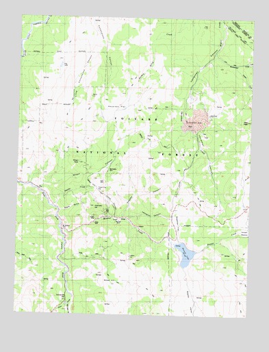
Heenan Lake, CA USGS Topographic Map
Click on map above to begin viewing in our Map Viewer.

This topographic map contains these locations and features:
Feature Name Type Latitude Longitude GNIS ID View Map
Barney Riley TrailTrailN38.7155°W119.7327°1662360View Map
Centerville (historical)LocaleN38.6313°W119.7207°1662361View Map
Centerville (historical)Populated PlaceN38.6310°W119.7232°1733664View Map
Centerville BridgeBridgeN38.6385°W119.7235°1662362View Map
Centerville FlatFlatN38.6327°W119.7230°258173View Map
Centerville Flat CampgroundLocaleN38.6316°W119.7210°274764View Map
Colorado HillSummitN38.6707°W119.7093°258606View Map
Curtz MineMineN38.6802°W119.7041°258999View Map
Dry LakeLakeN38.7295°W119.7287°259573View Map
Eagle GulchValleyN38.6685°W119.7282°259658View Map
Forest City FlatFlatN38.6777°W119.7052°260252View Map
Globe MineMineN38.6632°W119.7088°260611View Map
Goskey CanyonValleyN38.6657°W119.6938°260720View Map
Haypress FlatFlatN38.7135°W119.6988°261180View Map
Heenan CreekStreamN38.6513°W119.6541°261226View Map
Heenan LakeReservoirN38.6508°W119.6597°261227View Map
Heenan Lake 514 DamDamN38.6546°W119.6652°1663936View Map
High PeakSummitN38.7069°W119.6277°261323View Map
Leviathan CreekStreamN38.7355°W119.6454°262423View Map
Leviathan MineMineN38.7063°W119.6521°262424View Map
Lexington CanyonValleyN38.6652°W119.6921°227051View Map
Lincoln MineMineN38.6655°W119.7085°262486View Map
Little Cottonwood CanyonValleyN38.7441°W119.7099°262569View Map
LoopePopulated PlaceN38.6652°W119.6960°1659015View Map
Loope CanyonValleyN38.6660°W119.6977°262917View Map
Mogul CanyonValleyN38.6766°W119.7377°263723View Map
Mogul PeakSummitN38.6888°W119.7180°263724View Map
Monitor CreekStreamN38.6605°W119.7280°263737View Map
Morningstar MineMineN38.6849°W119.7024°263836View Map
Mount Bullion (historical)Populated PlaceN38.6605°W119.7263°1667831View Map
Mountaineer CreekStreamN38.7357°W119.6454°263913View Map
Poison CreekStreamN38.7302°W119.6349°264886View Map
Red Gap MineMineN38.6635°W119.6974°265271View Map
Sagehen FlatFlatN38.6616°W119.6630°265727View Map
Silver CreekStreamN38.6321°W119.7196°266179View Map
Silver HillSummitN38.6382°W119.6993°266190View Map
Smiths CreekStreamN38.6696°W119.7296°267270View Map
Sunshine MineMineN38.6996°W119.6899°274763View Map
Zaca MineMineN38.6682°W119.7032°269387View Map

Note: Coordinates in the location and feature list above are referenced to NAD83 datum.


Copyright (C) 2008-2024 Ryan Niemi / Sunset Dynamics ... All Rights Reserved