TopoQuest Logo
Do you find TopoQuest useful?
Help keep TopoQuest running and adding new maps/features by donating!
Bitcoin:  19c7KJd3qBynnjoSw5npx9KScwjBe4ifkT
Litecoin:  LXs6TkuXGGXo1vDsWCkWVdjQX94eUKd6ui
Home View Maps Find Maps Find Places Resources & Links


Martins Mill, Texas Topographic Map

USGS Map Title: Martins Mill, TX
USGS Map MRC: 32095D7
DRG (GeoTIFF) Download: o32095d7.tif


Neighboring USGS Topographic Map Quads:


  Myrtle Springs, TX  
32095E8
 

  Canton, TX  
32095E7
 

  Van, TX  
32095E6
 

  Phalba, TX  
32095D8
 

  Martins Mill, TX  
32095D7
 

  Ben Wheeler, TX  
32095D6
 

  Stockard, TX  
32095C8
 

  Murchinson West, TX  
32095C7
 

  Murchinson East, TX  
32095C6


Map MRC Location:

N33°
W96°
N33°
W95°
H8 H7 H6 H5 H4 H3 H2 H1
G8 G7 G6 G5 G4 G3 G2 G1
F8 F7 F6 F5 F4 F3 F2 F1
E8 E7 E6 E5 E4 E3 E2 E1
D8 D7 D6 D5 D4 D3 D2 D1
C8 C7 C6 C5 C4 C3 C2 C1
B8 B7 B6 B5 B4 B3 B2 B1
A8 A7 A6 A5 A4 A3 A2 A1
N32°
W96°
N32°
W95°

Martins Mill, TX USGS 1:24K Topographic Map Preview:
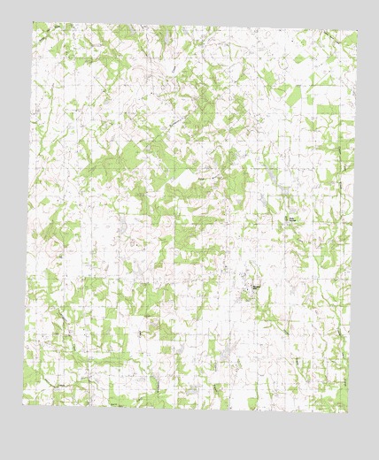
Martins Mill, TX USGS Topographic Map
Click on map above to begin viewing in our Map Viewer.

This topographic map contains these locations and features:
Feature Name Type Latitude Longitude GNIS ID View Map
Alexander LakeReservoirN32.4309°W95.8459°1859758View Map
Alexander Lake DamDamN32.4301°W95.8452°1859757View Map
Alligator CreekStreamN32.3929°W95.8344°1372278View Map
Carter CemeteryCemeteryN32.4768°W95.8111°1332215View Map
China Grove SchoolSchoolN32.3968°W95.8675°1332769View Map
Cool Springs ChurchChurchN32.4763°W95.8691°1333278View Map
Cox CemeteryCemeteryN32.4510°W95.7716°1333574View Map
Dubose DamDamN32.4501°W95.7802°1859763View Map
Dubose LakeReservoirN32.4520°W95.7816°1859764View Map
Hobbs ChurchChurchN32.3804°W95.7777°1337856View Map
Holly SpringsPopulated PlaceN32.4346°W95.7764°1378466View Map
Little Hope ChurchChurchN32.4824°W95.7961°1340117View Map
Lowrie LakeReservoirN32.3901°W95.7969°1859762View Map
Lowrie Lake DamDamN32.3901°W95.7969°1859761View Map
Martins MillPopulated PlaceN32.4163°W95.7902°1341036View Map
Pleasant Hill ChurchChurchN32.3763°W95.7964°1344181View Map
Sand BranchStreamN32.4649°W95.8230°1889834View Map
South Van Zandt Volunteer Fire Department Station 1BuildingN32.3985°W95.8523°2655595View Map
South Van Zandt Volunteer Fire Department Station 2BuildingN32.4191°W95.7913°2655590View Map
Steve CreekStreamN32.3760°W95.8211°1376299View Map
Walnut Spring ChurchChurchN32.4763°W95.8252°1349450View Map

Note: Coordinates in the location and feature list above are referenced to NAD83 datum.


Copyright (C) 2008-2025 Ryan Niemi / Sunset Dynamics ... All Rights Reserved