TopoQuest Logo
Do you find TopoQuest useful?
Help keep TopoQuest running and adding new maps/features by donating!
Bitcoin:  19c7KJd3qBynnjoSw5npx9KScwjBe4ifkT
Litecoin:  LXs6TkuXGGXo1vDsWCkWVdjQX94eUKd6ui
Home View Maps Find Maps Find Places Resources & Links


Myrtle Springs, Texas Topographic Map

USGS Map Title: Myrtle Springs, TX
USGS Map MRC: 32095E8
DRG (GeoTIFF) Download: o32095e8.tif


Neighboring USGS Topographic Map Quads:


  Wills Point, TX  
32096F1
 

  Edgewood, TX  
32095F8
 

  Fruitvale, TX  
32095F7
 

  Cedarvale, TX  
32096E1
 

  Myrtle Springs, TX  
32095E8
 

  Canton, TX  
32095E7
 

  Prairieville, TX  
32096D1
 

  Phalba, TX  
32095D8
 

  Martins Mill, TX  
32095D7


Map MRC Location:

N33°
W96°
N33°
W95°
H8 H7 H6 H5 H4 H3 H2 H1
G8 G7 G6 G5 G4 G3 G2 G1
F8 F7 F6 F5 F4 F3 F2 F1
E8 E7 E6 E5 E4 E3 E2 E1
D8 D7 D6 D5 D4 D3 D2 D1
C8 C7 C6 C5 C4 C3 C2 C1
B8 B7 B6 B5 B4 B3 B2 B1
A8 A7 A6 A5 A4 A3 A2 A1
N32°
W96°
N32°
W95°

Myrtle Springs, TX USGS 1:24K Topographic Map Preview:
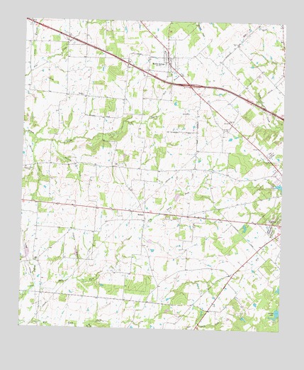
Myrtle Springs, TX USGS Topographic Map
Click on map above to begin viewing in our Map Viewer.

This topographic map contains these locations and features:
Feature Name Type Latitude Longitude GNIS ID View Map
Andy BranchStreamN32.6057°W95.9952°1329547View Map
Britton CreekStreamN32.5782°W95.9994°1331286View Map
Buck BranchStreamN32.5012°W95.9661°1331479View Map
Camp BranchStreamN32.5165°W95.9925°1331947View Map
Canton DivisionCivilN32.5551°W95.8769°1938599View Map
Canton High SchoolSchoolN32.5440°W95.8852°2008970View Map
Coppers BranchStreamN32.5193°W95.9744°1333340View Map
Cotton LakeReservoirN32.5701°W95.9519°1859862View Map
Cotton Lake DamDamN32.5701°W95.9519°1859861View Map
Dawson CreekStreamN32.5751°W95.9858°1334108View Map
Dennis's Flying Farm AirportAirportN32.6060°W95.9350°1386339View Map
Haven of Memories CemeteryCemeteryN32.5718°W95.8811°1337459View Map
Hayden ChurchChurchN32.5940°W95.9711°1337489View Map
HighPopulated PlaceN32.5655°W95.9539°2761939View Map
High CemeteryCemeteryN32.5662°W95.9530°1337701View Map
Lipsey LakeReservoirN32.5885°W95.8919°1864201View Map
Lipsey Lake DamDamN32.5885°W95.8919°1864200View Map
Myrtle SpringsPopulated PlaceN32.6099°W95.9302°1342346View Map
Myrtle Springs Census Designated PlaceCensusN32.6151°W95.9329°2586962View Map
Myrtle Springs Volunteer Fire DepartmentBuildingN32.6124°W95.9336°2655185View Map
Rats BranchStreamN32.5849°W95.9389°1344812View Map
Riley SpringSpringN32.5085°W95.8919°1998248View Map
Saint Justins Episcopal ChurchChurchN32.5437°W95.8827°2024371View Map
Soil Conservation Service Site 123 DamDamN32.5518°W95.9269°1859857View Map
Soil Conservation Service Site 123 ReservoirReservoirN32.5518°W95.9269°1859858View Map
Soil Conservation Service Site 124 DamDamN32.5368°W95.9402°1859859View Map
Soil Conservation Service Site 124 ReservoirReservoirN32.5368°W95.9402°1859860View Map
Soil Conservation Service Site 126 DamDamN32.5285°W95.9736°1859865View Map
Soil Conservation Service Site 126 ReservoirReservoirN32.5285°W95.9736°1859866View Map
Soil Conservation Service Site 127 DamDamN32.5285°W95.9969°1859863View Map
Soil Conservation Service Site 127 ReservoirReservoirN32.5285°W95.9969°1859864View Map
Spring LakeReservoirN32.5073°W95.8757°1347747View Map
Teel ChurchChurchN32.5276°W95.9933°1348326View Map
WallacePopulated PlaceN32.5468°W95.9405°1379226View Map
Wesley Chapel CemeteryCemeteryN32.5637°W95.9994°1349664View Map

Note: Coordinates in the location and feature list above are referenced to NAD83 datum.


Copyright (C) 2008-2025 Ryan Niemi / Sunset Dynamics ... All Rights Reserved