TopoQuest Logo
Do you find TopoQuest useful?
Help keep TopoQuest running and adding new maps/features by donating!
Bitcoin:  19c7KJd3qBynnjoSw5npx9KScwjBe4ifkT
Litecoin:  LXs6TkuXGGXo1vDsWCkWVdjQX94eUKd6ui
Home View Maps Find Maps Find Places Resources & Links


Marysvale Peak, Utah Topographic Map

USGS Map Title: Marysvale Peak, UT
USGS Map MRC: 38112D1
DRG (GeoTIFF) Download: o38112d1.tif


Neighboring USGS Topographic Map Quads:


  Antelope Range, UT  
38112E2
 

  Monroe Peak, UT  
38112E1
 

  Koosharem, UT  
38111E8
 

  Marysvale, UT  
38112D2
 

  Marysvale Peak, UT  
38112D1
 

  Greenwich, UT  
38111D8
 

  Piute Reservoir, UT  
38112C2
 

  Malmsten Peak, UT  
38112C1
 

  Parker Knoll, UT  
38111C8


Map MRC Location:

N39°
W113°
N39°
W112°
H8 H7 H6 H5 H4 H3 H2 H1
G8 G7 G6 G5 G4 G3 G2 G1
F8 F7 F6 F5 F4 F3 F2 F1
E8 E7 E6 E5 E4 E3 E2 E1
D8 D7 D6 D5 D4 D3 D2 D1
C8 C7 C6 C5 C4 C3 C2 C1
B8 B7 B6 B5 B4 B3 B2 B1
A8 A7 A6 A5 A4 A3 A2 A1
N38°
W113°
N38°
W112°

Marysvale Peak, UT USGS 1:24K Topographic Map Preview:
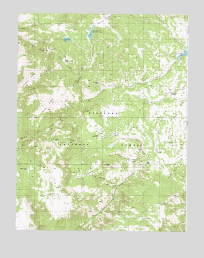
Marysvale Peak, UT USGS Topographic Map
Click on map above to begin viewing in our Map Viewer.

This topographic map contains these locations and features:
Feature Name Type Latitude Longitude GNIS ID View Map
Anderson CanyonValleyN38.4930°W112.1241°1438209View Map
Anderson DairyAreaN38.4678°W112.0377°1454647View Map
Barney LakeReservoirN38.4852°W112.0887°1447712View Map
Barney Lake Reservoir DamDamN38.4836°W112.0866°1447713View Map
Bean HillSummitN38.4130°W112.0583°1438435View Map
Big FlatFlatN38.4453°W112.0616°1438665View Map
Big Flat ReservoirReservoirN38.4411°W112.0610°1438670View Map
Big TableSummitN38.4011°W112.0766°1438751View Map
Blackbird MineMineN38.4236°W112.1213°1448146View Map
Browns DairyAreaN38.4950°W112.0377°1451199View Map
Burnt FlatFlatN38.4550°W112.0157°1439346View Map
Burnt Flat ReservoirReservoirN38.4543°W112.0125°1439347View Map
Cold SpringsSpringN38.4588°W112.0566°1439877View Map
Dry Creek Guard StationLocaleN38.4297°W112.0641°1440608View Map
Dry LakeFlatN38.3825°W112.0185°1440658View Map
Dyches DrawValleyN38.3928°W112.0544°1448362View Map
East ForkStreamN38.4730°W112.0696°1448365View Map
Jass DairyAreaN38.4822°W112.0369°1451268View Map
Langdon CreekStreamN38.4136°W112.0080°1442437View Map
Langdon MountainSummitN38.3911°W112.0194°1442436View Map
Left Fork Dry CreekStreamN38.4150°W112.0388°1448584View Map
Little MeadowsFlatN38.4075°W112.0749°1448605View Map
Little Meadows CreekStreamN38.4008°W112.0499°1448606View Map
Little TableSummitN38.4033°W112.1069°1442786View Map
Manning MeadowsFlatN38.4950°W112.0635°1443133View Map
Manning Meadows DamDamN38.4916°W112.0724°1447717View Map
Manning Meadows ReservoirReservoirN38.4904°W112.0702°1447716View Map
Marysvale PeakSummitN38.4839°W112.1013°1443222View Map
Middle Spring LakeLakeN38.4100°W112.1168°1443380View Map
Miners RidgeRidgeN38.4614°W112.1158°1448670View Map
Mud SpringSpringN38.4536°W112.0930°1454829View Map
Mud SpringSpringN38.4197°W112.0221°1443686View Map
Mud Spring DrawValleyN38.4414°W112.0110°1448713View Map
North Fork Box CreekStreamN38.4791°W112.0010°1443891View Map
Ogden CabinLocaleN38.4586°W112.0560°1450024View Map
Rock SpringSpringN38.4487°W112.0306°1445090View Map
Rudd Spring CreekStreamN38.3989°W112.0516°1448947View Map
Six Patch DrawValleyN38.4414°W112.0110°1449008View Map
Smith CanyonValleyN38.4516°W112.1224°1445700View Map
Smith Canyon TrailTrailN38.4686°W112.1096°1445702View Map
Straight CanyonValleyN38.4278°W112.1069°1446170View Map
Tuft DrawValleyN38.3766°W112.0783°1449116View Map
Upper Box Creek DamDamN38.4800°W112.0038°1447711View Map
Upper Box Creek ReservoirReservoirN38.4774°W112.0003°1433798View Map
Vale CreekStreamN38.4494°W112.0785°1446902View Map
Voyles PondLakeN38.3821°W112.0323°1449151View Map
White Ledge SpringSpringN38.4602°W112.0652°1449186View Map
Willis ReservoirReservoirN38.4217°W112.0227°1447389View Map
Willow SpringSpringN38.4145°W112.0276°1447434View Map
Wills ReservoirSpringN38.4206°W112.0218°1449204View Map
Windy RidgeRidgeN38.4464°W112.1010°1449207View Map

Note: Coordinates in the location and feature list above are referenced to NAD83 datum.


Copyright (C) 2008-2024 Ryan Niemi / Sunset Dynamics ... All Rights Reserved