TopoQuest Logo
Do you find TopoQuest useful?
Help keep TopoQuest running and adding new maps/features by donating!
Bitcoin:  19c7KJd3qBynnjoSw5npx9KScwjBe4ifkT
Litecoin:  LXs6TkuXGGXo1vDsWCkWVdjQX94eUKd6ui
Home View Maps Find Maps Find Places Resources & Links


Koosharem, Utah Topographic Map

USGS Map Title: Koosharem, UT
USGS Map MRC: 38111E8
DRG (GeoTIFF) Download: o38111e8.tif


Neighboring USGS Topographic Map Quads:


  Annabella, UT  
38112F1
 

  Water Creek Canyon, UT  
38111F8
 

  Boobe Hole Reservoir, UT  
38111F7
 

  Monroe Peak, UT  
38112E1
 

  Koosharem, UT  
38111E8
 

  Burrville, UT  
38111E7
 

  Marysvale Peak, UT  
38112D1
 

  Greenwich, UT  
38111D8
 

  Abes Knoll, UT  
38111D7


Map MRC Location:

N39°
W112°
N39°
W111°
H8 H7 H6 H5 H4 H3 H2 H1
G8 G7 G6 G5 G4 G3 G2 G1
F8 F7 F6 F5 F4 F3 F2 F1
E8 E7 E6 E5 E4 E3 E2 E1
D8 D7 D6 D5 D4 D3 D2 D1
C8 C7 C6 C5 C4 C3 C2 C1
B8 B7 B6 B5 B4 B3 B2 B1
A8 A7 A6 A5 A4 A3 A2 A1
N38°
W112°
N38°
W111°

Koosharem, UT USGS 1:24K Topographic Map Preview:
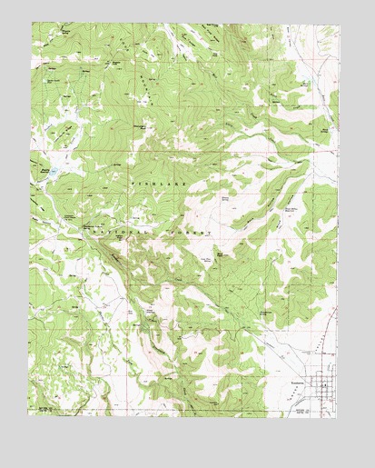
Koosharem, UT USGS Topographic Map
Click on map above to begin viewing in our Map Viewer.

This topographic map contains these locations and features:
Feature Name Type Latitude Longitude GNIS ID View Map
Birch CreekStreamN38.5975°W111.8802°1438782View Map
Birch SpringsSpringN38.5919°W111.8795°1438814View Map
Blue PeakSummitN38.5516°W111.9216°1438948View Map
Burr SpringsSpringN38.6068°W111.8899°1439369View Map
Central PastureAreaN38.6241°W111.9380°1451208View Map
Central PastureFlatN38.6164°W111.9394°1439628View Map
Christiersen SpringSpringN38.5332°W111.9074°1439729View Map
Clover FlatFlatN38.6153°W111.9521°1439819View Map
Cove MountainSummitN38.6025°W111.9605°1440072View Map
Devils CastleCliffN38.6111°W111.9952°1440422View Map
Devils Castle FlatFlatN38.6061°W111.9938°1440424View Map
Doe FlatFlatN38.6014°W111.9577°1440494View Map
Doe HoleBasinN38.6147°W111.9246°1440495View Map
Doe RidgeRidgeN38.6197°W111.9366°1440497View Map
Indian PeakSummitN38.5564°W111.9621°1442017View Map
Kinney SpringSpringN38.5686°W111.9226°1442337View Map
KoosharemPopulated PlaceN38.5103°W111.8813°1442357View Map
Koosharem CampgroundLocaleN38.5111°W111.8902°1448555View Map
Koosharem CanalCanalN38.5322°W111.8757°1442358View Map
Koosharem CemeteryCemeteryN38.5208°W111.8849°1442359View Map
Koosharem CreekStreamN38.5083°W111.8852°1442360View Map
Koosharem Elementary SchoolSchoolN38.5106°W111.8800°1448557View Map
Koosharem Fire DepartmentBuildingN38.5108°W111.8819°2627319View Map
Koosharem Guard StationLocaleN38.5630°W111.9863°1442361View Map
Koosharem Pasture SpringSpringN38.5603°W111.9792°1442362View Map
Koosharem Post OfficePost OfficeN38.5103°W111.8817°2769102View Map
Little CreekStreamN38.5816°W111.8869°1442688View Map
Lone Pine SpringSpringN38.5500°W111.9267°1429870View Map
Magelby ReservoirReservoirN38.5778°W111.9901°1443071View Map
Magleby DamDamN38.5805°W111.9924°1447723View Map
Magleby PassGapN38.6122°W111.9680°1443070View Map
Milos KitchenBasinN38.5336°W111.9530°1443500View Map
Monument PeakSummitN38.5916°W111.9527°1443572View Map
Reservoir HillSummitN38.5791°W111.9971°1444872View Map
Rim SeepSpringN38.5326°W111.9600°1444988View Map
Rock HollowValleyN38.5775°W111.8882°1445072View Map
Sevier County Ambulance - KoosharemBuildingN38.5108°W111.8820°2768462View Map
Tabernacle RidgeRidgeN38.5903°W111.9860°1446312View Map
Tenderfoot RidgeRidgeN38.5678°W111.9977°1446392View Map
The Church of Jesus Christ of Latter Day SaintsChurchN38.5105°W111.8810°1449505View Map
Thurber ForkStreamN38.5055°W111.9360°1446583View Map
Town of KoosharemCivilN38.5135°W111.8822°2412845View Map
Whooton SpringSpringN38.6218°W111.9882°1447301View Map
Wood HollowValleyN38.5758°W111.8882°1447508View Map
Wood Hollow ReservoirReservoirN38.5664°W111.8972°1447509View Map

Note: Coordinates in the location and feature list above are referenced to NAD83 datum.


Copyright (C) 2008-2024 Ryan Niemi / Sunset Dynamics ... All Rights Reserved