TopoQuest Logo
Do you find TopoQuest useful?
Help keep TopoQuest running and adding new maps/features by donating!
Bitcoin:  19c7KJd3qBynnjoSw5npx9KScwjBe4ifkT
Litecoin:  LXs6TkuXGGXo1vDsWCkWVdjQX94eUKd6ui
Home View Maps Find Maps Find Places Resources & Links


Mastodon Mountain, Idaho Topographic Map

USGS Map Title: Mastodon Mountain, ID
USGS Map MRC: 47115C8
DRG (GeoTIFF) Download: o47115c8.tif


Neighboring USGS Topographic Map Quads:


  Polaris Peak, ID  
47116D1
 

  Wallace, ID  
47115D8
 

  Mullan, ID  
47115D7
 

  Marble Creek, ID  
47116C1
 

  Mastodon Mountain, ID  
47115C8
 

  Avery, ID  
47115C7
 

  Marble Mountain, ID  
47116B1
 

  Hoyt Mountain, ID  
47115B8
 

  Fishhook Creek, ID  
47115B7


Map MRC Location:

N48°
W116°
N48°
W115°
H8 H7 H6 H5 H4 H3 H2 H1
G8 G7 G6 G5 G4 G3 G2 G1
F8 F7 F6 F5 F4 F3 F2 F1
E8 E7 E6 E5 E4 E3 E2 E1
D8 D7 D6 D5 D4 D3 D2 D1
C8 C7 C6 C5 C4 C3 C2 C1
B8 B7 B6 B5 B4 B3 B2 B1
A8 A7 A6 A5 A4 A3 A2 A1
N47°
W116°
N47°
W115°

Mastodon Mountain, ID USGS 1:24K Topographic Map Preview:
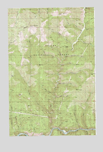
Mastodon Mountain, ID USGS Topographic Map
Click on map above to begin viewing in our Map Viewer.

This topographic map contains these locations and features:
Feature Name Type Latitude Longitude GNIS ID View Map
Ally GulchValleyN47.2505°W115.9665°376559View Map
Ally PointSummitN47.2791°W115.9704°376560View Map
Ally Point TrailTrailN47.2791°W115.9704°398581View Map
Avery Ranger StationLocaleN47.2530°W115.9185°400400View Map
Binney CreekStreamN47.3533°W115.8918°377644View Map
Blackjack CreekStreamN47.2524°W115.9849°377807View Map
Cairn CreekStreamN47.3585°W115.8904°378690View Map
Cedar CreekStreamN47.3446°W115.9004°379093View Map
Daisy GulchValleyN47.2916°W115.9385°380217View Map
Dennis KnobSummitN47.2902°W115.9865°380506View Map
Dunn PeakSummitN47.2944°W115.9002°380940View Map
Dunn Peak Trail (historical)TrailN47.3063°W115.8807°380941View Map
EtheltonPopulated PlaceN47.2549°W115.9057°396471View Map
Fisher CreekStreamN47.3744°W115.8904°381778View Map
Flash PeakSummitN47.3091°W115.8790°381817View Map
Flemming CreekStreamN47.2549°W115.8885°397710View Map
Foolhen MountainSummitN47.3685°W115.9268°381914View Map
Franklin MineMineN47.3027°W115.9310°382018View Map
Fritz CreekStreamN47.3008°W115.9290°382092View Map
Fume CreekStreamN47.3244°W115.9221°382130View Map
Hamilton CreekStreamN47.2560°W115.8993°399906View Map
Hamilton GulchValleyN47.2560°W115.8993°399336View Map
Harvey CreekStreamN47.2505°W115.9885°382948View Map
Horn GulchValleyN47.3277°W115.9160°383336View Map
HoytPopulated PlaceN47.2530°W115.9182°396676View Map
Hoyt CreekStreamN47.2571°W115.9302°383489View Map
Hunters PeakSummitN47.3194°W115.9828°2630703View Map
Italian CreekStreamN47.2546°W115.9265°383789View Map
Lumberjack CreekStreamN47.3091°W115.9290°386284View Map
Mack GulchValleyN47.3191°W115.9232°386332View Map
Marion CreekStreamN47.3219°W115.9265°386467View Map
Mastodon MineMineN47.3446°W115.9732°386535View Map
Mastodon MountainSummitN47.3566°W115.9690°386536View Map
Prince PeakSummitN47.3088°W115.9938°388883View Map
Prince Peak TrailTrailN47.3274°W115.9799°398591View Map
Prospect CreekStreamN47.3388°W115.9079°388900View Map
Prospect MountainSummitN47.3366°W115.9188°388908View Map
Rock CreekStreamN47.2555°W115.8896°389480View Map
Rover CreekStreamN47.3521°W115.8935°389680View Map
Shoshone CountyCivilN47.3530°W115.8924°1702379View Map
Slate CreekStreamN47.2566°W115.9374°390562View Map
Slate PeakSummitN47.3191°W115.9540°390567View Map
Slate-Dunn Peak TrailTrailN47.2802°W115.9127°398587View Map
Stanley RanchLocaleN47.2541°W115.9224°391345View Map
Uhlman CreekStreamN47.2874°W115.9338°392595View Map
West Fork Slate CreekStreamN47.2719°W115.9390°393198View Map
West Fork Slate Divide TrailTrailN47.3394°W115.9571°398589View Map

Note: Coordinates in the location and feature list above are referenced to NAD83 datum.


Copyright (C) 2008-2024 Ryan Niemi / Sunset Dynamics ... All Rights Reserved