TopoQuest Logo
Do you find TopoQuest useful?
Help keep TopoQuest running and adding new maps/features by donating!
Bitcoin:  19c7KJd3qBynnjoSw5npx9KScwjBe4ifkT
Litecoin:  LXs6TkuXGGXo1vDsWCkWVdjQX94eUKd6ui
Home View Maps Find Maps Find Places Resources & Links


Matanzas Inlet, Florida Topographic Map

USGS Map Title: Matanzas Inlet, FL
USGS Map MRC: 29081F2
DRG (GeoTIFF) Download: o29081f2.tif


Neighboring USGS Topographic Map Quads:


  Saint Augustine Beach, FL  
29081G3


  Dinner Island NE, FL  
29081F3
 

  Matanzas Inlet, FL  
29081F2


  Espanola, FL  
29081E3
 

  Beverly Beach, FL  
29081E2


Map MRC Location:

N30°
W82°
N30°
W81°
H8 H7 H6 H5 H4 H3 H2 H1
G8 G7 G6 G5 G4 G3 G2 G1
F8 F7 F6 F5 F4 F3 F2 F1
E8 E7 E6 E5 E4 E3 E2 E1
D8 D7 D6 D5 D4 D3 D2 D1
C8 C7 C6 C5 C4 C3 C2 C1
B8 B7 B6 B5 B4 B3 B2 B1
A8 A7 A6 A5 A4 A3 A2 A1
N29°
W82°
N29°
W81°

Matanzas Inlet, FL USGS 1:24K Topographic Map Preview:
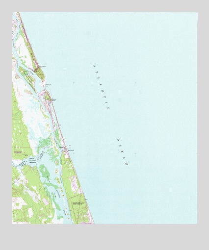
Matanzas Inlet, FL USGS Topographic Map
Click on map above to begin viewing in our Map Viewer.

This topographic map contains these locations and features:
Feature Name Type Latitude Longitude GNIS ID View Map
Claude Varne BridgeBridgeN29.7072°W81.2290°308369View Map
Crescent Beach Census Designated PlaceCensusN29.7351°W81.2412°2402803View Map
Devils ElbowBendN29.7433°W81.2451°307935View Map
Faver-Dykes State ParkParkN29.6764°W81.2478°308272View Map
Fort MatanzasPopulated PlaceN29.7150°W81.2387°307962View Map
Fort Matanzas National MonumentParkN29.7121°W81.2357°307963View Map
Hemming PointCapeN29.6655°W81.2381°307982View Map
Hominy BranchStreamN29.6519°W81.2426°284218View Map
Lake Rayonier OneLakeN29.6346°W81.2485°298569View Map
MarinelandPopulated PlaceN29.6689°W81.2134°286429View Map
Matanzas InletChannelN29.7058°W81.2284°308021View Map
Pellicer CreekStreamN29.6622°W81.2320°308073View Map
Pellicer Creek Aquatic PreserveParkN29.6700°W81.2328°308283View Map
Pellicer FlatsFlatN29.6486°W81.2245°288681View Map
Rattlesnake IslandIslandN29.6989°W81.2301°308093View Map
Styles CreekStreamN29.6575°W81.2442°291765View Map
Summer HavenPopulated PlaceN29.6991°W81.2234°308140View Map
Town of MarinelandCivilN29.6647°W81.2138°2406098View Map
Washington Oaks Gardens State ParkParkN29.6355°W81.2040°300202View Map

Note: Coordinates in the location and feature list above are referenced to NAD83 datum.


Copyright (C) 2008-2025 Ryan Niemi / Sunset Dynamics ... All Rights Reserved