TopoQuest Logo
Do you find TopoQuest useful?
Help keep TopoQuest running and adding new maps/features by donating!
Bitcoin:  19c7KJd3qBynnjoSw5npx9KScwjBe4ifkT
Litecoin:  LXs6TkuXGGXo1vDsWCkWVdjQX94eUKd6ui
Home View Maps Find Maps Find Places Resources & Links


Espanola, Florida Topographic Map

USGS Map Title: Espanola, FL
USGS Map MRC: 29081E3
DRG (GeoTIFF) Download: o29081e3.tif


Neighboring USGS Topographic Map Quads:


  Spuds, FL  
29081F4
 

  Dinner Island NE, FL  
29081F3
 

  Matanzas Inlet, FL  
29081F2
 

  Dinner Island, FL  
29081E4
 

  Espanola, FL  
29081E3
 

  Beverly Beach, FL  
29081E2
 

  Saint Johns Park, FL  
29081D4
 

  Bunnell, FL  
29081D3
 

  Flagler Beach West, FL  
29081D2


Map MRC Location:

N30°
W82°
N30°
W81°
H8 H7 H6 H5 H4 H3 H2 H1
G8 G7 G6 G5 G4 G3 G2 G1
F8 F7 F6 F5 F4 F3 F2 F1
E8 E7 E6 E5 E4 E3 E2 E1
D8 D7 D6 D5 D4 D3 D2 D1
C8 C7 C6 C5 C4 C3 C2 C1
B8 B7 B6 B5 B4 B3 B2 B1
A8 A7 A6 A5 A4 A3 A2 A1
N29°
W82°
N29°
W81°

Espanola, FL USGS 1:24K Topographic Map Preview:
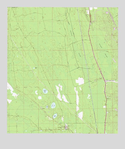
Espanola, FL USGS Topographic Map
Click on map above to begin viewing in our Map Viewer.

This topographic map contains these locations and features:
Feature Name Type Latitude Longitude GNIS ID View Map
Black LakeLakeN29.5280°W81.3227°278909View Map
EspanolaPopulated PlaceN29.5072°W81.3095°282253View Map
Espanola CemeteryCemeteryN29.5033°W81.3240°282254View Map
Espanola Volunteer Fire Department Station 51BuildingN29.5065°W81.3086°2644171View Map
Flagler County Fire Rescue 51BuildingN29.5066°W81.3086°2644405View Map
Flagler Lookout TowerTowerN29.5344°W81.2626°282543View Map
Honey HillIslandN29.5453°W81.3506°284226View Map
Hulett SwampSwampN29.5759°W81.2659°284390View Map
NeogaPopulated PlaceN29.5264°W81.3365°295481View Map
Neoga LakeLakeN29.5265°W81.3298°287586View Map
Palm Coast Fire Department Station 23BuildingN29.5895°W81.2603°2644410View Map
Poplar PondLakeN29.5649°W81.3445°289208View Map
Pringle SwampSwampN29.5839°W81.2961°289329View Map
Sabal Springs Golf and Racquet ClubLocaleN29.6137°W81.2720°2451825View Map
Saint Pauls ChurchChurchN29.5053°W81.3095°290348View Map
Speckled Perch LakeLakeN29.5421°W81.3319°291491View Map
Tank LakeLakeN29.5176°W81.3208°292021View Map
WDRU-TV (Bunnell)TowerN29.5191°W81.3170°309170View Map
WNFI-FM (Palatka)TowerN29.5191°W81.3170°309092View Map

Note: Coordinates in the location and feature list above are referenced to NAD83 datum.


Copyright (C) 2008-2025 Ryan Niemi / Sunset Dynamics ... All Rights Reserved