TopoQuest Logo
Do you find TopoQuest useful?
Help keep TopoQuest running and adding new maps/features by donating!
Bitcoin:  19c7KJd3qBynnjoSw5npx9KScwjBe4ifkT
Litecoin:  LXs6TkuXGGXo1vDsWCkWVdjQX94eUKd6ui
Home View Maps Find Maps Find Places Resources & Links


Mattamiscontis Mountain, Maine Topographic Map

USGS Map Title: Mattamiscontis Mountain, ME
USGS Map MRC: 45068D6
DRG (GeoTIFF) Download: o45068d6.tif


Neighboring USGS Topographic Map Quads:


  Cedar Lake, ME  
45068E7
 

  Nollesemic Lake, ME  
45068E6
 

  Medunkeunk Lake, ME  
45068E5
 

  Endless Lake, ME  
45068D7
 

  Mattamiscontis Mountain, ME  
45068D6
 

  Nine Meadow Ridge, ME  
45068D5
 

  Hardy Pond, ME  
45068C7
 

  Seboeis, ME  
45068C6
 

  Lincoln West, ME  
45068C5


Map MRC Location:

N46°
W69°
N46°
W68°
H8 H7 H6 H5 H4 H3 H2 H1
G8 G7 G6 G5 G4 G3 G2 G1
F8 F7 F6 F5 F4 F3 F2 F1
E8 E7 E6 E5 E4 E3 E2 E1
D8 D7 D6 D5 D4 D3 D2 D1
C8 C7 C6 C5 C4 C3 C2 C1
B8 B7 B6 B5 B4 B3 B2 B1
A8 A7 A6 A5 A4 A3 A2 A1
N45°
W69°
N45°
W68°

Mattamiscontis Mountain, ME USGS 1:24K Topographic Map Preview:
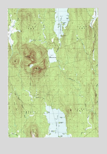
Mattamiscontis Mountain, ME USGS Topographic Map
Click on map above to begin viewing in our Map Viewer.

This topographic map contains these locations and features:
Feature Name Type Latitude Longitude GNIS ID View Map
Bald HillSummitN45.4017°W68.6648°561506View Map
Bear BrookStreamN45.3759°W68.7373°561807View Map
Bear PondLakeN45.4446°W68.7177°561865View Map
Birch IslandIslandN45.3817°W68.6873°562309View Map
Birch MountainSummitN45.4488°W68.7383°562323View Map
Black Cat IslandIslandN45.3898°W68.6798°562424View Map
Bog BrookStreamN45.4462°W68.7489°562674View Map
Bog PointCapeN45.3992°W68.6964°562685View Map
Buck PointCapeN45.3789°W68.6731°563110View Map
Cedar BrookStreamN45.4878°W68.7409°563714View Map
Cranberry IslandIslandN45.4856°W68.6759°564464View Map
Dutch IslandIslandN45.3759°W68.6795°565440View Map
East Branch Seboeis StreamStreamN45.3759°W68.7375°565576View Map
Gray Ledge DeadwaterLakeN45.4829°W68.7435°567103View Map
Hazeltine RidgeRidgeN45.4059°W68.7378°567838View Map
Herman PointCapeN45.3945°W68.6753°567951View Map
Hunt CoveBayN45.4887°W68.6673°568462View Map
Johnny Ayers BrookStreamN45.4403°W68.6311°568891View Map
Little Mattamiscontis LakeLakeN45.4539°W68.6889°569897View Map
Little Mattamiscontis MountainSummitN45.4412°W68.7119°569898View Map
Mattamiscontis Club CampLocaleN45.4742°W68.6739°570904View Map
Mattamiscontis LakeLakeN45.4907°W68.6768°570905View Map
Mattamiscontis MountainSummitN45.4528°W68.7185°570906View Map
Mountain BrookStreamN45.4623°W68.6959°571796View Map
Northwest InletStreamN45.4051°W68.6975°572478View Map
Penobscot CountyCivilN45.4005°W68.6494°581295View Map
Penobscot ReservationCivilN45.4697°W68.6725°582669View Map
Plantation of SeboeisCivilN45.3838°W68.7490°582719View Map
Sam Ayers DeadwaterSwampN45.4920°W68.6320°574795View Map
Sam Ayers StreamStreamN45.4356°W68.6267°574796View Map
Seboeis CemeteryCemeteryN45.3766°W68.7149°2736937View Map
Shore Road TrailTrailN45.3895°W68.7428°575430View Map
South Branch LakeLakeN45.3845°W68.6836°575782View Map
South Branch StreamStreamN45.4003°W68.6367°575801View Map
Squirrel BrookStreamN45.4692°W68.7003°576199View Map
Sweat Bog BrookStreamN45.3781°W68.7448°576592View Map
Tack PondLakeN45.4781°W68.7342°576635View Map
West Branch Seboeis StreamStreamN45.3759°W68.7375°578090View Map
Whitney RidgeRidgeN45.3803°W68.7161°578421View Map

Note: Coordinates in the location and feature list above are referenced to NAD83 datum.


Copyright (C) 2008-2025 Ryan Niemi / Sunset Dynamics ... All Rights Reserved