TopoQuest Logo
Do you find TopoQuest useful?
Help keep TopoQuest running and adding new maps/features by donating!
Bitcoin:  19c7KJd3qBynnjoSw5npx9KScwjBe4ifkT
Litecoin:  LXs6TkuXGGXo1vDsWCkWVdjQX94eUKd6ui
Home View Maps Find Maps Find Places Resources & Links


Maxwell Coulee, Montana Topographic Map

USGS Map Title: Maxwell Coulee, MT
USGS Map MRC: 47106C4
DRG (GeoTIFF) Download: o47106c4.tif


Neighboring USGS Topographic Map Quads:


  Bateman Coulee NE, MT  
47106D5
 

  Hagen Gap, MT  
47106D4
 

  Frank Coulee, MT  
47106D3
 

  Ada Creek, MT  
47106C5
 

  Maxwell Coulee, MT  
47106C4
 

  Coal Creek, MT  
47106C3
 

  Cohagen NE, MT  
47106B5
 

  Hafla School, MT  
47106B4
 

  Whiteside Ranch, MT  
47106B3


Map MRC Location:

N48°
W107°
N48°
W106°
H8 H7 H6 H5 H4 H3 H2 H1
G8 G7 G6 G5 G4 G3 G2 G1
F8 F7 F6 F5 F4 F3 F2 F1
E8 E7 E6 E5 E4 E3 E2 E1
D8 D7 D6 D5 D4 D3 D2 D1
C8 C7 C6 C5 C4 C3 C2 C1
B8 B7 B6 B5 B4 B3 B2 B1
A8 A7 A6 A5 A4 A3 A2 A1
N47°
W107°
N47°
W106°

Maxwell Coulee, MT USGS 1:24K Topographic Map Preview:
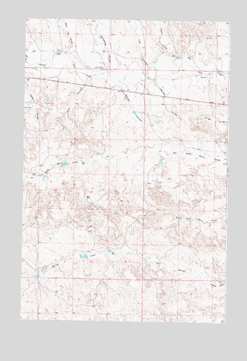
Maxwell Coulee, MT USGS Topographic Map
Click on map above to begin viewing in our Map Viewer.

This topographic map contains these locations and features:
Feature Name Type Latitude Longitude GNIS ID View Map
17N41E03D___01 WellWellN47.2567°W106.4750°821734View Map
18N41E01A___01 WellWellN47.3506°W106.4275°822382View Map
18N41E12A___01 WellWellN47.3356°W106.4325°822286View Map
18N42E18B___01 WellWellN47.3206°W106.4192°822189View Map
18N42E32B___01 WellWellN47.2772°W106.3981°821889View Map
19N42E32D___01 WellWellN47.3550°W106.3914°822410View Map
19N42E33BBCB01 WellWellN47.3667°W106.3828°822466View Map
Carcass CouleeValleyN47.3506°W106.4209°769597View Map
Casper CouleeValleyN47.3603°W106.4120°769645View Map
Jock CouleeValleyN47.3494°W106.4631°772829View Map
Maxwell CouleeValleyN47.3486°W106.4425°773943View Map
Nannastead CouleeValleyN47.3542°W106.4492°774548View Map
Peden CouleeValleyN47.3467°W106.4992°775135View Map
Rosa Spring Dam Number 1DamN47.2767°W106.4606°797347View Map
Seven Tree CouleeValleyN47.3617°W106.4762°776352View Map
Tree CouleeValleyN47.3558°W106.4228°777747View Map
USA Reservoir Number 2 DamDamN47.3150°W106.4739°795488View Map
Van NormanPopulated PlaceN47.3533°W106.3873°767932View Map
Van Norman Post Office (historical)Post OfficeN47.3528°W106.3784°1716044View Map
Wild Horse Reservoir DamDamN47.3100°W106.4806°797227View Map
Withee Number 1 DamDamN47.3167°W106.4306°797802View Map
Withee Number 2 DamDamN47.3167°W106.4156°797803View Map

Note: Coordinates in the location and feature list above are referenced to NAD83 datum.


Copyright (C) 2008-2025 Ryan Niemi / Sunset Dynamics ... All Rights Reserved