TopoQuest Logo
Do you find TopoQuest useful?
Help keep TopoQuest running and adding new maps/features by donating!
Bitcoin:  19c7KJd3qBynnjoSw5npx9KScwjBe4ifkT
Litecoin:  LXs6TkuXGGXo1vDsWCkWVdjQX94eUKd6ui
Home View Maps Find Maps Find Places Resources & Links


Bear Island, Minnesota Topographic Map

USGS Map Title: Bear Island, MN
USGS Map MRC: 47091G8
DRG (GeoTIFF) Download: o47091g8.tif


Neighboring USGS Topographic Map Quads:


  Crab Lake, MN  
47092H1
 

  Shagawa Lake, MN  
47091H8
 

  Ely, MN  
47091H7
 

  Eagles Nest, MN  
47092G1
 

  Bear Island, MN  
47091G8
 

  Kangas Bay, MN  
47091G7
 

  Isaac Lake, MN  
47092F1
 

  Babbitt, MN  
47091F8
 

  Babbitt NE, MN  
47091F7


Map MRC Location:

N48°
W92°
N48°
W91°
H8 H7 H6 H5 H4 H3 H2 H1
G8 G7 G6 G5 G4 G3 G2 G1
F8 F7 F6 F5 F4 F3 F2 F1
E8 E7 E6 E5 E4 E3 E2 E1
D8 D7 D6 D5 D4 D3 D2 D1
C8 C7 C6 C5 C4 C3 C2 C1
B8 B7 B6 B5 B4 B3 B2 B1
A8 A7 A6 A5 A4 A3 A2 A1
N47°
W92°
N47°
W91°

Bear Island, MN USGS 1:24K Topographic Map Preview:
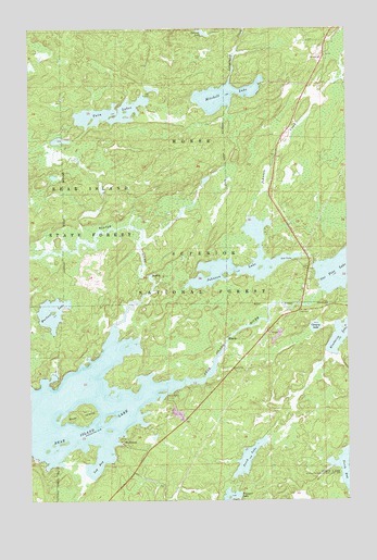
Bear Island, MN USGS Topographic Map
Click on map above to begin viewing in our Map Viewer.

This topographic map contains these locations and features:
Feature Name Type Latitude Longitude GNIS ID View Map
Bear IslandIslandN47.7727°W91.9802°660736View Map
Bear Island DamDamN47.7899°W91.9235°1776513View Map
Bear Island LakeLakeN47.7808°W91.9442°660739View Map
Bear Island ReservoirReservoirN47.7899°W91.9235°1776514View Map
Beaver PondLakeN47.8742°W91.9330°660763View Map
Beaver RiverStreamN47.7960°W91.9677°660765View Map
Blueberry LakeLakeN47.7937°W91.8777°660844View Map
Canary LakeLakeN47.7958°W91.8878°660950View Map
Johnson CreekStreamN47.8132°W91.8865°661590View Map
Johnson LakeLakeN47.8107°W91.9162°661591View Map
Log BayBayN47.7594°W91.9743°661787View Map
Mitchell LakeLakeN47.8572°W91.9230°661937View Map
Muckwa LakeLakeN47.7997°W91.9942°661976View Map
One Pine LakeLakeN47.8111°W91.8769°662103View Map
Perch LakeLakeN47.7613°W91.9145°662160View Map
RothmanPopulated PlaceN47.7660°W91.9643°662299View Map
Twin LakesLakeN47.8527°W91.9675°662694View Map
Unorganized Territory of Birch LakeCivilN47.7585°W91.9899°663598View Map

Note: Coordinates in the location and feature list above are referenced to NAD83 datum.


Copyright (C) 2008-2025 Ryan Niemi / Sunset Dynamics ... All Rights Reserved