TopoQuest Logo
Do you find TopoQuest useful?
Help keep TopoQuest running and adding new maps/features by donating!
Bitcoin:  19c7KJd3qBynnjoSw5npx9KScwjBe4ifkT
Litecoin:  LXs6TkuXGGXo1vDsWCkWVdjQX94eUKd6ui
Home View Maps Find Maps Find Places Resources & Links


McClure Creek, Montana Topographic Map

USGS Map Title: McClure Creek, MT
USGS Map MRC: 45106H8
DRG (GeoTIFF) Download: o45106h8.tif


Neighboring USGS Topographic Map Quads:


  Minnehaha Creek North, MT  
46107A1
 

  Griffin Coulee SW, MT  
46106A8
 

  Griffin Coulee, MT  
46106A7
 

  Minnehaha Creek South, MT  
45107H1
 

  McClure Creek, MT  
45106H8
 

  Trail Creek School, MT  
45106H7
 

  Wolf School, MT  
45107G1
 

  Sarpy School, MT  
45106G8
 

  Rough Draw, MT  
45106G7


Map MRC Location:

N46°
W107°
N46°
W106°
H8 H7 H6 H5 H4 H3 H2 H1
G8 G7 G6 G5 G4 G3 G2 G1
F8 F7 F6 F5 F4 F3 F2 F1
E8 E7 E6 E5 E4 E3 E2 E1
D8 D7 D6 D5 D4 D3 D2 D1
C8 C7 C6 C5 C4 C3 C2 C1
B8 B7 B6 B5 B4 B3 B2 B1
A8 A7 A6 A5 A4 A3 A2 A1
N45°
W107°
N45°
W106°

McClure Creek, MT USGS 1:24K Topographic Map Preview:
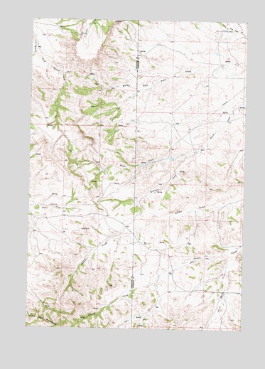
McClure Creek, MT USGS Topographic Map
Click on map above to begin viewing in our Map Viewer.

This topographic map contains these locations and features:
Feature Name Type Latitude Longitude GNIS ID View Map
01N38E22CADD01 WellWellN45.9047°W106.9917°813238View Map
02N38E01BACA01 SpringSpringN45.9547°W106.9531°813550View Map
02N38E01BDBA01 SpringSpringN45.9528°W106.9528°813537View Map
02N38E03ABBB01 SpringSpringN45.9563°W106.9908°813559View Map
02N38E03BDBB01 SpringSpringN45.9528°W106.9953°813538View Map
02N38E03CCAD01 SpringSpringN45.9448°W106.9972°813498View Map
02N38E03DBAA01 SpringSpringN45.9492°W106.9862°813516View Map
02N38E11ABBD01 SpringSpringN45.9411°W106.9678°813478View Map
02N38E11ADBC01 SpringSpringN45.9375°W106.9639°813461View Map
02N38E11DAAC01 SpringSpringN45.9342°W106.9616°813442View Map
02N38E11DCCA01 SpringSpringN45.9294°W106.9678°813412View Map
02N38E12CADB01 SpringSpringN45.9333°W106.9511°813438View Map
02N38E15ADDA01 WellWellN45.9217°W106.9806°813370View Map
02N38E22BBAB01 WellWellN45.9136°W106.9973°813330View Map
02N38E24BCBA01 WellWellN45.9097°W106.9587°813292View Map
02N38E25CDDD01 WellWellN45.8847°W106.9512°813073View Map
02N38E26AAAB01 WellWellN45.8989°W106.9612°813198View Map
02N38E26AABA01 WellWellN45.8986°W106.9631°813194View Map
02N38E34ABBC01 SpringSpringN45.8833°W106.9897°813052View Map
02N39E01BBCA01 WellWellN45.9458°W106.8753°813500View Map
02N39E05BCBD01 WellWellN45.9583°W106.9156°813572View Map
02N39E05DDDC01 WellWellN45.9486°W106.8992°813514View Map
02N39E06B___01 WellWellN45.9578°W106.9353°813567View Map
02N39E16ACDD01 WellWellN45.9272°W106.8812°813398View Map
02N39E17DCAA01 WellWellN45.9233°W106.9034°813378View Map
02N39E19CACB01 WellWellN45.9097°W106.9331°813291View Map
02N39E20DBCB01 WellWellN45.9100°W106.9078°813295View Map
02N39E27CCCC01 WellWellN45.8900°W106.8764°813121View Map
02N39E29BCCC01 WellWellN45.8983°W106.9173°813191View Map
02N39E31____01 SpringSpringN45.8764°W106.9323°812996View Map
02N39E31ACDC01 WellWellN45.8839°W106.9250°813059View Map
02N39E31CBCD01 SpringSpringN45.8799°W106.9365°813021View Map
02N39E31CDBA01 WellWellN45.8789°W106.9325°813017View Map
02N39E31CDCC01 SpringSpringN45.8761°W106.9326°812990View Map
02N39E32DDDD01 WellWellN45.8761°W106.8978°812989View Map
02N42E05CABB01 WellWellN45.9555°W106.9559°813554View Map
03N38E22AACC01 WellWellN45.9967°W106.9017°813712View Map
03N38E25ADCB01 WellWellN45.9794°W106.9439°813669View Map
03N38E25CDDB01 WellWellN45.9728°W106.9509°813641View Map
03N38E26CBBB01 WellWellN45.9783°W106.9800°813661View Map
Black Hank CreekStreamN45.9064°W106.8800°768966View Map
Black Hank School (historical)SchoolN45.8980°W106.8770°1716558View Map
Farleys Number 1 DamDamN45.9433°W106.9173°796949View Map
McClure CreekStreamN45.9478°W106.9012°773975View Map

Note: Coordinates in the location and feature list above are referenced to NAD83 datum.


Copyright (C) 2008-2024 Ryan Niemi / Sunset Dynamics ... All Rights Reserved