TopoQuest Logo
Do you find TopoQuest useful?
Help keep TopoQuest running and adding new maps/features by donating!
Bitcoin:  19c7KJd3qBynnjoSw5npx9KScwjBe4ifkT
Litecoin:  LXs6TkuXGGXo1vDsWCkWVdjQX94eUKd6ui
Home View Maps Find Maps Find Places Resources & Links


Trail Creek School, Montana Topographic Map

USGS Map Title: Trail Creek School, MT
USGS Map MRC: 45106H7
DRG (GeoTIFF) Download: o45106h7.tif


Neighboring USGS Topographic Map Quads:


  Griffin Coulee SW, MT  
46106A8
 

  Griffin Coulee, MT  
46106A7
 

  Sheep Creek Camp, MT  
46106A6
 

  McClure Creek, MT  
45106H8
 

  Trail Creek School, MT  
45106H7
 

  Colstrip West, MT  
45106H6
 

  Sarpy School, MT  
45106G8
 

  Rough Draw, MT  
45106G7
 

  Colstrip SW, MT  
45106G6


Map MRC Location:

N46°
W107°
N46°
W106°
H8 H7 H6 H5 H4 H3 H2 H1
G8 G7 G6 G5 G4 G3 G2 G1
F8 F7 F6 F5 F4 F3 F2 F1
E8 E7 E6 E5 E4 E3 E2 E1
D8 D7 D6 D5 D4 D3 D2 D1
C8 C7 C6 C5 C4 C3 C2 C1
B8 B7 B6 B5 B4 B3 B2 B1
A8 A7 A6 A5 A4 A3 A2 A1
N45°
W107°
N45°
W106°

Trail Creek School, MT USGS 1:24K Topographic Map Preview:
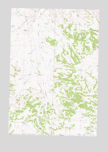
Trail Creek School, MT USGS Topographic Map
Click on map above to begin viewing in our Map Viewer.

This topographic map contains these locations and features:
Feature Name Type Latitude Longitude GNIS ID View Map
02N39E02CABB01 SpringSpringN45.9556°W106.8498°813558View Map
02N39E03CDBB01 WellWellN45.9511°W106.8709°813523View Map
02N39E12C___01 WellWellN45.9361°W106.8309°813450View Map
02N39E12CCCB01 WellWellN45.9350°W106.8342°813444View Map
02N39E12CCCD01 WellWellN45.9347°W106.8331°813443View Map
02N39E12CCDB01 WellWellN45.9358°W106.8320°813448View Map
02N39E14BDBB01 WellWellN45.9297°W106.8503°813416View Map
02N39E14BDBB02 SpringSpringN45.9297°W106.8506°813417View Map
02N39E23CAA_01 WellWellN45.9067°W106.8484°813263View Map
02N39E23CAAB01 WellWellN45.9133°W106.8470°813329View Map
02N39E24BDAA01 SpringSpringN45.9150°W106.8261°813338View Map
02N39E24CDAB01 WellWellN45.9078°W106.8267°813276View Map
02N39E24CDDD01 WellWellN45.9058°W106.8173°813252View Map
02N39E25ACDC01 WellWellN45.8983°W106.8223°813190View Map
02N39E34ADBB01 WellWellN45.8867°W106.8609°813090View Map
02N39E34DADB01 WellWellN45.8811°W106.8578°813032View Map
02N39E36CDDB01 SpringSpringN45.8772°W106.8270°813002View Map
02N40E06AABB01 WellWellN45.9625°W106.8003°813594View Map
02N40E06AABB02 WellWellN45.9625°W106.8003°813595View Map
02N40E06CBDB01 WellWellN45.9530°W106.8117°813542View Map
02N40E07BDCB01 WellWellN45.9405°W106.8103°813476View Map
02N40E18DABD01 SpringSpringN45.9251°W106.7974°813392View Map
02N40E18DBB_01 WellWellN45.9253°W106.7975°813387View Map
02N40E28AADD01 WellWellN45.9014°W106.7531°813212View Map
02N40E28CCBB01 SpringSpringN45.8933°W106.7730°813160View Map
02N40E29CDCC01 WellWellN45.8917°W106.7889°813130View Map
02N40E30BAAC01 WellWellN45.9039°W106.8061°813234View Map
02N40E31DCCD01 WellWellN45.8767°W106.7948°812995View Map
02N40E32BBAB01 WellWellN45.8903°W106.7917°813123View Map
02N40E32BBDA01 WellWellN45.8861°W106.7889°813084View Map
02N40E33CCDD01 SpringSpringN45.8764°W106.7698°812993View Map
02N40E33DAAA01 WellWellN45.8830°W106.7534°813050View Map
03N39E36BACD01 WellWellN45.9739°W106.8278°813645View Map
03N40E19DB__01 WellWellN45.9975°W106.8003°813714View Map
03N40E31DADC01 SpringSpringN45.9672°W106.7942°813619View Map
Ashenhurst Number 2 DamDamN45.9950°W106.8673°796999View Map
Castle Rock (historical)Populated PlaceN45.8755°W106.8034°1923243View Map
Castle Rock School (historical)SchoolN45.8889°W106.8173°1716557View Map
Donley CreekStreamN45.9333°W106.8456°770719View Map
Middle Fork Trail CreekStreamN45.9761°W106.8573°774181View Map
North Fork Trail CreekStreamN45.9858°W106.8503°774818View Map
Robbie CreekStreamN45.9339°W106.8286°775820View Map
Trail CreekStreamN45.9883°W106.8428°777732View Map
Trail Creek School (historical)SchoolN45.9778°W106.8531°777740View Map
Wildhorse Pasture DamDamN46.0000°W106.8439°795038View Map

Note: Coordinates in the location and feature list above are referenced to NAD83 datum.


Copyright (C) 2008-2025 Ryan Niemi / Sunset Dynamics ... All Rights Reserved