TopoQuest Logo
Do you find TopoQuest useful?
Help keep TopoQuest running and adding new maps/features by donating!
Bitcoin:  19c7KJd3qBynnjoSw5npx9KScwjBe4ifkT
Litecoin:  LXs6TkuXGGXo1vDsWCkWVdjQX94eUKd6ui
Home View Maps Find Maps Find Places Resources & Links


Sarpy School, Montana Topographic Map

USGS Map Title: Sarpy School, MT
USGS Map MRC: 45106G8
DRG (GeoTIFF) Download: o45106g8.tif


Neighboring USGS Topographic Map Quads:


  Minnehaha Creek South, MT  
45107H1
 

  McClure Creek, MT  
45106H8
 

  Trail Creek School, MT  
45106H7
 

  Wolf School, MT  
45107G1
 

  Sarpy School, MT  
45106G8
 

  Rough Draw, MT  
45106G7
 

  Jeans Fork NE, MT  
45107F1
 

  Chalky Point, MT  
45106F8
 

  Black Spring, MT  
45106F7


Map MRC Location:

N46°
W107°
N46°
W106°
H8 H7 H6 H5 H4 H3 H2 H1
G8 G7 G6 G5 G4 G3 G2 G1
F8 F7 F6 F5 F4 F3 F2 F1
E8 E7 E6 E5 E4 E3 E2 E1
D8 D7 D6 D5 D4 D3 D2 D1
C8 C7 C6 C5 C4 C3 C2 C1
B8 B7 B6 B5 B4 B3 B2 B1
A8 A7 A6 A5 A4 A3 A2 A1
N45°
W107°
N45°
W106°

Sarpy School, MT USGS 1:24K Topographic Map Preview:
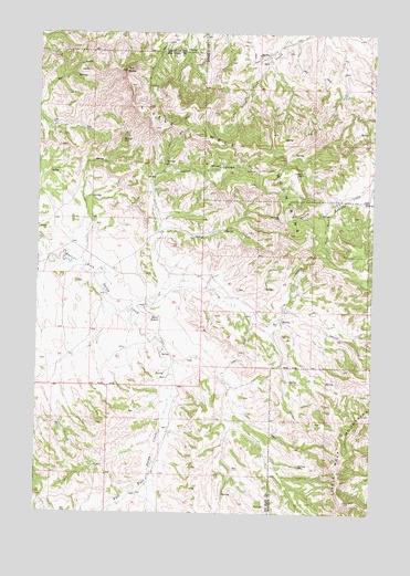
Sarpy School, MT USGS Topographic Map
Click on map above to begin viewing in our Map Viewer.

This topographic map contains these locations and features:
Feature Name Type Latitude Longitude GNIS ID View Map
01N38E11BBCB01 WellWellN45.8536°W106.9798°812769View Map
01N38E22AADA01 WellWellN45.8244°W106.9809°812485View Map
01N38E23BBBD01 WellWellN45.8250°W106.9792°812493View Map
01N38E23CCDA01 WellWellN45.8133°W106.9762°812317View Map
01N38E25BCCA01 WellWellN45.8064°W106.9584°812234View Map
01N38E26DBAA01 WellWellN45.8047°W106.9656°812213View Map
01N38E34CDCC01 WellWellN45.7836°W106.9953°811985View Map
01N38E35ACBD01 WellWellN45.7928°W106.9678°812088View Map
01N38E36ADDD01 WellWellN45.7908°W106.9395°812066View Map
01N38E36BACD01 WellWellN45.7950°W106.9539°812105View Map
01N38E36BBCB01 WellWellN45.7955°W106.9589°812110View Map
01N38E36BDAD01 WellWellN45.7922°W106.9498°812077View Map
01N38E36BDAD02 WellWellN45.7922°W106.9498°812078View Map
01N38E36BDAD03 WellWellN45.7922°W106.9498°812079View Map
01N38E36BDBB01 WellWellN45.7939°W106.9539°812096View Map
01N38E36BDBD01 WellWellN45.7928°W106.9528°812087View Map
01N38E36CDBD01 WellWellN45.7836°W106.9517°811984View Map
01N38E36CDCD01 WellWellN45.7833°W106.9523°811982View Map
01N39E05CBB_01 WellWellN45.8669°W106.9081°812890View Map
01N39E19CAAB01 WellWellN45.8236°W106.9317°812476View Map
01N39E30BCAC01 WellWellN45.8122°W106.9350°812300View Map
01N39E30BCDB01 WellWellN45.8114°W106.9362°812287View Map
01N39E30BDCB01 WellWellN45.8111°W106.9339°812285View Map
01N39E31AAAC01 WellWellN45.8014°W106.9206°812171View Map
01N39E31AAAC02 WellWellN45.8014°W106.9203°812170View Map
01S38E12BBDB01 WellWellN45.7730°W106.9912°811878View Map
01S38E12DDBD01 WellWellN45.7625°W106.9773°811765View Map
01S38E13CBDA01 WellWellN45.7503°W106.9906°811653View Map
01S38E14DADB01 WellWellN45.7508°W106.9970°811656View Map
01S39E04BCAC01 WellWellN45.7842°W106.9298°811993View Map
01S39E07CABA01 WellWellN45.7667°W106.9664°811805View Map
01S39E08BBDB01 WellWellN45.7722°W106.9512°811872View Map
01S39E18BDAA01 WellWellN45.7575°W106.9648°811731View Map
01S39E18BDAD01 WellWellN45.7553°W106.9648°811698View Map
02N38E36CDBD01 WellWellN45.8725°W106.9525°812945View Map
02N38E36DCDC01 SpringSpringN45.8706°W106.9458°812928View Map
09S39E22CCBC01 WellWellN45.7761°W106.9498°811913View Map
Harris CanyonValleyN45.8253°W106.9548°772165View Map
Little Wolf MountainsRangeN45.8425°W106.9109°773504View Map
Red ButteSummitN45.8653°W106.9684°775618View Map
Sarpy (historical)Populated PlaceN45.7958°W106.9528°1716487View Map
Sarpy Post Office (historical)Post OfficeN45.7958°W106.9528°1716488View Map
Sarpy School (historical)SchoolN45.8008°W106.9548°776229View Map

Note: Coordinates in the location and feature list above are referenced to NAD83 datum.


Copyright (C) 2008-2024 Ryan Niemi / Sunset Dynamics ... All Rights Reserved