TopoQuest Logo
Do you find TopoQuest useful?
Help keep TopoQuest running and adding new maps/features by donating!
Bitcoin:  19c7KJd3qBynnjoSw5npx9KScwjBe4ifkT
Litecoin:  LXs6TkuXGGXo1vDsWCkWVdjQX94eUKd6ui
Home View Maps Find Maps Find Places Resources & Links


McGraws, West Virginia Topographic Map

USGS Map Title: McGraws, WV
USGS Map MRC: 37081F4
DRG (GeoTIFF) Download: o37081f4.tif


Neighboring USGS Topographic Map Quads:


  Pilot Knob, WV  
37081G5
 

  Arnett, WV  
37081G4
 

  Eccles, WV  
37081G3
 

  Matheny, WV  
37081F5
 

  McGraws, WV  
37081F4
 

  Lester, WV  
37081F3
 

  Pineville, WV  
37081E5
 

  Mullens, WV  
37081E4
 

  Rhodell, WV  
37081E3


Map MRC Location:

N38°
W82°
N38°
W81°
H8 H7 H6 H5 H4 H3 H2 H1
G8 G7 G6 G5 G4 G3 G2 G1
F8 F7 F6 F5 F4 F3 F2 F1
E8 E7 E6 E5 E4 E3 E2 E1
D8 D7 D6 D5 D4 D3 D2 D1
C8 C7 C6 C5 C4 C3 C2 C1
B8 B7 B6 B5 B4 B3 B2 B1
A8 A7 A6 A5 A4 A3 A2 A1
N37°
W82°
N37°
W81°

McGraws, WV USGS 1:24K Topographic Map Preview:
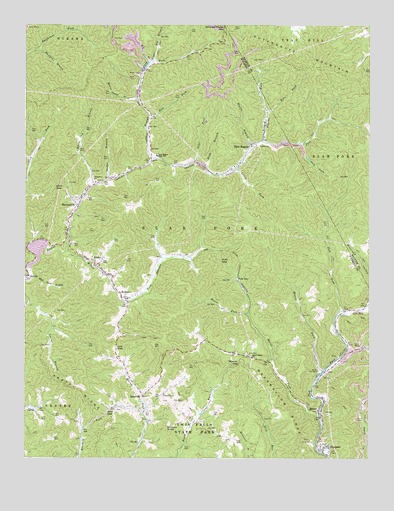
McGraws, WV USGS Topographic Map
Click on map above to begin viewing in our Map Viewer.

This topographic map contains these locations and features:
Feature Name Type Latitude Longitude GNIS ID View Map
Bear ForkStreamN37.7240°W81.4548°1535358View Map
Bearwallow RidgeRidgeN37.6265°W81.4020°1535433View Map
Big BranchStreamN37.7390°W81.4543°1535787View Map
Bobs ForkStreamN37.7248°W81.4123°1536183View Map
Bridge BranchStreamN37.7057°W81.4698°1536334View Map
Buck ForkStreamN37.7115°W81.3970°1536551View Map
Buck Fork DamDamN37.7034°W81.3998°1559266View Map
Buck Fork LakeReservoirN37.7034°W81.3998°1559267View Map
CastleLocaleN37.6398°W81.4987°1537089View Map
Franks ForkStreamN37.7168°W81.4140°1539234View Map
Friendship ChurchChurchN37.6434°W81.4495°1539269View Map
Frye CemeteryCemeteryN37.6425°W81.4936°2085821View Map
Glen GapGapN37.7032°W81.4890°1539457View Map
Glen Lyn Police DepartmentBuildingN37.6294°W81.4353°2086274View Map
Glen RogersPopulated PlaceN37.7154°W81.4179°1554568View Map
Glen Rogers Grade School (historical)SchoolN37.7093°W81.4240°1741466View Map
Glen Rogers High School (historical)SchoolN37.7123°W81.4520°1539458View Map
Glen Rogers Post OfficePost OfficeN37.7159°W81.4167°1741467View Map
Hickory KnobSummitN37.6337°W81.4484°1554695View Map
James Brooks SpringSpringN37.7401°W81.4418°1678179View Map
Lewis ForkStreamN37.7087°W81.4229°1541807View Map
Low GapGapN37.6571°W81.4668°1542491View Map
MabenPopulated PlaceN37.6387°W81.3940°1555015View Map
Maben Post OfficePost OfficeN37.6382°W81.3940°1741488View Map
Manns Camp BranchStreamN37.7284°W81.4584°1542724View Map
Marsh ForkStreamN37.6384°W81.3929°1542780View Map
McGrawsPopulated PlaceN37.6709°W81.4632°1543008View Map
McGraws Post OfficePost OfficeN37.6713°W81.4648°1741491View Map
Measle ForkStreamN37.6501°W81.3918°1543099View Map
MilamPopulated PlaceN37.6815°W81.4729°1555119View Map
Milam ForkStreamN37.6846°W81.4851°1543257View Map
Mouse ForkStreamN37.6668°W81.4187°1543888View Map
Old Slab ForkStreamN37.6668°W81.3840°1544371View Map
Otter ForkStreamN37.7109°W81.4382°1544464View Map
Pierpoint Freewill Baptist ChurchChurchN37.6271°W81.3918°1741500View Map
PierpontPopulated PlaceN37.6282°W81.3912°1544806View Map
Pinegrove ChurchChurchN37.7048°W81.4743°1544910View Map
Polk GapPopulated PlaceN37.6768°W81.4226°1555385View Map
Polk GapGapN37.6818°W81.4287°1545118View Map
Pretty RidgeRidgeN37.6459°W81.4854°1545244View Map
RavencliffPopulated PlaceN37.6982°W81.4812°1555444View Map
Ravencliff Post OfficePost OfficeN37.6908°W81.4846°1741503View Map
Rush BranchStreamN37.7096°W81.4345°1546154View Map
SaulsvillePopulated PlaceN37.6429°W81.4568°1546450View Map
Saulsville Baptist ChurchChurchN37.6384°W81.4565°1741506View Map
Skinned Poplar GapGapN37.7496°W81.4276°1546869View Map
Station GapGapN37.6521°W81.4226°1547354View Map
Sweet Home ChurchChurchN37.6543°W81.4173°1547799View Map
Tilley-Tolliver CemeteryCemeteryN37.6440°W81.4327°2586352View Map
Trough ForkStreamN37.7118°W81.4543°1548286View Map
Twin Falls Resort State Park Golf CourseLocaleN37.6325°W81.4408°2634223View Map
Twin Falls State ParkParkN37.6334°W81.4368°1548401View Map
Upper Big BranchStreamN37.7393°W81.4537°1548502View Map
Upper Laurel Volunteer Fire and Ambulance ServiceBuildingN37.6826°W81.4958°2577836View Map
Wallis BranchStreamN37.7154°W81.4170°1548741View Map
Watt Oliver BranchStreamN37.6768°W81.4979°1548837View Map
White Oak BranchStreamN37.7037°W81.4751°1549036View Map
Wolf GapGapN37.6382°W81.4701°1549277View Map
Wolfpen BranchStreamN37.7434°W81.4957°1549310View Map

Note: Coordinates in the location and feature list above are referenced to NAD83 datum.


Copyright (C) 2008-2024 Ryan Niemi / Sunset Dynamics ... All Rights Reserved