TopoQuest Logo
Do you find TopoQuest useful?
Help keep TopoQuest running and adding new maps/features by donating!
Bitcoin:  19c7KJd3qBynnjoSw5npx9KScwjBe4ifkT
Litecoin:  LXs6TkuXGGXo1vDsWCkWVdjQX94eUKd6ui
Home View Maps Find Maps Find Places Resources & Links


McKay Hollow, Utah Topographic Map

USGS Map Title: McKay Hollow, UT
USGS Map MRC: 41111C2
DRG (GeoTIFF) Download: o41111c2.tif


Neighboring USGS Topographic Map Quads:


  Meachum Ridge, UT  
41111D3
 

  Neponset Reservoir NW, UT  
41111D2
 

  Neponset Reservoir NE, UT  
41111D1
 

  Peck Canyon, UT  
41111C3
 

  McKay Hollow, UT  
41111C2
 

  Murphy Ridge, UT  
41111C1
 

  Francis Canyon, UT  
41111B3
 

  Shearing Corral, UT  
41111B2
 

  Wahsatch, UT  
41111B1


Map MRC Location:

N42°
W112°
N42°
W111°
H8 H7 H6 H5 H4 H3 H2 H1
G8 G7 G6 G5 G4 G3 G2 G1
F8 F7 F6 F5 F4 F3 F2 F1
E8 E7 E6 E5 E4 E3 E2 E1
D8 D7 D6 D5 D4 D3 D2 D1
C8 C7 C6 C5 C4 C3 C2 C1
B8 B7 B6 B5 B4 B3 B2 B1
A8 A7 A6 A5 A4 A3 A2 A1
N41°
W112°
N41°
W111°

McKay Hollow, UT USGS 1:24K Topographic Map Preview:
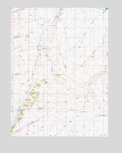
McKay Hollow, UT USGS Topographic Map
Click on map above to begin viewing in our Map Viewer.

This topographic map contains these locations and features:
Feature Name Type Latitude Longitude GNIS ID View Map
Alkali HollowValleyN41.3686°W111.1341°1438156View Map
Beer HollowValleyN41.3055°W111.2255°1438569View Map
Chicken HollowValleyN41.3508°W111.2155°1439677View Map
Chicken SpringSpringN41.3477°W111.2310°1439682View Map
Five Spring CanyonValleyN41.3744°W111.2269°1455142View Map
Kate HollowValleyN41.3394°W111.1327°1442282View Map
Keg SpringSpringN41.3125°W111.1321°1442291View Map
Lake RidgeRidgeN41.2519°W111.2235°1442419View Map
McKay HollowValleyN41.3119°W111.1332°1443256View Map
McKay RidgeRidgeN41.2744°W111.1646°1443257View Map
Negro Dan HollowValleyN41.3391°W111.2102°1443787View Map
Negro Dan SpringSpringN41.3361°W111.2122°1443788View Map
Road HollowValleyN41.2919°W111.2285°1445008View Map
Saleratus Reservoir Number 1ReservoirN41.2756°W111.2410°1454513View Map
Saleratus Reservoir Number 2ReservoirN41.2681°W111.2434°1454514View Map
Spring CanyonValleyN41.3166°W111.2221°1449913View Map
Spring CreekStreamN41.3155°W111.2221°1449048View Map
Table MountainSummitN41.3027°W111.2085°1446317View Map

Note: Coordinates in the location and feature list above are referenced to NAD83 datum.


Copyright (C) 2008-2025 Ryan Niemi / Sunset Dynamics ... All Rights Reserved