TopoQuest Logo
Do you find TopoQuest useful?
Help keep TopoQuest running and adding new maps/features by donating!
Bitcoin:  19c7KJd3qBynnjoSw5npx9KScwjBe4ifkT
Litecoin:  LXs6TkuXGGXo1vDsWCkWVdjQX94eUKd6ui
Home View Maps Find Maps Find Places Resources & Links


Neponset Reservoir NE, Utah Topographic Map

USGS Map Title: Neponset Reservoir NE, UT
USGS Map MRC: 41111D1
DRG (GeoTIFF) Download: o41111d1.tif


Neighboring USGS Topographic Map Quads:


  Woodruff, UT  
41111E2
 

  Woodruff Narrows, WY  
41111E1
 

  Sawtooth Mountain, WY  
41110E8
 

  Neponset Reservoir NW, UT  
41111D2
 

  Neponset Reservoir NE, UT  
41111D1
 

  Three Forks, WY  
41110D8
 

  McKay Hollow, UT  
41111C2
 

  Murphy Ridge, UT  
41111C1
 

  Evanston, WY  
41110C8


Map MRC Location:

N42°
W112°
N42°
W111°
H8 H7 H6 H5 H4 H3 H2 H1
G8 G7 G6 G5 G4 G3 G2 G1
F8 F7 F6 F5 F4 F3 F2 F1
E8 E7 E6 E5 E4 E3 E2 E1
D8 D7 D6 D5 D4 D3 D2 D1
C8 C7 C6 C5 C4 C3 C2 C1
B8 B7 B6 B5 B4 B3 B2 B1
A8 A7 A6 A5 A4 A3 A2 A1
N41°
W112°
N41°
W111°

Neponset Reservoir NE, UT USGS 1:24K Topographic Map Preview:
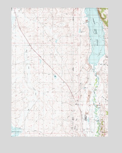
Neponset Reservoir NE, UT USGS Topographic Map
Click on map above to begin viewing in our Map Viewer.

This topographic map contains these locations and features:
Feature Name Type Latitude Longitude GNIS ID View Map
Acocks CanyonValleyN41.4699°W111.0052°1584646View Map
Bear RiverPopulated PlaceN41.3841°W111.0263°1926815View Map
Chapman CanalCanalN41.3916°W111.0327°1586581View Map
Chapman CanalCanalN41.3777°W111.0857°1426534View Map
Christensen DitchCanalN41.4463°W111.0113°1586692View Map
Christensen HollowValleyN41.4530°W111.0044°1586693View Map
Crompton DitchCanalN41.4574°W111.0046°1587227View Map
Dry LakeLakeN41.4333°W111.0692°1455245View Map
Fowkes Canyon CreekStreamN41.4136°W111.0074°1588699View Map
Highway RanchLocaleN41.4830°W111.1221°1455319View Map
Murphy HollowValleyN41.3774°W111.0852°1430607View Map
Murphy RidgeRidgeN41.3816°W111.0410°1591923View Map
Shell HollowValleyN41.3797°W111.0102°1594238View Map
Stacey HollowValleyN41.3791°W111.1049°1446088View Map
Town of Bear RiverCivilN41.3859°W111.0270°2411670View Map
Tunnel DitchCanalN41.4238°W111.0052°1595732View Map
Uinta County Fire Protection Bear RiverBuildingN41.3877°W111.0360°2673617View Map
Whitney CanyonValleyN41.4447°W111.0107°1597012View Map
Whitney Canyon CreekStreamN41.4447°W111.0107°1596336View Map
Woodruff Narrows ReservoirReservoirN41.4752°W111.0172°1596609View Map

Note: Coordinates in the location and feature list above are referenced to NAD83 datum.


Copyright (C) 2008-2025 Ryan Niemi / Sunset Dynamics ... All Rights Reserved