TopoQuest Logo
Do you find TopoQuest useful?
Help keep TopoQuest running and adding new maps/features by donating!
Bitcoin:  19c7KJd3qBynnjoSw5npx9KScwjBe4ifkT
Litecoin:  LXs6TkuXGGXo1vDsWCkWVdjQX94eUKd6ui
Home View Maps Find Maps Find Places Resources & Links


Murphy Ridge, Utah Topographic Map

USGS Map Title: Murphy Ridge, UT
USGS Map MRC: 41111C1
DRG (GeoTIFF) Download: o41111c1.tif


Neighboring USGS Topographic Map Quads:


  Neponset Reservoir NW, UT  
41111D2
 

  Neponset Reservoir NE, UT  
41111D1
 

  Three Forks, WY  
41110D8
 

  McKay Hollow, UT  
41111C2
 

  Murphy Ridge, UT  
41111C1
 

  Evanston, WY  
41110C8
 

  Shearing Corral, UT  
41111B2
 

  Wahsatch, UT  
41111B1
 

  Millis, WY  
41110B8


Map MRC Location:

N42°
W112°
N42°
W111°
H8 H7 H6 H5 H4 H3 H2 H1
G8 G7 G6 G5 G4 G3 G2 G1
F8 F7 F6 F5 F4 F3 F2 F1
E8 E7 E6 E5 E4 E3 E2 E1
D8 D7 D6 D5 D4 D3 D2 D1
C8 C7 C6 C5 C4 C3 C2 C1
B8 B7 B6 B5 B4 B3 B2 B1
A8 A7 A6 A5 A4 A3 A2 A1
N41°
W112°
N41°
W111°

Murphy Ridge, UT USGS 1:24K Topographic Map Preview:
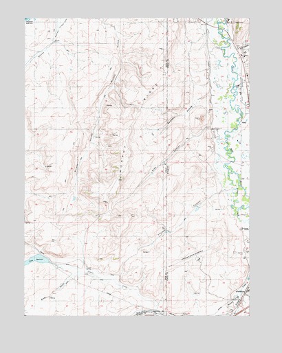
Murphy Ridge, UT USGS Topographic Map
Click on map above to begin viewing in our Map Viewer.

This topographic map contains these locations and features:
Feature Name Type Latitude Longitude GNIS ID View Map
Adin Brown DitchCanalN41.3438°W111.0044°1584703View Map
AlmyPopulated PlaceN41.3316°W111.0046°1584802View Map
Almy CemeteryCemeteryN41.3469°W111.0055°1584803View Map
Almy Number Seven MineMineN41.3463°W111.0007°1746993View Map
Almy Number Six MineMineN41.3411°W111.0007°1746992View Map
Bartlett HollowValleyN41.3433°W111.0227°1585165View Map
Bartlett HollowValleyN41.3433°W111.0224°1425303View Map
Brown HollowValleyN41.2669°W111.0988°1439167View Map
Chesney DamDamN41.2933°W111.0207°1607909View Map
Chesney ReservoirReservoirN41.2933°W111.0207°1607910View Map
Crane CreekStreamN41.2519°W111.0530°1440130View Map
Crane ReservoirReservoirN41.2722°W111.1248°1440131View Map
Dry CanyonValleyN41.3613°W111.0069°1587785View Map
Evanston-Uinta County Airport Burns FieldAirportN41.2743°W111.0295°1608992View Map
KEVA-AM (Evanston)TowerN41.2580°W111.0149°1609209View Map
Morris DitchCanalN41.3727°W111.0260°1591766View Map
Murphy RidgeRidgeN41.3233°W111.0682°1430611View Map
Red Canyon CreekStreamN41.3388°W111.0007°1593257View Map
Sims CanyonValleyN41.3294°W111.0219°1594370View Map
Sims CanyonValleyN41.3299°W111.0219°1432480View Map
Thomas CanyonValleyN41.3033°W111.0146°1433464View Map
Thomas CanyonValleyN41.3024°W111.0141°1595498View Map
Wasatch CreekStreamN41.2583°W111.0055°1433975View Map
Wasatch CreekStreamN41.2586°W111.0041°1596050View Map
WyutaLocaleN41.2549°W111.0513°1455587View Map
Yellow CreekStreamN41.3105°W111.0113°1447551View Map
Yellow CreekStreamN41.3105°W111.0113°1604307View Map

Note: Coordinates in the location and feature list above are referenced to NAD83 datum.


Copyright (C) 2008-2025 Ryan Niemi / Sunset Dynamics ... All Rights Reserved