TopoQuest Logo
Do you find TopoQuest useful?
Help keep TopoQuest running and adding new maps/features by donating!
Bitcoin:  19c7KJd3qBynnjoSw5npx9KScwjBe4ifkT
Litecoin:  LXs6TkuXGGXo1vDsWCkWVdjQX94eUKd6ui
Home View Maps Find Maps Find Places Resources & Links


McWilliams Canyon, New Mexico Topographic Map

USGS Map Title: McWilliams Canyon, NM
USGS Map MRC: 36104H6
DRG (GeoTIFF) Download: o36104h6.tif


Neighboring USGS Topographic Map Quads:


  Little Pine Canyon, CO  
37104A7
 

  Valdez, CO  
37104A6
 

  Starkville, CO  
37104A5
 

  Caliente Canyon North, NM  
36104H7
 

  McWilliams Canyon, NM  
36104H6
 

  Tin Pan Canyon, NM  
36104H5
 

  Caliente Canyon South, NM  
36104G7
 

  Curtis Camp, NM  
36104G6
 

  Red River Peak, NM  
36104G5


Map MRC Location:

N37°
W105°
N37°
W104°
H8 H7 H6 H5 H4 H3 H2 H1
G8 G7 G6 G5 G4 G3 G2 G1
F8 F7 F6 F5 F4 F3 F2 F1
E8 E7 E6 E5 E4 E3 E2 E1
D8 D7 D6 D5 D4 D3 D2 D1
C8 C7 C6 C5 C4 C3 C2 C1
B8 B7 B6 B5 B4 B3 B2 B1
A8 A7 A6 A5 A4 A3 A2 A1
N36°
W105°
N36°
W104°

McWilliams Canyon, NM USGS 1:24K Topographic Map Preview:
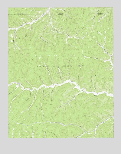
McWilliams Canyon, NM USGS Topographic Map
Click on map above to begin viewing in our Map Viewer.

This topographic map contains these locations and features:
Feature Name Type Latitude Longitude GNIS ID View Map
Alkali CanyonValleyN36.9850°W104.7000°885682View Map
Bruggerman CanyonValleyN36.9234°W104.6658°886794View Map
Commissary CanyonValleyN36.9200°W104.7230°897343View Map
Conklin CanyonValleyN36.9228°W104.6972°887788View Map
Corduroy CanyonValleyN36.9256°W104.7086°887844View Map
Cottonwood CanyonValleyN36.9714°W104.7103°887898View Map
Dargot CanyonValleyN36.9286°W104.6836°888198View Map
Deer CanyonValleyN36.9717°W104.6714°888291View Map
Doyle CanyonValleyN36.9303°W104.6778°888500View Map
Drive Out CanyonValleyN36.9954°W104.6321°194970View Map
Fence CanyonValleyN36.9803°W104.7491°194980View Map
Jenkins CanyonValleyN36.9531°W104.6289°890438View Map
Jones CanyonValleyN36.9439°W104.6255°890541View Map
McCuen CanyonValleyN36.9206°W104.7158°891737View Map
McWilliams CanyonValleyN36.9969°W104.7022°194967View Map
Number Eight CanyonValleyN36.8750°W104.6694°892760View Map
Number Five CanyonValleyN36.9189°W104.6475°892761View Map
Number Nine CanyonValleyN36.9236°W104.7067°892762View Map
Sawmill CanyonValleyN36.9845°W104.7228°894616View Map
Sheep Spring CanyonValleyN36.9197°W104.6639°894780View Map
Sheep Spring CreekStreamN36.9197°W104.6639°902749View Map
Shingle Mill CanyonValleyN36.9256°W104.7364°894795View Map
Six Horse CanyonValleyN36.9264°W104.6964°894881View Map
Spring CanyonValleyN36.9717°W104.6714°895254View Map
T B L CanyonValleyN36.9211°W104.7325°895473View Map
Taber Morey CanyonValleyN36.9492°W104.6305°895481View Map
TX CanyonValleyN36.9256°W104.7494°895479View Map
White Horse CanyonValleyN36.9789°W104.7397°896499View Map

Note: Coordinates in the location and feature list above are referenced to NAD83 datum.


Copyright (C) 2008-2025 Ryan Niemi / Sunset Dynamics ... All Rights Reserved