TopoQuest Logo
Do you find TopoQuest useful?
Help keep TopoQuest running and adding new maps/features by donating!
Bitcoin:  19c7KJd3qBynnjoSw5npx9KScwjBe4ifkT
Litecoin:  LXs6TkuXGGXo1vDsWCkWVdjQX94eUKd6ui
Home View Maps Find Maps Find Places Resources & Links


Tin Pan Canyon, New Mexico Topographic Map

USGS Map Title: Tin Pan Canyon, NM
USGS Map MRC: 36104H5
DRG (GeoTIFF) Download: o36104h5.tif


Neighboring USGS Topographic Map Quads:


  Valdez, CO  
37104A6
 

  Starkville, CO  
37104A5
 

  Fishers Peak, CO  
37104A4
 

  McWilliams Canyon, NM  
36104H6
 

  Tin Pan Canyon, NM  
36104H5
 

  Raton, NM  
36104H4
 

  Curtis Camp, NM  
36104G6
 

  Red River Peak, NM  
36104G5
 

  Clifton House, NM  
36104G4


Map MRC Location:

N37°
W105°
N37°
W104°
H8 H7 H6 H5 H4 H3 H2 H1
G8 G7 G6 G5 G4 G3 G2 G1
F8 F7 F6 F5 F4 F3 F2 F1
E8 E7 E6 E5 E4 E3 E2 E1
D8 D7 D6 D5 D4 D3 D2 D1
C8 C7 C6 C5 C4 C3 C2 C1
B8 B7 B6 B5 B4 B3 B2 B1
A8 A7 A6 A5 A4 A3 A2 A1
N36°
W105°
N36°
W104°

Tin Pan Canyon, NM USGS 1:24K Topographic Map Preview:
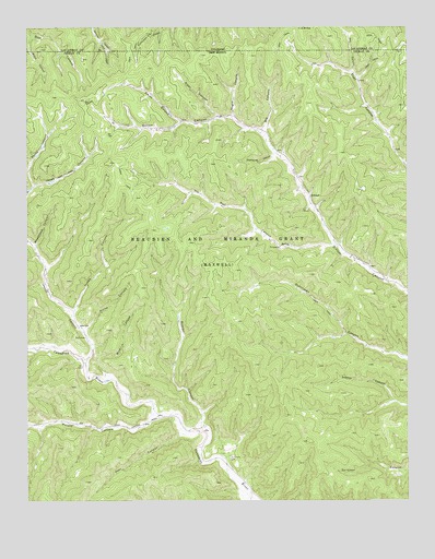
Tin Pan Canyon, NM USGS Topographic Map
Click on map above to begin viewing in our Map Viewer.

This topographic map contains these locations and features:
Feature Name Type Latitude Longitude GNIS ID View Map
Bartlett MineMineN36.9064°W104.5197°916523View Map
Big CanyonValleyN36.9726°W104.5483°194973View Map
Blind CanyonValleyN36.9980°W104.6241°194971View Map
Blossburg Number FourMineN36.8914°W104.5194°917899View Map
BrilliantPopulated PlaceN36.9561°W104.5344°902183View Map
Brilliant Coal MineMineN36.9514°W104.5347°916513View Map
Brilliant Post Office (historical)Post OfficeN36.9561°W104.5344°937584View Map
Deer CanyonValleyN36.8922°W104.5758°888292View Map
Dutchman Coal MineMineN36.9159°W104.5100°916100View Map
Hobbs CanyonValleyN36.9250°W104.6103°890040View Map
Horse CanyonValleyN36.9122°W104.6058°890145View Map
Meatblock CanyonValleyN36.9428°W104.6230°891816View Map
Negro CanyonValleyN36.9765°W104.5581°194972View Map
Pertie CanyonValleyN36.9586°W104.6233°893203View Map
Piper CanyonValleyN36.9772°W104.5633°893342View Map
Potato CanyonValleyN36.8970°W104.5833°893434View Map
Rex CanyonValleyN36.9880°W104.5182°194974View Map
Rice CanyonValleyN36.9078°W104.6000°893883View Map
Rockhouse CanyonValleyN36.9664°W104.5444°894100View Map
Rombo CanyonValleyN36.8953°W104.5678°894136View Map
Smith CanyonValleyN36.9756°W104.5755°894932View Map
Tin Pan CanyonValleyN36.9425°W104.5255°895684View Map

Note: Coordinates in the location and feature list above are referenced to NAD83 datum.


Copyright (C) 2008-2024 Ryan Niemi / Sunset Dynamics ... All Rights Reserved