TopoQuest Logo
Do you find TopoQuest useful?
Help keep TopoQuest running and adding new maps/features by donating!
Bitcoin:  19c7KJd3qBynnjoSw5npx9KScwjBe4ifkT
Litecoin:  LXs6TkuXGGXo1vDsWCkWVdjQX94eUKd6ui
Home View Maps Find Maps Find Places Resources & Links


Meacham Corner, Oregon Topographic Map

USGS Map Title: Meacham Corner, OR
USGS Map MRC: 45123F1
DRG (GeoTIFF) Download: o45123f1.tif


Neighboring USGS Topographic Map Quads:


  Vernonia, OR  
45123G2
 

  Bacona, OR  
45123G1
 

  Chapman, OR  
45122G8
 

  Buxton, OR  
45123F2
 

  Meacham Corner, OR  
45123F1
 

  Dixie Mountain, OR  
45122F8
 

  Gales Creek, OR  
45123E2
 

  Forest Grove, OR  
45123E1
 

  Hillsboro, OR  
45122E8


Map MRC Location:

N46°
W124°
N46°
W123°
H8 H7 H6 H5 H4 H3 H2 H1
G8 G7 G6 G5 G4 G3 G2 G1
F8 F7 F6 F5 F4 F3 F2 F1
E8 E7 E6 E5 E4 E3 E2 E1
D8 D7 D6 D5 D4 D3 D2 D1
C8 C7 C6 C5 C4 C3 C2 C1
B8 B7 B6 B5 B4 B3 B2 B1
A8 A7 A6 A5 A4 A3 A2 A1
N45°
W124°
N45°
W123°

Meacham Corner, OR USGS 1:24K Topographic Map Preview:
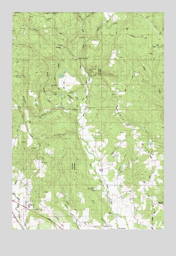
Meacham Corner, OR USGS Topographic Map
Click on map above to begin viewing in our Map Viewer.

This topographic map contains these locations and features:
Feature Name Type Latitude Longitude GNIS ID View Map
Arcade CemeteryCemeteryN45.6524°W123.0158°1117026View Map
Bald MountainSummitN45.7128°W123.1239°1117181View Map
Banks Water Treatment FacilityLocaleN45.6680°W123.1114°2660835View Map
Bateman ReservoirReservoirN45.6401°W123.0958°1130231View Map
Big CanyonValleyN45.6807°W123.0718°1117594View Map
Buck Mountain Ranch (historical)LocaleN45.7457°W123.0404°1157957View Map
Bump ReservoirReservoirN45.7132°W123.0858°1130236View Map
Burgdorfer FlatFlatN45.7359°W123.0432°1118321View Map
Camp MountaindaleLocaleN45.6487°W123.0584°1157959View Map
Covey Ridge VineyardLocaleN45.6300°W123.1083°2664080View Map
Dam Site ReservoirReservoirN45.6952°W123.0843°1130234View Map
Denny CreekStreamN45.7218°W123.0707°1157971View Map
Dixie (historical)Populated PlaceN45.7304°W123.0054°1130235View Map
Dixie Post Office (historical)Post OfficeN45.7304°W123.0054°1165166View Map
East Gumm CreekStreamN45.6484°W123.0401°1130241View Map
Eccles Mill (historical)LocaleN45.6315°W123.1226°1166513View Map
Fern SpringSpringN45.7036°W123.0759°1120679View Map
Gilbert AirportAirportN45.6503°W123.0393°2770596View Map
Grebe CreekStreamN45.6957°W123.0851°1121365View Map
Gumm CreekStreamN45.6537°W123.0393°1157991View Map
Hidden ValleyBasinN45.6887°W123.1029°1121797View Map
Horning ReservoirReservoirN45.6749°W123.0133°1130239View Map
Krueger's Tree FarmsLocaleN45.6711°W123.0625°2664085View Map
Little Bend Park (historical)ParkN45.7351°W123.0668°1158004View Map
Meacham CornerLocaleN45.6940°W123.0657°1158012View Map
Meadow BrookStreamN45.6929°W123.0693°1130238View Map
Mountaindale ChurchChurchN45.7296°W123.0865°1158016View Map
Mountaindale School (historical)SchoolN45.6365°W123.0440°1157946View Map
Murtaugh CreekStreamN45.6918°W123.0712°1158017View Map
Ornoname 22 DamDamN45.7148°W123.0846°1163802View Map
Panther CreekStreamN45.7443°W123.0668°1125162View Map
Plentywater CreekStreamN45.7112°W123.0646°1125490View Map
Pumpkin RidgeRidgeN45.6568°W123.0115°1158023View Map
Raffety CemeteryCemeteryN45.6334°W123.0457°1125772View Map
Rails End ReservoirReservoirN45.6498°W123.0859°1130232View Map
Rebart ReservoirReservoirN45.6453°W123.0807°1130672View Map
Red Slide HillSummitN45.7073°W123.0947°1125905View Map
Rock CreekStreamN45.7326°W123.0654°1158029View Map
Rye HillSummitN45.7403°W123.0331°1126388View Map
Shipley SpringsSpringN45.6392°W123.1129°1126889View Map
Silver Winds FarmLocaleN45.6292°W123.0483°2664083View Map
Sky RanchLocaleN45.7009°W123.1084°1157411View Map
Smoke RanchLocaleN45.7289°W123.0061°2675459View Map
Snooseville CornerLocaleN45.7232°W123.0712°1158036View Map
Spaniol ReservoirReservoirN45.7022°W123.0859°1130237View Map
Sunago ReservoirReservoirN45.6901°W123.1084°1130233View Map
Washington Grange HallBuildingN45.6401°W123.0054°1639220View Map
Welches PondLakeN45.6621°W123.0329°1130240View Map
Whiskey CreekStreamN45.6959°W123.0859°1128940View Map
White Water FarmsLocaleN45.6275°W123.1161°2664079View Map

Note: Coordinates in the location and feature list above are referenced to NAD83 datum.


Copyright (C) 2008-2024 Ryan Niemi / Sunset Dynamics ... All Rights Reserved