TopoQuest Logo
Do you find TopoQuest useful?
Help keep TopoQuest running and adding new maps/features by donating!
Bitcoin:  19c7KJd3qBynnjoSw5npx9KScwjBe4ifkT
Litecoin:  LXs6TkuXGGXo1vDsWCkWVdjQX94eUKd6ui
Home View Maps Find Maps Find Places Resources & Links


Gales Creek, Oregon Topographic Map

USGS Map Title: Gales Creek, OR
USGS Map MRC: 45123E2
DRG (GeoTIFF) Download: o45123e2.tif


Neighboring USGS Topographic Map Quads:


  Timber, OR  
45123F3
 

  Buxton, OR  
45123F2
 

  Meacham Corner, OR  
45123F1
 

  Roaring Creek, OR  
45123E3
 

  Gales Creek, OR  
45123E2
 

  Forest Grove, OR  
45123E1
 

  Turner Creek, OR  
45123D3
 

  Gaston, OR  
45123D2
 

  Laurelwood, OR  
45123D1


Map MRC Location:

N46°
W124°
N46°
W123°
H8 H7 H6 H5 H4 H3 H2 H1
G8 G7 G6 G5 G4 G3 G2 G1
F8 F7 F6 F5 F4 F3 F2 F1
E8 E7 E6 E5 E4 E3 E2 E1
D8 D7 D6 D5 D4 D3 D2 D1
C8 C7 C6 C5 C4 C3 C2 C1
B8 B7 B6 B5 B4 B3 B2 B1
A8 A7 A6 A5 A4 A3 A2 A1
N45°
W124°
N45°
W123°

Gales Creek, OR USGS 1:24K Topographic Map Preview:
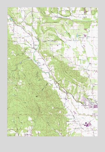
Gales Creek, OR USGS Topographic Map
Click on map above to begin viewing in our Map Viewer.

This topographic map contains these locations and features:
Feature Name Type Latitude Longitude GNIS ID View Map
Alexander CreekStreamN45.5082°W123.1490°1116848View Map
Bakersfield Post Office (historical)Post OfficeN45.6171°W123.1834°1164197View Map
Balm GrovePopulated PlaceN45.5968°W123.2184°1157951View Map
Bamford SpringSpringN45.5815°W123.1901°1160878View Map
Cedar CanyonValleyN45.6146°W123.1623°1157962View Map
Cedar Canyon CreekStreamN45.6115°W123.1368°1160879View Map
Clear CreekStreamN45.5734°W123.2134°1118998View Map
Culver CreekStreamN45.5865°W123.2209°1119621View Map
David HillRidgeN45.5593°W123.1682°1119701View Map
Deep CreekStreamN45.5632°W123.2446°1119789View Map
Dorman PondReservoirN45.6130°W123.2462°1120034View Map
Dorn Spur (historical)LocaleN45.6112°W123.1548°1637751View Map
Feathered Friend PondReservoirN45.5415°W123.1471°1160877View Map
Fir CreekStreamN45.5840°W123.2123°1120726View Map
Forest Glen ParkParkN45.5306°W123.1449°1157916View Map
Forest Grove Fire and Rescue Gales CreekBuildingN45.5852°W123.2140°2576920View Map
Forest Grove Water Treatment PlantLocaleN45.5344°W123.1377°2660837View Map
Forest View CemeteryCemeteryN45.5215°W123.1279°1157984View Map
Gales CreekPopulated PlaceN45.5865°W123.2148°1121036View Map
Gales Creek CemeteryCemeteryN45.5759°W123.2193°1121037View Map
Gales Creek Elementary SchoolSchoolN45.5856°W123.2156°1157918View Map
Gales Creek Post OfficePost OfficeN45.5865°W123.2148°1165287View Map
Gales PeakSummitN45.5384°W123.2120°1157986View Map
Godfrey CreekStreamN45.5573°W123.1926°1121185View Map
Hartwick ReservoirReservoirN45.6214°W123.1442°1121643View Map
Heesacker ReservoirReservoirN45.5674°W123.1435°1130225View Map
HillsidePopulated PlaceN45.5921°W123.1926°1157996View Map
Hillside CemeteryCemeteryN45.5918°W123.1925°1158083View Map
Hollis Hartwick DamDamN45.6198°W123.1429°1131528View Map
Howell ReservoirsReservoirN45.5734°W123.2082°1130226View Map
Iler CreekStreamN45.5837°W123.2129°1122187View Map
Jackson ReservoirReservoirN45.5972°W123.1548°1122363View Map
Joppa Post Office (historical)Post OfficeN45.5954°W123.2168°1164439View Map
Kansas CityPopulated PlaceN45.5959°W123.1471°1157998View Map
Kelly CreekStreamN45.5609°W123.1943°1122670View Map
Killin WetlandsSwampN45.6141°W123.1524°2013631View Map
Killin Wetlands ParkParkN45.6184°W123.1582°2040764View Map
Knighten CreekStreamN45.5107°W123.1340°1122816View Map
Knox Ridge City ParkParkN45.5254°W123.1339°2040205View Map
Lewis FarmLocaleN45.6006°W123.1531°2664078View Map
Little Beaver CreekStreamN45.5948°W123.2112°1158003View Map
Lousignont CanalCanalN45.5729°W123.1415°1157972View Map
Lousignont CreekStreamN45.5834°W123.1612°1158334View Map
Maple Headquarters DamDamN45.5965°W123.1429°1133600View Map
Maple Headquarters ReservoirReservoirN45.5975°W123.1440°1133601View Map
Menke Spur (historical)LocaleN45.6157°W123.1709°1637752View Map
Montague (historical)LocaleN45.6109°W123.1879°1637754View Map
Mountain View Memorial GardensCemeteryN45.5348°W123.1404°1124430View Map
Noble Hill FarmLocaleN45.5528°W123.1394°2664037View Map
Normandin SpringSpringN45.5919°W123.1983°1124712View Map
Orchard Dale (historical)LocaleN45.6207°W123.2179°1130224View Map
Park Farms CreekStreamN45.6148°W123.1626°1125177View Map
Peak Post Office (historical)Post OfficeN45.5359°W123.1687°1164586View Map
Pecks PondReservoirN45.5740°W123.1487°1125269View Map
Prickett CreekStreamN45.5362°W123.1668°1125663View Map
Purdin CemeteryCemeteryN45.5487°W123.1332°1125707View Map
Raymond Dierickx DamDamN45.6048°W123.1396°1133657View Map
Raymond Dierickx ReservoirReservoirN45.6036°W123.1435°1133658View Map
Reuter City ParkParkN45.5284°W123.1421°2040206View Map
Roderick CreekStreamN45.5465°W123.1798°1126253View Map
Sadd CreekStreamN45.6140°W123.1659°1158031View Map
Seavy Hop Spur (historical)LocaleN45.6112°W123.1840°1637753View Map
Shipley PoolReservoirN45.5984°W123.2454°1161619View Map
Soda Springs (historical)LocaleN45.5707°W123.2332°1130227View Map
Spiering ReservoirReservoirN45.6152°W123.1462°1127387View Map
Talisman City ParkParkN45.5293°W123.1257°2040208View Map
Tanner CreekStreamN45.5046°W123.2201°1163296View Map
Thatcher (historical)LocaleN45.5648°W123.1415°1127946View Map
Thatcher Post Office (historical)Post OfficeN45.5648°W123.1415°1166039View Map
Thatcher/Loomis City ParkParkN45.5380°W123.1333°2040209View Map
Thomas CreekStreamN45.5662°W123.2384°1128019View Map
Wall CreekStreamN45.5023°W123.2376°1158049View Map
Washburn (historical)LocaleN45.6151°W123.2484°1135983View Map
WattsPopulated PlaceN45.5415°W123.1684°1158052View Map
White CreekStreamN45.6087°W123.2396°1128976View Map

Note: Coordinates in the location and feature list above are referenced to NAD83 datum.


Copyright (C) 2008-2024 Ryan Niemi / Sunset Dynamics ... All Rights Reserved