TopoQuest Logo
Do you find TopoQuest useful?
Help keep TopoQuest running and adding new maps/features by donating!
Bitcoin:  19c7KJd3qBynnjoSw5npx9KScwjBe4ifkT
Litecoin:  LXs6TkuXGGXo1vDsWCkWVdjQX94eUKd6ui
Home View Maps Find Maps Find Places Resources & Links


Chapman, Oregon Topographic Map

USGS Map Title: Chapman, OR
USGS Map MRC: 45122G8
DRG (GeoTIFF) Download: o45122g8.tif


Neighboring USGS Topographic Map Quads:


  Baker Point, OR  
45123H1
 

  Trenholm, OR  
45122H8
 

  Deer Island, OR  
45122H7
 

  Bacona, OR  
45123G1
 

  Chapman, OR  
45122G8
 

  Saint Helens, OR  
45122G7
 

  Meacham Corner, OR  
45123F1
 

  Dixie Mountain, OR  
45122F8
 

  Sauvie Island, OR  
45122F7


Map MRC Location:

N46°
W123°
N46°
W122°
H8 H7 H6 H5 H4 H3 H2 H1
G8 G7 G6 G5 G4 G3 G2 G1
F8 F7 F6 F5 F4 F3 F2 F1
E8 E7 E6 E5 E4 E3 E2 E1
D8 D7 D6 D5 D4 D3 D2 D1
C8 C7 C6 C5 C4 C3 C2 C1
B8 B7 B6 B5 B4 B3 B2 B1
A8 A7 A6 A5 A4 A3 A2 A1
N45°
W123°
N45°
W122°

Chapman, OR USGS 1:24K Topographic Map Preview:
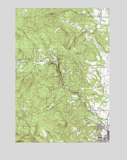
Chapman, OR USGS Topographic Map
Click on map above to begin viewing in our Map Viewer.

This topographic map contains these locations and features:
Feature Name Type Latitude Longitude GNIS ID View Map
Alder CreekStreamN45.7657°W122.8790°1116819View Map
Alder CreekStreamN45.8218°W122.9462°1116820View Map
Apple ValleyBasinN45.7696°W122.9043°1117018View Map
Bald HillSummitN45.7810°W122.9613°1136024View Map
Bonnie FallsFallsN45.8041°W122.9377°1117932View Map
Brush CreekStreamN45.8229°W122.9734°1118154View Map
Cedar CreekStreamN45.8262°W122.9779°1118747View Map
ChapmanPopulated PlaceN45.8251°W122.9854°1118824View Map
Chapman Post Office (historical)Post OfficeN45.8251°W122.9854°1165036View Map
City of ScappooseCivilN45.7563°W122.8771°2411837View Map
Columbia County Rider Chinook Plaza Park and RideLocaleN45.7518°W122.8781°2668408View Map
Columbia County Rider Park and RideLocaleN45.7575°W122.8771°2668097View Map
Cox CreekStreamN45.8598°W122.8826°1119444View Map
Deep CreekStreamN45.7901°W122.9109°1129956View Map
Dooly CreekStreamN45.7548°W122.9768°1120031View Map
Fall CreekStreamN45.8012°W122.9354°1120598View Map
Grabhorn's AirportAirportN45.7803°W122.8924°1131616View Map
Heinen PondLakeN45.8009°W122.9302°1129955View Map
James O Fisher DamDamN45.7898°W122.8762°1133566View Map
James O Fisher ReservoirReservoirN45.7898°W122.8762°1129957View Map
Lizzie CreekStreamN45.8251°W122.9923°1123327View Map
McLafferty CreekStreamN45.7568°W122.9818°1123998View Map
Petersen Elementary SchoolSchoolN45.7525°W122.8783°1638677View Map
Pisgah Home CemeteryCemeteryN45.7853°W122.9964°1161990View Map
Ruley (historical)LocaleN45.8248°W122.9762°1129954View Map
Saint Helens Arthur AcademySchoolN45.8669°W122.8870°2416123View Map
Saint Helens DivisionCivilN45.8654°W122.9291°1938107View Map
Salmon CreekStreamN45.8673°W122.8921°1126511View Map
ScappoosePopulated PlaceN45.7543°W122.8776°1126635View Map
Scappoose City HallBuildingN45.7575°W122.8768°2661149View Map
Scappoose DivisionCivilN45.7655°W122.8794°1938113View Map
Scappoose Middle SchoolSchoolN45.7539°W122.8783°1638676View Map
Scappoose Municipal CourtBuildingN45.7575°W122.8768°2661150View Map
Scappoose Police DepartmentBuildingN45.7575°W122.8767°2737721View Map
Scappoose Post OfficePost OfficeN45.7593°W122.8786°1165918View Map
Scappoose Public LibraryBuildingN45.7567°W122.8767°2661073View Map
Scappoose Rural Fire Protection DistrictBuildingN45.7614°W122.8791°2576547View Map
Scappoose Rural Fire Protection District ChapmanBuildingN45.8246°W122.9960°2576782View Map
Sherman ReservoirReservoirN45.7833°W122.8825°1126874View Map
Sherman Reservoir Number TwoReservoirN45.7818°W122.8899°1160967View Map
Sly CreekStreamN45.8057°W122.8882°1127097View Map
SpitzenbergPopulated PlaceN45.8257°W122.9462°1127394View Map
Strawberry RidgeRidgeN45.7512°W122.8965°1127656View Map
Warren Census Designated PlaceCensusN45.8133°W122.8797°2611783View Map
Watts House Pioneer MuseumBuildingN45.7563°W122.8769°2661263View Map
Woods PondLakeN45.7679°W122.8804°1129958View Map
YanktonPopulated PlaceN45.8668°W122.8868°1129356View Map
Yankton - Hillcrest CemeteryCemeteryN45.8673°W122.8764°1129357View Map
Yankton Post Office (historical)Post OfficeN45.8668°W122.8868°1166222View Map

Note: Coordinates in the location and feature list above are referenced to NAD83 datum.


Copyright (C) 2008-2024 Ryan Niemi / Sunset Dynamics ... All Rights Reserved