TopoQuest Logo
Do you find TopoQuest useful?
Help keep TopoQuest running and adding new maps/features by donating!
Bitcoin:  19c7KJd3qBynnjoSw5npx9KScwjBe4ifkT
Litecoin:  LXs6TkuXGGXo1vDsWCkWVdjQX94eUKd6ui
Home View Maps Find Maps Find Places Resources & Links


Huron, Oregon Topographic Map

USGS Map Title: Huron, OR
USGS Map MRC: 45118D3
DRG (GeoTIFF) Download: o45118d3.tif


Neighboring USGS Topographic Map Quads:


  Meacham, OR  
45118E4
 

  Duncan, OR  
45118E3
 

  Thimbleberry Mountain, OR  
45118E2
 

  Meacham Lake, OR  
45118D4
 

  Huron, OR  
45118D3
 

  Drumhill Ridge, OR  
45118D2
 

  McIntyre Creek, OR  
45118C4
 

  Kamela SE, OR  
45118C3
 

  Hilgard, OR  
45118C2


Map MRC Location:

N46°
W119°
N46°
W118°
H8 H7 H6 H5 H4 H3 H2 H1
G8 G7 G6 G5 G4 G3 G2 G1
F8 F7 F6 F5 F4 F3 F2 F1
E8 E7 E6 E5 E4 E3 E2 E1
D8 D7 D6 D5 D4 D3 D2 D1
C8 C7 C6 C5 C4 C3 C2 C1
B8 B7 B6 B5 B4 B3 B2 B1
A8 A7 A6 A5 A4 A3 A2 A1
N45°
W119°
N45°
W118°

Huron, OR USGS 1:24K Topographic Map Preview:
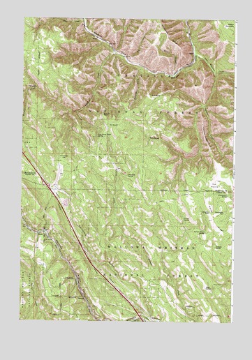
Huron, OR USGS Topographic Map
Click on map above to begin viewing in our Map Viewer.

This topographic map contains these locations and features:
Feature Name Type Latitude Longitude GNIS ID View Map
Allen CreekStreamN45.4996°W118.3405°1137146View Map
Allens Spur (historical)LocaleN45.4807°W118.3055°1167744View Map
Bodie (historical)LocaleN45.4107°W118.3652°1167697View Map
Butcher CreekStreamN45.4854°W118.3216°1139036View Map
Butcher Knife SpringSpringN45.4120°W118.2666°1139039View Map
Butcher PointRidgeN45.4604°W118.3283°1158151View Map
California GulchValleyN45.3760°W118.2983°1139158View Map
CampLocaleN45.4860°W118.2755°1139188View Map
East Meacham CreekStreamN45.4857°W118.2752°1141629View Map
Four Horse Smith SpringSpringN45.4514°W118.3307°1142358View Map
Fowler SpringSpringN45.4174°W118.2796°1142381View Map
Fox PrairieAreaN45.4318°W118.2622°1116584View Map
HuronLocaleN45.4918°W118.3322°1143957View Map
Huron Post Office (historical)Post OfficeN45.4918°W118.3322°1165425View Map
Laka (historical)LocaleN45.4893°W118.3244°1167785View Map
Lansing SpringSpringN45.4061°W118.2608°1144821View Map
MotanicLocaleN45.3840°W118.3372°1158383View Map
Nunamaker PondLakeN45.4201°W118.2558°1147089View Map
Nunamaker SpringSpringN45.4274°W118.2541°1147090View Map
Oregon Trail Interpretive ParkLocaleN45.3990°W118.3180°1954300View Map
Owsley CreekStreamN45.4785°W118.2638°1147316View Map
Owsley HogbackSummitN45.4476°W118.2655°1147317View Map
Pack Rat SpringSpringN45.4345°W118.3128°1147330View Map
Reardon Siding (historical)LocaleN45.4901°W118.3263°1167812View Map
Red SaddleGapN45.4565°W118.3219°1148333View Map
Ridgetop PondLakeN45.4202°W118.2646°1148434View Map
Rock SpringSpringN45.4684°W118.2938°1148635View Map
Ruddock Post Office (historical)Post OfficeN45.3771°W118.3072°1164649View Map
Rugg CabinLocaleN45.3910°W118.2613°1116585View Map
Rugg CemeteryCemeteryN45.3907°W118.2619°1148840View Map
Rugg SpringSpringN45.3892°W118.2663°1148841View Map
Short CanyonValleyN45.4768°W118.2872°1149425View Map
Strickland FlatFlatN45.4418°W118.3522°1150490View Map
Tie CreekStreamN45.4829°W118.3144°1151212View Map
Tillicum CreekStreamN45.4804°W118.3052°1151226View Map
Walker RidgeRidgeN45.4243°W118.2663°1151839View Map
Wells SpringSpringN45.4504°W118.3002°1152012View Map

Note: Coordinates in the location and feature list above are referenced to NAD83 datum.


Copyright (C) 2008-2024 Ryan Niemi / Sunset Dynamics ... All Rights Reserved