TopoQuest Logo
Do you find TopoQuest useful?
Help keep TopoQuest running and adding new maps/features by donating!
Bitcoin:  19c7KJd3qBynnjoSw5npx9KScwjBe4ifkT
Litecoin:  LXs6TkuXGGXo1vDsWCkWVdjQX94eUKd6ui
Home View Maps Find Maps Find Places Resources & Links


Mead, Washington Topographic Map

USGS Map Title: Mead, WA
USGS Map MRC: 47117G3
DRG (GeoTIFF) Download: o47117g3.tif


Neighboring USGS Topographic Map Quads:


  Deer Park, WA  
47117H4
 

  Chattaroy, WA  
47117H3
 

  Mount Kit Carson, WA  
47117H2
 

  Dartford, WA  
47117G4
 

  Mead, WA  
47117G3
 

  Foothills, WA  
47117G2
 

  Spokane NW, WA  
47117F4
 

  Spokane NE, WA  
47117F3
 

  Greenacres, WA  
47117F2


Map MRC Location:

N48°
W118°
N48°
W117°
H8 H7 H6 H5 H4 H3 H2 H1
G8 G7 G6 G5 G4 G3 G2 G1
F8 F7 F6 F5 F4 F3 F2 F1
E8 E7 E6 E5 E4 E3 E2 E1
D8 D7 D6 D5 D4 D3 D2 D1
C8 C7 C6 C5 C4 C3 C2 C1
B8 B7 B6 B5 B4 B3 B2 B1
A8 A7 A6 A5 A4 A3 A2 A1
N47°
W118°
N47°
W117°

Mead, WA USGS 1:24K Topographic Map Preview:
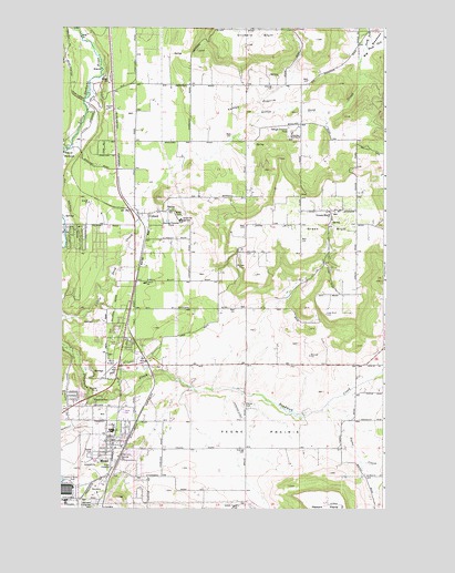
Mead, WA USGS Topographic Map
Click on map above to begin viewing in our Map Viewer.

This topographic map contains these locations and features:
Feature Name Type Latitude Longitude GNIS ID View Map
Big MeadowsFlatN47.8724°W117.2524°1503353View Map
Boyle R & D AirportAirportN47.8333°W117.2736°2443286View Map
Bruce Road BridgeBridgeN47.7802°W117.3044°2729590View Map
BuckeyePopulated PlaceN47.8424°W117.3744°1510844View Map
Circle Bar J Boys RanchLocaleN47.8474°W117.2866°1503984View Map
ColbertPopulated PlaceN47.8266°W117.3419°1512105View Map
Colbert Elementary SchoolSchoolN47.8084°W117.3428°1530839View Map
Colbert Post OfficePost OfficeN47.8379°W117.3478°2781661View Map
Colbert Road BridgeBridgeN47.8238°W117.3742°2729592View Map
DeanLocaleN47.8313°W117.3466°1511752View Map
Faith Christian SchoolSchoolN47.8127°W117.3466°1514839View Map
Green BluffCliffN47.8224°W117.2744°1505258View Map
Green BluffPopulated PlaceN47.8274°W117.2716°1512254View Map
Green Bluff Census Designated PlaceCensusN47.8190°W117.2770°2584978View Map
Indian Treaty TreeLocaleN47.7507°W117.3063°1505736View Map
Little Spokane Drive BridgeBridgeN47.8426°W117.3747°2729593View Map
Mater Cleri SeminaryChurchN47.8249°W117.3297°1506506View Map
MeadPopulated PlaceN47.7674°W117.3549°1512447View Map
Mead Census Designated PlaceCensusN47.7795°W117.3499°2585005View Map
Mead Flying ServiceAirportN47.7868°W117.3582°1533836View Map
Mead Junior High SchoolSchoolN47.7704°W117.3549°1514842View Map
Mead Post OfficePost OfficeN47.7642°W117.3552°2781685View Map
North Fork Little Deep CreekStreamN47.8699°W117.2580°1507056View Map
Pell CreekStreamN47.8718°W117.2513°1507360View Map
Peone CemeteryCemeteryN47.7770°W117.3048°1507372View Map
Peone CreekStreamN47.7757°W117.2747°1507373View Map
Peone Creek ParkParkN47.7788°W117.3605°1507374View Map
Peone PrairieFlatN47.7699°W117.2991°1507375View Map
South Fork Little Deep CreekStreamN47.8699°W117.2580°1508533View Map
Spokane County Fire District 4 Station 44 ColbertBuildingN47.8142°W117.3484°2643767View Map
Spokane County Fire District 4 Station 47 GreenbluffBuildingN47.8271°W117.2742°2643789View Map
Spokane County Fire District 9 Station 92BuildingN47.7732°W117.3547°2643796View Map
Valley PrairieFlatN47.8549°W117.3038°1509204View Map
WaysideLocaleN47.8671°W117.3741°1511805View Map

Note: Coordinates in the location and feature list above are referenced to NAD83 datum.


Copyright (C) 2008-2025 Ryan Niemi / Sunset Dynamics ... All Rights Reserved