TopoQuest Logo
Do you find TopoQuest useful?
Help keep TopoQuest running and adding new maps/features by donating!
Bitcoin:  19c7KJd3qBynnjoSw5npx9KScwjBe4ifkT
Litecoin:  LXs6TkuXGGXo1vDsWCkWVdjQX94eUKd6ui
Home View Maps Find Maps Find Places Resources & Links


Dartford, Washington Topographic Map

USGS Map Title: Dartford, WA
USGS Map MRC: 47117G4
DRG (GeoTIFF) Download: o47117g4.tif


Neighboring USGS Topographic Map Quads:


  Clayton, WA  
47117H5
 

  Deer Park, WA  
47117H4
 

  Chattaroy, WA  
47117H3
 

  Nine Mile Falls, WA  
47117G5
 

  Dartford, WA  
47117G4
 

  Mead, WA  
47117G3
 

  Airway Heights, WA  
47117F5
 

  Spokane NW, WA  
47117F4
 

  Spokane NE, WA  
47117F3


Map MRC Location:

N48°
W118°
N48°
W117°
H8 H7 H6 H5 H4 H3 H2 H1
G8 G7 G6 G5 G4 G3 G2 G1
F8 F7 F6 F5 F4 F3 F2 F1
E8 E7 E6 E5 E4 E3 E2 E1
D8 D7 D6 D5 D4 D3 D2 D1
C8 C7 C6 C5 C4 C3 C2 C1
B8 B7 B6 B5 B4 B3 B2 B1
A8 A7 A6 A5 A4 A3 A2 A1
N47°
W118°
N47°
W117°

Dartford, WA USGS 1:24K Topographic Map Preview:
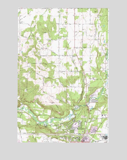
Dartford, WA USGS Topographic Map
Click on map above to begin viewing in our Map Viewer.

This topographic map contains these locations and features:
Feature Name Type Latitude Longitude GNIS ID View Map
Brentwood Elementary SchoolSchoolN47.7633°W117.4169°1514840View Map
Commellini JunctionLocaleN47.7918°W117.4124°1511749View Map
Dart HillSummitN47.7804°W117.4038°1504324View Map
DartfordPopulated PlaceN47.7846°W117.4169°1512136View Map
Dartford CreekStreamN47.7827°W117.4161°1504325View Map
Deadman CreekStreamN47.7954°W117.3838°1504371View Map
FairwoodPopulated PlaceN47.7668°W117.4174°1867610View Map
Fairwood Census Designated PlaceCensusN47.7678°W117.4158°2408106View Map
Fairwood Shopping CenterLocaleN47.7677°W117.4202°1513672View Map
Farwell Elementary SchoolSchoolN47.7758°W117.3807°1530880View Map
Griffith SpringSpringN47.7652°W117.4588°1505302View Map
Half Moon PrairieFlatN47.8463°W117.4244°1505344View Map
Hamann CornerPopulated PlaceN47.8304°W117.4252°1511018View Map
KWRS-FM (Spokane)TowerN47.7582°W117.4177°1534387View Map
Layton HillSummitN47.8716°W117.3958°1512383View Map
Little Deep CreekStreamN47.7957°W117.3794°1506197View Map
Little Spokane Drive BridgeBridgeN47.7847°W117.4051°2729589View Map
Lockhart HillSummitN47.7871°W117.4536°1506246View Map
McKay HillSummitN47.8293°W117.4863°1506573View Map
Mead Senior High SchoolSchoolN47.7700°W117.4143°1531018View Map
Midway Elementary SchoolSchoolN47.8101°W117.3961°1514844View Map
Midway Elementary SchoolSchoolN47.7932°W117.3961°1514845View Map
Northwood Middle SchoolSchoolN47.7758°W117.3834°1514843View Map
Pease HillSummitN47.8518°W117.4644°1507352View Map
Pete's AirportAirportN47.8416°W117.4469°1533738View Map
Pine River ParkParkN47.7929°W117.3961°1507444View Map
Rattlesnake HillSummitN47.7807°W117.4447°1507732View Map
Saint George's SchoolSchoolN47.7680°W117.4726°1508011View Map
Spokane Country ClubLocaleN47.7674°W117.4399°1533228View Map
Spokane County Fire District 4 Station 45 Wild RoseBuildingN47.8743°W117.4700°2643786View Map
Spokane County Fire District 4 Station 49 WaysideBuildingN47.8321°W117.4155°2643775View Map
Spokane County Fire District 9 Station 91BuildingN47.7692°W117.4206°2643795View Map
Spokane State Fish HatcheryLocaleN47.7663°W117.4608°1510575View Map
Waikiki SpringsSpringN47.7757°W117.4202°1509257View Map
Wandermere LakeReservoirN47.7820°W117.3979°1513488View Map
Wandermere Lake DamDamN47.7816°W117.3977°1532318View Map
WaysideLocaleN47.8599°W117.4436°1509339View Map
Wayside CemeteryCemeteryN47.8606°W117.4338°1509340View Map
Whitworth UniversitySchoolN47.7537°W117.4181°1509493View Map
Wild RoseLocaleN47.8741°W117.4974°1511804View Map
Wild Rose CemeteryCemeteryN47.8608°W117.4972°1509510View Map

Note: Coordinates in the location and feature list above are referenced to NAD83 datum.


Copyright (C) 2008-2024 Ryan Niemi / Sunset Dynamics ... All Rights Reserved