TopoQuest Logo
Do you find TopoQuest useful?
Help keep TopoQuest running and adding new maps/features by donating!
Bitcoin:  19c7KJd3qBynnjoSw5npx9KScwjBe4ifkT
Litecoin:  LXs6TkuXGGXo1vDsWCkWVdjQX94eUKd6ui
Home View Maps Find Maps Find Places Resources & Links


Beargrass Basin, Arizona Topographic Map

USGS Map Title: Beargrass Basin, AZ
USGS Map MRC: 33110A2
DRG (GeoTIFF) Download: o33110a2.tif


Neighboring USGS Topographic Map Quads:


  Dewey Flat, AZ  
33110B3
 

  Calva, AZ  
33110B2
 

  Bylas, AZ  
33110B1
 

  Mount Turnbull, AZ  
33110A3
 

  Beargrass Basin, AZ  
33110A2
 

  Geronimo, AZ  
33110A1
 

  Cobre Grande Mountain, AZ  
32110H3
 

  Jackson Mountain, AZ  
32110H2
 

  Telegraph Wash, AZ  
32110H1


Map MRC Location:

N34°
W111°
N34°
W110°
H8 H7 H6 H5 H4 H3 H2 H1
G8 G7 G6 G5 G4 G3 G2 G1
F8 F7 F6 F5 F4 F3 F2 F1
E8 E7 E6 E5 E4 E3 E2 E1
D8 D7 D6 D5 D4 D3 D2 D1
C8 C7 C6 C5 C4 C3 C2 C1
B8 B7 B6 B5 B4 B3 B2 B1
A8 A7 A6 A5 A4 A3 A2 A1
N33°
W111°
N33°
W110°

Beargrass Basin, AZ USGS 1:24K Topographic Map Preview:
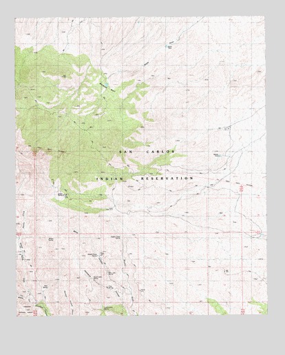
Beargrass Basin, AZ USGS Topographic Map
Click on map above to begin viewing in our Map Viewer.

This topographic map contains these locations and features:
Feature Name Type Latitude Longitude GNIS ID View Map
Beargrass BasinBasinN33.0934°W110.2051°1156View Map
Box SpringSpringN33.0181°W110.2049°1917View Map
Clay SpringSpringN33.0114°W110.2045°2986View Map
Cottonwood SpringSpringN33.0023°W110.2071°3364View Map
Dutch Cabin SpringSpringN33.0154°W110.2124°4206View Map
Fiddler Camp SpringSpringN33.0330°W110.1985°4579View Map
Goat CampLocaleN33.0498°W110.2256°5074View Map
Indian SpringSpringN33.0512°W110.2271°6228View Map
Lower Goat CampLocaleN33.0462°W110.2009°7466View Map
Mescal PitLocaleN33.0245°W110.2465°7918View Map
Middle Fork Goodwin CanyonValleyN33.0067°W110.2412°7978View Map
Middle Prong SpringSpringN33.0254°W110.2101°7996View Map
Mine CanyonValleyN33.0101°W110.1943°8087View Map
North Fork Goodwin CanyonValleyN33.0067°W110.2412°8726View Map
Pace SpringSpringN33.0451°W110.2093°22596View Map
Squaw CreekStreamN33.0320°W110.2487°11732View Map
Wilk SpringSpringN33.0114°W110.2262°13803View Map
Willow SpringSpringN33.0323°W110.2346°13842View Map

Note: Coordinates in the location and feature list above are referenced to NAD83 datum.


Copyright (C) 2008-2024 Ryan Niemi / Sunset Dynamics ... All Rights Reserved