TopoQuest Logo
Do you find TopoQuest useful?
Help keep TopoQuest running and adding new maps/features by donating!
Bitcoin:  19c7KJd3qBynnjoSw5npx9KScwjBe4ifkT
Litecoin:  LXs6TkuXGGXo1vDsWCkWVdjQX94eUKd6ui
Home View Maps Find Maps Find Places Resources & Links


Cobre Grande Mountain, Arizona Topographic Map

USGS Map Title: Cobre Grande Mountain, AZ
USGS Map MRC: 32110H3
DRG (GeoTIFF) Download: o32110h3.tif


Neighboring USGS Topographic Map Quads:


  Rawhide Mountain, AZ  
33110A4
 

  Mount Turnbull, AZ  
33110A3
 

  Beargrass Basin, AZ  
33110A2
 

  Booger Canyon, AZ  
32110H4
 

  Cobre Grande Mountain, AZ  
32110H3
 

  Jackson Mountain, AZ  
32110H2
 

  Oak Grove Canyon, AZ  
32110G4
 

  Klondyke, AZ  
32110G3
 

  Buford Hill, AZ  
32110G2


Map MRC Location:

N33°
W111°
N33°
W110°
H8 H7 H6 H5 H4 H3 H2 H1
G8 G7 G6 G5 G4 G3 G2 G1
F8 F7 F6 F5 F4 F3 F2 F1
E8 E7 E6 E5 E4 E3 E2 E1
D8 D7 D6 D5 D4 D3 D2 D1
C8 C7 C6 C5 C4 C3 C2 C1
B8 B7 B6 B5 B4 B3 B2 B1
A8 A7 A6 A5 A4 A3 A2 A1
N32°
W111°
N32°
W110°

Cobre Grande Mountain, AZ USGS 1:24K Topographic Map Preview:
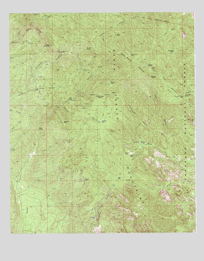
Cobre Grande Mountain, AZ USGS Topographic Map
Click on map above to begin viewing in our Map Viewer.

This topographic map contains these locations and features:
Feature Name Type Latitude Longitude GNIS ID View Map
AravaipaPopulated PlaceN32.9573°W110.3551°25296View Map
Black TankReservoirN32.9194°W110.2944°1629View Map
Blue Jay TankReservoirN32.9602°W110.3073°1707View Map
Boundary SpringSpringN32.9791°W110.3232°1881View Map
Cobre Grande MineMineN32.9762°W110.2934°3063View Map
Cobre Grande MountainSummitN32.9670°W110.2929°3064View Map
Copper CanyonValleyN32.9553°W110.3273°3216View Map
Copper Canyon SpringSpringN32.9532°W110.3140°3219View Map
Cottonwood CanyonValleyN32.9240°W110.2770°3308View Map
Cottonwood SpringSpringN32.9529°W110.2574°3360View Map
Davidson TankReservoirN32.9388°W110.3134°3722View Map
Gable SpringSpringN32.9876°W110.3032°4895View Map
Goat CanyonValleyN32.9203°W110.2698°5077View Map
Grand Reef MineMineN32.8831°W110.3173°5222View Map
Grand Reef MountainSummitN32.8909°W110.3237°42775View Map
Head Center MineMineN32.9781°W110.3395°5668View Map
Holdout Trail Sixty NineTrailN32.9201°W110.2993°22524View Map
Horse MountainSummitN32.9817°W110.3481°5975View Map
Horse RidgeRidgeN32.9909°W110.3590°5987View Map
Imperial MountainSummitN32.9381°W110.3395°6184View Map
Jerky BasinBasinN32.9892°W110.2668°6394View Map
Landsman CampLocaleN32.9681°W110.3268°6865View Map
Landsman SpringSpringN32.9684°W110.3265°22544View Map
Mineshaft SpringSpringN32.9640°W110.2781°8110View Map
Monkey SpringSpringN32.9701°W110.2821°8208View Map
NL TankReservoirN32.9264°W110.2878°8675View Map
Poncho TankReservoirN32.9195°W110.2979°9633View Map
Princess Pat MineMineN32.9992°W110.3584°9784View Map
Reef Basin Sixty Eight TrailTrailN32.9167°W110.3070°42914View Map
Reef TankReservoirN32.9062°W110.3027°10195View Map
Roten CabinLocaleN32.9512°W110.2590°10508View Map
Sin Fin MineMineN32.9781°W110.3406°11356View Map
Soda Water SpringSpringN32.9780°W110.2644°11525View Map
Spring Trail SpringSpringN32.9732°W110.3193°22672View Map
Stowe SpringSpringN32.9345°W110.3554°11891View Map
Tenstrike MineMineN32.9053°W110.3251°12260View Map
Tule CanyonValleyN32.9478°W110.3398°12824View Map
Tule SpringSpringN32.9512°W110.3332°12828View Map
Tunnel SpringSpringN32.9758°W110.3106°22688View Map
Warm SpringSpringN32.9836°W110.3739°13344View Map
Williamson CanyonValleyN32.9570°W110.3645°13816View Map

Note: Coordinates in the location and feature list above are referenced to NAD83 datum.


Copyright (C) 2008-2025 Ryan Niemi / Sunset Dynamics ... All Rights Reserved