TopoQuest Logo
Do you find TopoQuest useful?
Help keep TopoQuest running and adding new maps/features by donating!
Bitcoin:  19c7KJd3qBynnjoSw5npx9KScwjBe4ifkT
Litecoin:  LXs6TkuXGGXo1vDsWCkWVdjQX94eUKd6ui
Home View Maps Find Maps Find Places Resources & Links


Meehan, Mississippi Topographic Map

USGS Map Title: Meehan, MS
USGS Map MRC: 32088C7
DRG (GeoTIFF) Download: o32088c7.tif


Neighboring USGS Topographic Map Quads:


  Duffee, MS  
32088D8
 

  Collinsville, MS  
32088D7
 

  Meridian North, MS  
32088D6
 

  Chunky, MS  
32088C8
 

  Meehan, MS  
32088C7
 

  Meridian South, MS  
32088C6
 

  Rose Hill, MS  
32088B8
 

  Stonewall, MS  
32088B7
 

  Sable, MS  
32088B6


Map MRC Location:

N33°
W89°
N33°
W88°
H8 H7 H6 H5 H4 H3 H2 H1
G8 G7 G6 G5 G4 G3 G2 G1
F8 F7 F6 F5 F4 F3 F2 F1
E8 E7 E6 E5 E4 E3 E2 E1
D8 D7 D6 D5 D4 D3 D2 D1
C8 C7 C6 C5 C4 C3 C2 C1
B8 B7 B6 B5 B4 B3 B2 B1
A8 A7 A6 A5 A4 A3 A2 A1
N32°
W89°
N32°
W88°

Meehan, MS USGS 1:24K Topographic Map Preview:
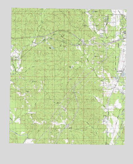
Meehan, MS USGS Topographic Map
Click on map above to begin viewing in our Map Viewer.

This topographic map contains these locations and features:
Feature Name Type Latitude Longitude GNIS ID View Map
Allen CreekStreamN32.2696°W88.8717°666212View Map
ArundePopulated PlaceN32.3032°W88.7623°691670View Map
Arundel SpringSpringN32.3115°W88.7725°683972View Map
Burwell CemeteryCemeteryN32.3362°W88.7778°683978View Map
Burwell CreekStreamN32.3335°W88.7578°667848View Map
Burwell LakeLakeN32.3731°W88.7861°667849View Map
Burwell Lake DamDamN32.3718°W88.7834°681264View Map
Cow CreekStreamN32.3190°W88.8701°668893View Map
Doctor Slaughter Lake DamDamN32.3401°W88.8334°681233View Map
DuBose SchoolSchoolN32.2635°W88.8098°669461View Map
East Mississippi Correctional FacilityBuildingN32.3379°W88.7990°2739810View Map
Fairchild CemeteryCemeteryN32.3601°W88.7842°669868View Map
Fairchild SpringsSpringN32.3610°W88.7848°683995View Map
Golden Grove ChurchChurchN32.3079°W88.8512°670454View Map
Goodwater Baptist ChurchChurchN32.2979°W88.8548°670505View Map
Goodwater CemeteryCemeteryN32.2974°W88.8542°706378View Map
GrahamPopulated PlaceN32.3426°W88.8492°691899View Map
Hognose CreekStreamN32.2993°W88.7531°671267View Map
Interchange 129CrossingN32.3440°W88.7964°691467View Map
Interchange 142CrossingN32.2668°W88.8128°691502View Map
Little CreekStreamN32.2724°W88.7534°672584View Map
Lost GapPopulated PlaceN32.3418°W88.8070°692021View Map
Lost Gap ChurchChurchN32.3599°W88.7970°672873View Map
Lost Gap Volunteer Fire and Rescue DepartmentBuildingN32.3549°W88.7736°2667906View Map
MeehanPopulated PlaceN32.3282°W88.8664°673459View Map
Meehan Volunteer Fire and Rescue DepartmentBuildingN32.3322°W88.8655°2667899View Map
Meridian National Fish HatcheryParkN32.3182°W88.7505°2765405View Map
Mount Zion ChurchChurchN32.3407°W88.8192°674354View Map
National Fish Hatchery Ponds DamDamN32.3151°W88.7517°681193View Map
New Prospect Baptist ChurchChurchN32.2765°W88.7703°674803View Map
O'Neil LakeReservoirN32.3210°W88.8085°675003View Map
Osborne CemeteryCemeteryN32.2810°W88.8139°675316View Map
P Coleman Pond DamDamN32.3118°W88.8034°681188View Map
Pigford LakeReservoirN32.3389°W88.8300°675727View Map
Pigford Lake DamDamN32.3418°W88.8300°681235View Map
Pleasant Grove ChurchChurchN32.3313°W88.7842°676010View Map
Poplar Spring ChurchChurchN32.2646°W88.8109°684036View Map
R Johnson Lake DamDamN32.3135°W88.7600°681191View Map
Rock CreekStreamN32.3160°W88.8689°676747View Map
Sageville CemeteryCemeteryN32.3085°W88.7750°706401View Map
Sageville ChurchChurchN32.3085°W88.7748°676999View Map
SavoyPopulated PlaceN32.2707°W88.7698°677444View Map
Sowashee CreekStreamN32.3043°W88.7512°678030View Map
SterlingPopulated PlaceN32.3051°W88.7737°684046View Map
Tillman Lookout TowerTowerN32.2874°W88.8248°711322View Map
Tunnel HillSummitN32.3463°W88.8198°678930View Map
Tunnel Hill CemeteryCemeteryN32.3504°W88.8295°674315View Map
Ullyses Lee Pond DamDamN32.3201°W88.8100°681200View Map
Usher LakeReservoirN32.3518°W88.7856°679159View Map

Note: Coordinates in the location and feature list above are referenced to NAD83 datum.


Copyright (C) 2008-2024 Ryan Niemi / Sunset Dynamics ... All Rights Reserved