TopoQuest Logo
Do you find TopoQuest useful?
Help keep TopoQuest running and adding new maps/features by donating!
Bitcoin:  19c7KJd3qBynnjoSw5npx9KScwjBe4ifkT
Litecoin:  LXs6TkuXGGXo1vDsWCkWVdjQX94eUKd6ui
Home View Maps Find Maps Find Places Resources & Links


Sable, Mississippi Topographic Map

USGS Map Title: Sable, MS
USGS Map MRC: 32088B6
DRG (GeoTIFF) Download: o32088b6.tif


Neighboring USGS Topographic Map Quads:


  Meehan, MS  
32088C7
 

  Meridian South, MS  
32088C6
 

  Vimville, MS  
32088C5
 

  Stonewall, MS  
32088B7
 

  Sable, MS  
32088B6
 

  Snell, MS  
32088B5
 

  Wautubbee, MS  
32088A7
 

  Quitman, MS  
32088A6
 

  Sykes, MS  
32088A5


Map MRC Location:

N33°
W89°
N33°
W88°
H8 H7 H6 H5 H4 H3 H2 H1
G8 G7 G6 G5 G4 G3 G2 G1
F8 F7 F6 F5 F4 F3 F2 F1
E8 E7 E6 E5 E4 E3 E2 E1
D8 D7 D6 D5 D4 D3 D2 D1
C8 C7 C6 C5 C4 C3 C2 C1
B8 B7 B6 B5 B4 B3 B2 B1
A8 A7 A6 A5 A4 A3 A2 A1
N32°
W89°
N32°
W88°

Sable, MS USGS 1:24K Topographic Map Preview:
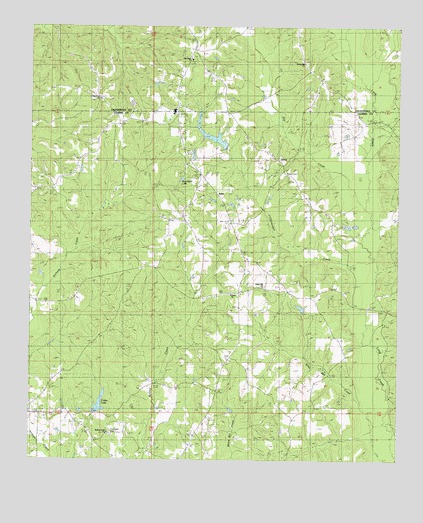
Sable, MS USGS Topographic Map
Click on map above to begin viewing in our Map Viewer.

This topographic map contains these locations and features:
Feature Name Type Latitude Longitude GNIS ID View Map
Beat Line School (historical)SchoolN32.2029°W88.6884°709413View Map
Bently School (historical)SchoolN32.1396°W88.6648°687493View Map
Briar Patch LakeReservoirN32.2061°W88.6988°690786View Map
Chancellor CemeteryCemeteryN32.1326°W88.7223°690787View Map
Chinquapin CreekStreamN32.1840°W88.6356°668400View Map
Chinquapin Lake DamDamN32.2118°W88.6834°681089View Map
Chinquapin Lake DamDamN32.2201°W88.6934°681097View Map
Clarkdale Elementary SchoolSchoolN32.2263°W88.7014°706368View Map
Clarkdale High SchoolSchoolN32.2257°W88.7031°711570View Map
Clarkdale Volunteer Fire and Rescue Department Station 1BuildingN32.2280°W88.7006°2667905View Map
Coker LakeReservoirN32.1411°W88.7262°668651View Map
Coker Lake DamDamN32.1368°W88.7284°681025View Map
DevoePopulated PlaceN32.2113°W88.6653°690789View Map
Devoe CemeteryCemeteryN32.2088°W88.6664°669244View Map
Devoe School (historical)SchoolN32.2085°W88.6637°687504View Map
Dry CreekStreamN32.1996°W88.6389°669434View Map
Francis Creek Oil FieldOilfieldN32.1335°W88.6473°709431View Map
Gulledge School (historical)SchoolN32.2090°W88.7348°687519View Map
Martin Store (historical)LocaleN32.2246°W88.7000°687533View Map
New Hope Baptist ChurchChurchN32.2413°W88.6987°674694View Map
New Hope CemeteryCemeteryN32.2415°W88.6956°706388View Map
O'Neil BridgeBridgeN32.1360°W88.6264°687544View Map
Oak Grove CemeteryCemeteryN32.2290°W88.7262°706390View Map
Oak Grove ChurchChurchN32.2296°W88.7281°675034View Map
Riley Mill CreekStreamN32.1382°W88.6323°676667View Map
Rolling Creek Baptist ChurchChurchN32.1332°W88.7231°676828View Map
Rolling Creek Volunteer Fire DepartmentBuildingN32.1330°W88.7217°2668064View Map
RoyPopulated PlaceN32.1807°W88.7089°692190View Map
SablePopulated PlaceN32.2013°W88.6878°692198View Map
Spring Hill ChurchChurchN32.2401°W88.6609°678120View Map
Thomas Lake DamDamN32.2135°W88.6950°681091View Map
Union Baptist ChurchChurchN32.1729°W88.6834°679055View Map
Union CemeteryCemeteryN32.1718°W88.6825°709482View Map
Union Hill ChurchChurchN32.1790°W88.6789°679095View Map
Union School (historical)SchoolN32.1671°W88.6612°687561View Map
Walkers Mill (historical)LocaleN32.2051°W88.6937°687562View Map
Wier School (historical)SchoolN32.1724°W88.7189°687566View Map
Williams Store (historical)LocaleN32.1385°W88.7484°687567View Map
Zion Spring ChurchChurchN32.2046°W88.7431°680041View Map

Note: Coordinates in the location and feature list above are referenced to NAD83 datum.


Copyright (C) 2008-2025 Ryan Niemi / Sunset Dynamics ... All Rights Reserved