TopoQuest Logo
Do you find TopoQuest useful?
Help keep TopoQuest running and adding new maps/features by donating!
Bitcoin:  19c7KJd3qBynnjoSw5npx9KScwjBe4ifkT
Litecoin:  LXs6TkuXGGXo1vDsWCkWVdjQX94eUKd6ui
Home View Maps Find Maps Find Places Resources & Links


Rose Hill, Mississippi Topographic Map

USGS Map Title: Rose Hill, MS
USGS Map MRC: 32088B8
DRG (GeoTIFF) Download: o32088b8.tif


Neighboring USGS Topographic Map Quads:


  Hickory, MS  
32089C1
 

  Chunky, MS  
32088C8
 

  Meehan, MS  
32088C7
 

  Hero, MS  
32089B1
 

  Rose Hill, MS  
32088B8
 

  Stonewall, MS  
32088B7
 

  Paulding, MS  
32089A1
 

  Pachuta, MS  
32088A8
 

  Wautubbee, MS  
32088A7


Map MRC Location:

N33°
W89°
N33°
W88°
H8 H7 H6 H5 H4 H3 H2 H1
G8 G7 G6 G5 G4 G3 G2 G1
F8 F7 F6 F5 F4 F3 F2 F1
E8 E7 E6 E5 E4 E3 E2 E1
D8 D7 D6 D5 D4 D3 D2 D1
C8 C7 C6 C5 C4 C3 C2 C1
B8 B7 B6 B5 B4 B3 B2 B1
A8 A7 A6 A5 A4 A3 A2 A1
N32°
W89°
N32°
W88°

Rose Hill, MS USGS 1:24K Topographic Map Preview:
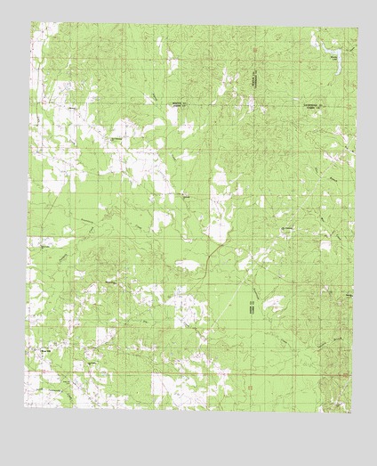
Rose Hill, MS USGS Topographic Map
Click on map above to begin viewing in our Map Viewer.

This topographic map contains these locations and features:
Feature Name Type Latitude Longitude GNIS ID View Map
Algood CreekStreamN32.1715°W88.9306°666195View Map
Concord Church (historical)ChurchN32.2221°W88.8820°687500View Map
Dry CreekStreamN32.1501°W88.9053°690616View Map
East Galilee ChurchChurchN32.1399°W88.9776°669581View Map
FellowshipPopulated PlaceN32.1951°W88.9406°707797View Map
Fellowship Baptist ChurchChurchN32.1949°W88.9420°669936View Map
Fellowship CemeteryCemeteryN32.1951°W88.9389°707798View Map
Fellowship Volunteer Fire DepartmentBuildingN32.2125°W88.9696°2667891View Map
Green Valley CemeteryCemeteryN32.1776°W88.9939°707801View Map
Green Valley ChurchChurchN32.1779°W88.9945°670682View Map
Hopewell ChurchChurchN32.2224°W88.9828°671420View Map
Johnson CreekStreamN32.2254°W88.9970°671938View Map
Lawson CemeteryCemeteryN32.1276°W88.8812°690799View Map
Little CreekStreamN32.1885°W88.9667°672598View Map
Magnolia ChurchChurchN32.1638°W88.8784°673072View Map
Magnolia School (historical)SchoolN32.1626°W88.8759°709441View Map
McCormick Lake DamDamN32.1335°W88.9384°681021View Map
Muse Mill (historical)LocaleN32.1407°W88.8906°687542View Map
New FellowshipPopulated PlaceN32.2126°W88.9703°707815View Map
New Fellowship Baptist ChurchChurchN32.1851°W88.9056°674617View Map
New Fellowship Baptist ChurchChurchN32.2129°W88.9698°674618View Map
Parks School (historical)SchoolN32.2374°W88.9364°689518View Map
Penantly CreekStreamN32.1860°W88.9731°675584View Map
Pleasant Grove CemeteryCemeteryN32.1651°W88.9659°707821View Map
Pleasant Grove ChurchChurchN32.1665°W88.9673°676007View Map
Rose HillPopulated PlaceN32.1446°W88.9959°676843View Map
Rose Hill CemeteryCemeteryN32.1335°W88.9825°676847View Map
Rose Hill Post OfficePost OfficeN32.1403°W88.9931°712214View Map
Rose Hill Volunteer Fire DepartmentBuildingN32.1424°W88.9934°2668055View Map
Spring Hill School (historical)SchoolN32.2460°W88.9970°689541View Map
Tanyard BranchStreamN32.1404°W88.8906°690810View Map
Wanita LakeReservoirN32.2420°W88.8850°679327View Map
Wanita Lake DamDamN32.2435°W88.8867°681114View Map
Wanita Mill (historical)LocaleN32.2446°W88.8789°684052View Map
Wanitka LakeReservoirN32.2396°W88.9848°689557View Map

Note: Coordinates in the location and feature list above are referenced to NAD83 datum.


Copyright (C) 2008-2024 Ryan Niemi / Sunset Dynamics ... All Rights Reserved