TopoQuest Logo
Do you find TopoQuest useful?
Help keep TopoQuest running and adding new maps/features by donating!
Bitcoin:  19c7KJd3qBynnjoSw5npx9KScwjBe4ifkT
Litecoin:  LXs6TkuXGGXo1vDsWCkWVdjQX94eUKd6ui
Home View Maps Find Maps Find Places Resources & Links


Melvin West, Illinois Topographic Map

USGS Map Title: Melvin West, IL
USGS Map MRC: 40088E3
DRG (GeoTIFF) Download: o40088e3.tif


Neighboring USGS Topographic Map Quads:


  Forrest South, IL  
40088F4
 

  Chatsworth South, IL  
40088F3
 

  Buckley NW, IL  
40088F2
 

  Sibley, IL  
40088E4
 

  Melvin West, IL  
40088E3
 

  Melvin East, IL  
40088E2
 

  Gibson City West, IL  
40088D4
 

  Gibson City East, IL  
40088D3
 

  Perdueville, IL  
40088D2


Map MRC Location:

N41°
W89°
N41°
W88°
H8 H7 H6 H5 H4 H3 H2 H1
G8 G7 G6 G5 G4 G3 G2 G1
F8 F7 F6 F5 F4 F3 F2 F1
E8 E7 E6 E5 E4 E3 E2 E1
D8 D7 D6 D5 D4 D3 D2 D1
C8 C7 C6 C5 C4 C3 C2 C1
B8 B7 B6 B5 B4 B3 B2 B1
A8 A7 A6 A5 A4 A3 A2 A1
N40°
W89°
N40°
W88°

Melvin West, IL USGS 1:24K Topographic Map Preview:
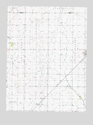
Melvin West, IL USGS Topographic Map
Click on map above to begin viewing in our Map Viewer.

This topographic map contains these locations and features:
Feature Name Type Latitude Longitude GNIS ID View Map
Burr Oak GroveWoodsN40.5789°W88.3673°1810564View Map
Cothern School (historical)SchoolN40.5311°W88.2920°406612View Map
Eclipse School (historical)SchoolN40.5606°W88.2909°407761View Map
Grand Prairie School (historical)SchoolN40.6036°W88.2525°409264View Map
GuthriePopulated PlaceN40.5084°W88.3251°409581View Map
Guthrie School (historical)SchoolN40.5017°W88.3289°409582View Map
Hornstein FarmsLocaleN40.5725°W88.3158°2703764View Map
Howell School (historical)SchoolN40.5017°W88.2720°410627View Map
Miner School (historical)SchoolN40.5311°W88.3289°413639View Map
Mueller FarmsLocaleN40.6033°W88.3483°2703760View Map
Pleasant Valley School (historical)SchoolN40.5011°W88.3664°415909View Map
Selock School (historical)SchoolN40.5311°W88.2525°418195View Map
Township of Peach OrchardCivilN40.5740°W88.2721°429537View Map
West Point School (historical)SchoolN40.5881°W88.2920°420897View Map
WGCY-FM (Gibson City)TowerN40.5670°W88.3448°428493View Map

Note: Coordinates in the location and feature list above are referenced to NAD83 datum.


Copyright (C) 2008-2025 Ryan Niemi / Sunset Dynamics ... All Rights Reserved