TopoQuest Logo
Do you find TopoQuest useful?
Help keep TopoQuest running and adding new maps/features by donating!
Bitcoin:  19c7KJd3qBynnjoSw5npx9KScwjBe4ifkT
Litecoin:  LXs6TkuXGGXo1vDsWCkWVdjQX94eUKd6ui
Home View Maps Find Maps Find Places Resources & Links


Chatsworth South, Illinois Topographic Map

USGS Map Title: Chatsworth South, IL
USGS Map MRC: 40088F3
DRG (GeoTIFF) Download: o40088f3.tif


Neighboring USGS Topographic Map Quads:


  Forrest North, IL  
40088G4
 

  Chatsworth North, IL  
40088G3
 

  Piper City, IL  
40088G2
 

  Forrest South, IL  
40088F4
 

  Chatsworth South, IL  
40088F3
 

  Buckley NW, IL  
40088F2
 

  Sibley, IL  
40088E4
 

  Melvin West, IL  
40088E3
 

  Melvin East, IL  
40088E2


Map MRC Location:

N41°
W89°
N41°
W88°
H8 H7 H6 H5 H4 H3 H2 H1
G8 G7 G6 G5 G4 G3 G2 G1
F8 F7 F6 F5 F4 F3 F2 F1
E8 E7 E6 E5 E4 E3 E2 E1
D8 D7 D6 D5 D4 D3 D2 D1
C8 C7 C6 C5 C4 C3 C2 C1
B8 B7 B6 B5 B4 B3 B2 B1
A8 A7 A6 A5 A4 A3 A2 A1
N40°
W89°
N40°
W88°

Chatsworth South, IL USGS 1:24K Topographic Map Preview:
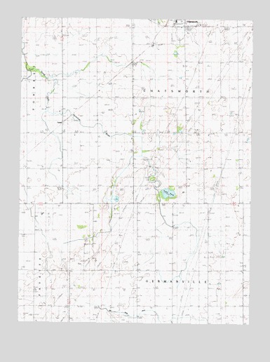
Chatsworth South, IL USGS Topographic Map
Click on map above to begin viewing in our Map Viewer.

This topographic map contains these locations and features:
Feature Name Type Latitude Longitude GNIS ID View Map
Allen School (historical)SchoolN40.7170°W88.3742°403428View Map
Center School (historical)SchoolN40.7178°W88.2956°405822View Map
CerealPopulated PlaceN40.7084°W88.3512°422538View Map
Cereal School (historical)SchoolN40.7181°W88.3337°405915View Map
Chatsworth Grade SchoolSchoolN40.7492°W88.2914°1737549View Map
Chatsworth RLA Airport (historical)AirportN40.7431°W88.2912°427135View Map
Cording School (historical)SchoolN40.6875°W88.3709°406582View Map
Dassow School (historical)SchoolN40.6642°W88.2920°406960View Map
Dietz School (historical)SchoolN40.6898°W88.2851°407214View Map
Freehill School (historical)SchoolN40.6317°W88.2909°408723View Map
Germanville CemeteryCemeteryN40.6739°W88.2969°408964View Map
Glabe School (historical)SchoolN40.6600°W88.2545°409045View Map
Happy Home School (historical)SchoolN40.6889°W88.3337°409764View Map
Mount Zion School (historical)SchoolN40.7192°W88.2573°414147View Map
Phillips School (historical)SchoolN40.6336°W88.2550°415615View Map
Pleasant Valley School (historical)SchoolN40.6886°W88.2562°415910View Map
Pleasant View School (historical)SchoolN40.7473°W88.2584°415937View Map
Quinn School (historical)SchoolN40.6461°W88.3353°416321View Map
Ruppel School (historical)SchoolN40.6581°W88.2734°417046View Map
Saint Patrick's Catholic CemeteryCemeteryN40.7478°W88.3150°417676View Map
Stoddard Spring (historical)LocaleN40.7398°W88.3048°1737680View Map
Town of ChatsworthCivilN40.7139°W88.3049°2396640View Map
Township of ChatsworthCivilN40.7178°W88.2954°428793View Map
Township of GermanvilleCivilN40.6460°W88.2914°429051View Map
Turtle PondLakeN40.6786°W88.2946°419964View Map

Note: Coordinates in the location and feature list above are referenced to NAD83 datum.


Copyright (C) 2008-2025 Ryan Niemi / Sunset Dynamics ... All Rights Reserved