TopoQuest Logo
Do you find TopoQuest useful?
Help keep TopoQuest running and adding new maps/features by donating!
Bitcoin:  19c7KJd3qBynnjoSw5npx9KScwjBe4ifkT
Litecoin:  LXs6TkuXGGXo1vDsWCkWVdjQX94eUKd6ui
Home View Maps Find Maps Find Places Resources & Links


Forrest South, Illinois Topographic Map

USGS Map Title: Forrest South, IL
USGS Map MRC: 40088F4
DRG (GeoTIFF) Download: o40088f4.tif


Neighboring USGS Topographic Map Quads:


  Southeast Pontiac, IL  
40088G5
 

  Forrest North, IL  
40088G4
 

  Chatsworth North, IL  
40088G3
 

  Fairbury, IL  
40088F5
 

  Forrest South, IL  
40088F4
 

  Chatsworth South, IL  
40088F3
 

  Colfax, IL  
40088E5
 

  Sibley, IL  
40088E4
 

  Melvin West, IL  
40088E3


Map MRC Location:

N41°
W89°
N41°
W88°
H8 H7 H6 H5 H4 H3 H2 H1
G8 G7 G6 G5 G4 G3 G2 G1
F8 F7 F6 F5 F4 F3 F2 F1
E8 E7 E6 E5 E4 E3 E2 E1
D8 D7 D6 D5 D4 D3 D2 D1
C8 C7 C6 C5 C4 C3 C2 C1
B8 B7 B6 B5 B4 B3 B2 B1
A8 A7 A6 A5 A4 A3 A2 A1
N40°
W89°
N40°
W88°

Forrest South, IL USGS 1:24K Topographic Map Preview:
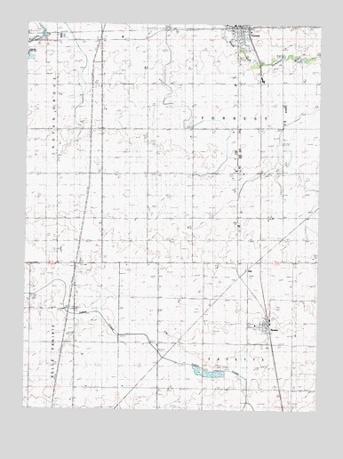
Forrest South, IL USGS Topographic Map
Click on map above to begin viewing in our Map Viewer.

This topographic map contains these locations and features:
Feature Name Type Latitude Longitude GNIS ID View Map
Bee Hive School (historical)SchoolN40.7450°W88.4876°404091View Map
Broadhead School (historical)SchoolN40.7170°W88.4098°404884View Map
Center School (historical)SchoolN40.6875°W88.4103°405820View Map
Five Mile CemeteryCemeteryN40.7389°W88.4078°408420View Map
Forrest - Strawn - Wing Fire Protection DistrictBuildingN40.6524°W88.3971°2682535View Map
Forrest CemeteryCemeteryN40.7389°W88.4084°1737599View Map
Forrest Post OfficePost OfficeN40.7494°W88.4088°2788344View Map
Frye School (historical)SchoolN40.6878°W88.4859°408785View Map
Keeley School (historical)SchoolN40.6884°W88.4473°411340View Map
Knaur School (historical)SchoolN40.6503°W88.4789°411571View Map
Murphy Station (historical)LocaleN40.7014°W88.4481°1737627View Map
Potter School (historical)SchoolN40.7159°W88.4878°416079View Map
RiskPopulated PlaceN40.6709°W88.4053°423123View Map
Rudd School (historical)SchoolN40.7445°W88.4484°417025View Map
Saint Rose Catholic ChurchChurchN40.6503°W88.3970°1737670View Map
South Apostolic Christian CemeteryCemeteryN40.6731°W88.4764°418735View Map
South Church (historical)ChurchN40.6800°W88.4673°418739View Map
StrawnPopulated PlaceN40.6525°W88.3964°419208View Map
Strawn CemeteryCemeteryN40.6526°W88.4039°1737681View Map
Strawn High School (historical)SchoolN40.6525°W88.4017°1737682View Map
Strawn Post OfficePost OfficeN40.6505°W88.3961°1737683View Map
Strawn United Methodist ChurchChurchN40.6520°W88.3978°1737684View Map
Township of FayetteCivilN40.6451°W88.4032°428996View Map
Township of ForrestCivilN40.7164°W88.4102°429012View Map
Village of StrawnCivilN40.6537°W88.3999°2399919View Map
Village ParkParkN40.6528°W88.3973°1737695View Map
Weeks School (historical)SchoolN40.7156°W88.4478°420709View Map

Note: Coordinates in the location and feature list above are referenced to NAD83 datum.


Copyright (C) 2008-2025 Ryan Niemi / Sunset Dynamics ... All Rights Reserved