TopoQuest Logo
Do you find TopoQuest useful?
Help keep TopoQuest running and adding new maps/features by donating!
Bitcoin:  19c7KJd3qBynnjoSw5npx9KScwjBe4ifkT
Litecoin:  LXs6TkuXGGXo1vDsWCkWVdjQX94eUKd6ui
Home View Maps Find Maps Find Places Resources & Links


Bearskin Mountain, Utah Topographic Map

USGS Map Title: Bearskin Mountain, UT
USGS Map MRC: 38112D7
DRG (GeoTIFF) Download: o38112d7.tif


Neighboring USGS Topographic Map Quads:


  Read, UT  
38112E8
 

  Pinnacle Pass, UT  
38112E7
 

  Cinder Crater, UT  
38112E6
 

  Ranch Canyon, UT  
38112D8
 

  Bearskin Mountain, UT  
38112D7
 

  Gillies Hill, UT  
38112D6
 

  Cave Canyon, UT  
38112C8
 

  Adamsville, UT  
38112C7
 

  Beaver, UT  
38112C6


Map MRC Location:

N39°
W113°
N39°
W112°
H8 H7 H6 H5 H4 H3 H2 H1
G8 G7 G6 G5 G4 G3 G2 G1
F8 F7 F6 F5 F4 F3 F2 F1
E8 E7 E6 E5 E4 E3 E2 E1
D8 D7 D6 D5 D4 D3 D2 D1
C8 C7 C6 C5 C4 C3 C2 C1
B8 B7 B6 B5 B4 B3 B2 B1
A8 A7 A6 A5 A4 A3 A2 A1
N38°
W113°
N38°
W112°

Bearskin Mountain, UT USGS 1:24K Topographic Map Preview:
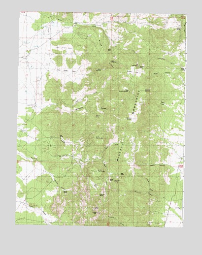
Bearskin Mountain, UT USGS Topographic Map
Click on map above to begin viewing in our Map Viewer.

This topographic map contains these locations and features:
Feature Name Type Latitude Longitude GNIS ID View Map
Bailey MountainSummitN38.4669°W112.8133°1425228View Map
Bailey RidgeRidgeN38.4722°W112.8066°1425229View Map
Bailey SpringSpringN38.4782°W112.8060°1425230View Map
Bearskin FlatFlatN38.4655°W112.7869°1425365View Map
Bearskin MountainSummitN38.4550°W112.7811°1425366View Map
Bettie SpringSpringN38.4056°W112.7975°1425448View Map
Big Cedar CoveBasinN38.4633°W112.8413°1425475View Map
Boulder SpringSpringN38.4020°W112.8024°1425896View Map
Burnt HollowValleyN38.3914°W112.7622°1426184View Map
Carlyle SpringSpringN38.4810°W112.7506°1426361View Map
Granite PeakSummitN38.3827°W112.8155°1428324View Map
Granite Rock SpringSpringN38.4015°W112.8020°1428331View Map
Jackrabbit SpringSpringN38.4694°W112.7844°1429092View Map
Kirk CanyonValleyN38.4255°W112.8505°1429367View Map
Kirk SpringSpringN38.4265°W112.8434°1429368View Map
Left Fork Ranch CanyonValleyN38.4147°W112.8174°1429544View Map
Left Fork Wildhorse CanyonValleyN38.4452°W112.8341°1429557View Map
Little Bearskin MountainSummitN38.4547°W112.7927°1429674View Map
Little Cedar CoveBasinN38.4780°W112.8447°1429690View Map
Mathew SpringSpringN38.4673°W112.7511°1430137View Map
Milford NeedlePillarN38.3855°W112.8161°1430319View Map
North Twin Flat MountainSummitN38.4266°W112.8166°1430872View Map
Old Indian SpringSpringN38.4692°W112.7858°1430978View Map
Patterson HollowValleyN38.4464°W112.7636°1431140View Map
Pumice Hole MineMineN38.4114°W112.8322°1431498View Map
Right Fork Ranch CanyonValleyN38.4144°W112.8172°1431810View Map
Ryan RanchLocaleN38.4919°W112.7549°1432064View Map
Schoo MineMineN38.4864°W112.8236°1432271View Map
Shag HollowValleyN38.4127°W112.7583°1432352View Map
South Twin Flat MountainSummitN38.4072°W112.8144°1432768View Map
Sunnyside HollowValleyN38.3941°W112.7719°1433067View Map
The ParkFlatN38.3997°W112.8174°1433392View Map
Upper Bailey SpringSpringN38.4712°W112.8062°1436555View Map
West Park SpringSpringN38.3933°W112.8127°1434105View Map
Wildcat HollowValleyN38.4639°W112.7561°1434274View Map
Wildhorse CanyonValleyN38.4427°W112.8463°1434283View Map
Wildhorse MountainSummitN38.4383°W112.7899°1434285View Map
Wildhorse SpringSpringN38.4392°W112.8169°1434287View Map
Willow SpringSpringN38.4918°W112.7547°1434347View Map
Wycroft CanyonValleyN38.4108°W112.8569°1434482View Map
Wycroft SpringSpringN38.3956°W112.8398°1434483View Map

Note: Coordinates in the location and feature list above are referenced to NAD83 datum.


Copyright (C) 2008-2025 Ryan Niemi / Sunset Dynamics ... All Rights Reserved