TopoQuest Logo
Do you find TopoQuest useful?
Help keep TopoQuest running and adding new maps/features by donating!
Bitcoin:  19c7KJd3qBynnjoSw5npx9KScwjBe4ifkT
Litecoin:  LXs6TkuXGGXo1vDsWCkWVdjQX94eUKd6ui
Home View Maps Find Maps Find Places Resources & Links


Gillies Hill, Utah Topographic Map

USGS Map Title: Gillies Hill, UT
USGS Map MRC: 38112D6
DRG (GeoTIFF) Download: o38112d6.tif


Neighboring USGS Topographic Map Quads:


  Pinnacle Pass, UT  
38112E7
 

  Cinder Crater, UT  
38112E6
 

  Cove Fort, UT  
38112E5
 

  Bearskin Mountain, UT  
38112D7
 

  Gillies Hill, UT  
38112D6
 

  Pole Mountain, UT  
38112D5
 

  Adamsville, UT  
38112C7
 

  Beaver, UT  
38112C6
 

  Black Ridge, UT  
38112C5


Map MRC Location:

N39°
W113°
N39°
W112°
H8 H7 H6 H5 H4 H3 H2 H1
G8 G7 G6 G5 G4 G3 G2 G1
F8 F7 F6 F5 F4 F3 F2 F1
E8 E7 E6 E5 E4 E3 E2 E1
D8 D7 D6 D5 D4 D3 D2 D1
C8 C7 C6 C5 C4 C3 C2 C1
B8 B7 B6 B5 B4 B3 B2 B1
A8 A7 A6 A5 A4 A3 A2 A1
N38°
W113°
N38°
W112°

Gillies Hill, UT USGS 1:24K Topographic Map Preview:
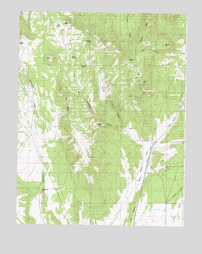
Gillies Hill, UT USGS Topographic Map
Click on map above to begin viewing in our Map Viewer.

This topographic map contains these locations and features:
Feature Name Type Latitude Longitude GNIS ID View Map
Bald RidgesRidgeN38.4366°W112.7119°1425262View Map
Bull HollowValleyN38.4647°W112.6311°1426117View Map
Bull HollowValleyN38.4558°W112.6605°1451162View Map
Chokecherry HollowValleyN38.4319°W112.6755°1426609View Map
Cowboy SpringSpringN38.4834°W112.6972°1427023View Map
Crater KnollSummitN38.4727°W112.7261°1427081View Map
Cunningham HillPopulated PlaceN38.3961°W112.7249°1437539View Map
Fortuna CanyonValleyN38.4327°W112.6694°1428044View Map
Fortune MineMineN38.4466°W112.6791°1428045View Map
Fourmile RidgeRidgeN38.4944°W112.6549°1428066View Map
Fourmile SpringSpringN38.4726°W112.6678°1428068View Map
Gillies HillSummitN38.4580°W112.6588°1428190View Map
Harris MineMineN38.4394°W112.7166°1428550View Map
Hawks Nest SpringSpringN38.4686°W112.7037°1428594View Map
Limestone PointCapeN38.4341°W112.6927°1429634View Map
Little BasinBasinN38.4639°W112.6616°1429670View Map
Little Dry LakeLakeN38.4918°W112.7190°1429724View Map
Maple FlatsFlatN38.4377°W112.7022°1430086View Map
Mud Spring HollowValleyN38.4264°W112.6444°1443718View Map
Red KnollSummitN38.4941°W112.7138°1431657View Map
Wildcat FieldsFlatN38.4155°W112.6536°1434272View Map
Wiregrass SpringSpringN38.4731°W112.7109°1434424View Map
Woodtick HillSummitN38.4816°W112.6411°1434472View Map

Note: Coordinates in the location and feature list above are referenced to NAD83 datum.


Copyright (C) 2008-2025 Ryan Niemi / Sunset Dynamics ... All Rights Reserved