TopoQuest Logo
Do you find TopoQuest useful?
Help keep TopoQuest running and adding new maps/features by donating!
Bitcoin:  19c7KJd3qBynnjoSw5npx9KScwjBe4ifkT
Litecoin:  LXs6TkuXGGXo1vDsWCkWVdjQX94eUKd6ui
Home View Maps Find Maps Find Places Resources & Links


Mendenhall Springs, California Topographic Map

USGS Map Title: Mendenhall Springs, CA
USGS Map MRC: 37121E6
DRG (GeoTIFF) Download: o37121e6.tif


Neighboring USGS Topographic Map Quads:


  Livermore, CA  
37121F7
 

  Altamont, CA  
37121F6
 

  Midway, CA  
37121F5
 

  La Costa Valley, CA  
37121E7
 

  Mendenhall Springs, CA  
37121E6
 

  Cedar Mountain, CA  
37121E5
 

  Calaveras Reservoir, CA  
37121D7
 

  Mount Day, CA  
37121D6
 

  Eylar Mountain, CA  
37121D5


Map MRC Location:

N38°
W122°
N38°
W121°
H8 H7 H6 H5 H4 H3 H2 H1
G8 G7 G6 G5 G4 G3 G2 G1
F8 F7 F6 F5 F4 F3 F2 F1
E8 E7 E6 E5 E4 E3 E2 E1
D8 D7 D6 D5 D4 D3 D2 D1
C8 C7 C6 C5 C4 C3 C2 C1
B8 B7 B6 B5 B4 B3 B2 B1
A8 A7 A6 A5 A4 A3 A2 A1
N37°
W122°
N37°
W121°

Mendenhall Springs, CA USGS 1:24K Topographic Map Preview:
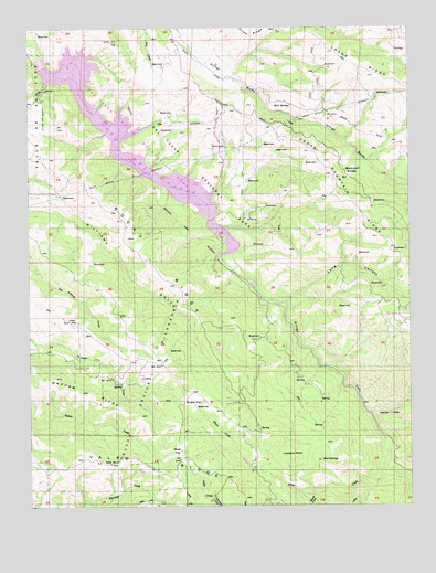
Mendenhall Springs, CA USGS Topographic Map
Click on map above to begin viewing in our Map Viewer.

This topographic map contains these locations and features:
Feature Name Type Latitude Longitude GNIS ID View Map
Ardilla Group CampLocaleN37.5797°W121.7044°1670301View Map
Cedar Mountain RidgeRidgeN37.5649°W121.6311°220790View Map
Crane RidgeRidgeN37.6227°W121.6558°221801View Map
Del Valle 1-056 DamDamN37.6151°W121.7462°1663259View Map
Devils HoleBendN37.5241°W121.6327°222313View Map
Discovery PeakSummitN37.5122°W121.6994°2677923View Map
East Bay Regional Park District Ambulance Station 5BuildingN37.5674°W121.6868°2662318View Map
Heron BayBayN37.6152°W121.7333°1670319View Map
Hetch Hetchy CampLocaleN37.5930°W121.7161°1670320View Map
KKIQ-FM (Livermore)TowerN37.5949°W121.6627°1662922View Map
Lake del ValleReservoirN37.5993°W121.7218°254866View Map
Lake Del Valle State Recreation AreaParkN37.5963°W121.7141°222244View Map
Lang CanyonValleyN37.5533°W121.6666°234132View Map
Lichen Bark Picnic AreaLocaleN37.5785°W121.6975°1670324View Map
Lookout PointSummitN37.5144°W121.6652°1659011View Map
Mendenhall RanchLocaleN37.5891°W121.6480°1724021View Map
Mendenhall SpringsSpringN37.5876°W121.6471°228494View Map
Mendenhall SpringsPopulated PlaceN37.5883°W121.6477°1670327View Map
Mud SpringsSpringN37.5119°W121.6549°229267View Map
Mud SpringsSpringN37.6051°W121.6643°229268View Map
Oak Point Picnic AreaLocaleN37.5849°W121.6944°1670331View Map
Punta Vaca Caravan CampLocaleN37.5666°W121.6866°1670337View Map
Rocky RidgeRidgeN37.5655°W121.7119°231791View Map
Rocky Ridge Visitors CenterBuildingN37.5766°W121.6952°1670338View Map
Rose FlatFlatN37.5147°W121.7019°231885View Map
Rose PeakSummitN37.5111°W121.7247°2677924View Map
Shafer CreekStreamN37.5127°W121.6813°232844View Map
Shafer FlatFlatN37.5277°W121.6972°232845View Map
South Fork Trout CreekStreamN37.5030°W121.6577°235060View Map
Swallow Group CampLocaleN37.5760°W121.6897°1670342View Map
Trout CreekStreamN37.5083°W121.6344°236562View Map
Venados Group CampLocaleN37.5958°W121.7194°1670346View Map

Note: Coordinates in the location and feature list above are referenced to NAD83 datum.


Copyright (C) 2008-2024 Ryan Niemi / Sunset Dynamics ... All Rights Reserved