TopoQuest Logo
Do you find TopoQuest useful?
Help keep TopoQuest running and adding new maps/features by donating!
Bitcoin:  19c7KJd3qBynnjoSw5npx9KScwjBe4ifkT
Litecoin:  LXs6TkuXGGXo1vDsWCkWVdjQX94eUKd6ui
Home View Maps Find Maps Find Places Resources & Links


Midway, California Topographic Map

USGS Map Title: Midway, CA
USGS Map MRC: 37121F5
DRG (GeoTIFF) Download: o37121f5.tif


Neighboring USGS Topographic Map Quads:


  Byron Hot Springs, CA  
37121G6
 

  Clifton Court Forebay, CA  
37121G5
 

  Union Island, CA  
37121G4
 

  Altamont, CA  
37121F6
 

  Midway, CA  
37121F5
 

  Tracy, CA  
37121F4
 

  Mendenhall Springs, CA  
37121E6
 

  Cedar Mountain, CA  
37121E5
 

  Lone Tree Creek, CA  
37121E4


Map MRC Location:

N38°
W122°
N38°
W121°
H8 H7 H6 H5 H4 H3 H2 H1
G8 G7 G6 G5 G4 G3 G2 G1
F8 F7 F6 F5 F4 F3 F2 F1
E8 E7 E6 E5 E4 E3 E2 E1
D8 D7 D6 D5 D4 D3 D2 D1
C8 C7 C6 C5 C4 C3 C2 C1
B8 B7 B6 B5 B4 B3 B2 B1
A8 A7 A6 A5 A4 A3 A2 A1
N37°
W122°
N37°
W121°

Midway, CA USGS 1:24K Topographic Map Preview:
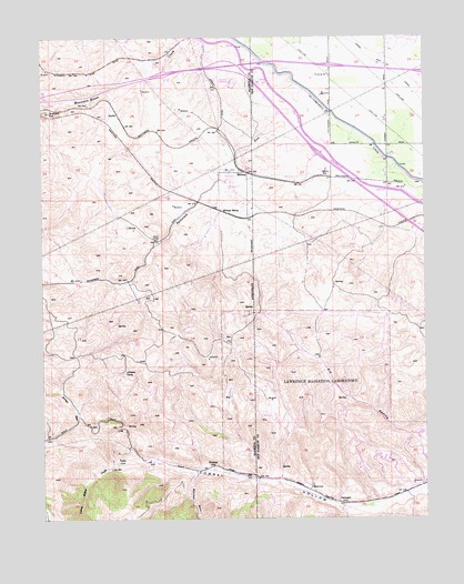
Midway, CA USGS Topographic Map
Click on map above to begin viewing in our Map Viewer.

This topographic map contains these locations and features:
Feature Name Type Latitude Longitude GNIS ID View Map
Alameda County Fire Department Station 21BuildingN37.6336°W121.5046°2623982View Map
Altamont SpeedwayLocaleN37.7383°W121.5622°1654156View Map
CarnegieLocaleN37.6288°W121.5274°220622View Map
Carnegie State Vehicular Recreation AreaParkN37.6338°W121.5446°2570551View Map
CayleyLocaleN37.7302°W121.6005°1658240View Map
Department of Forestry and Fire Protection Station 26 Castle RockBuildingN37.7212°W121.5141°2624701View Map
Johnson CampLocaleN37.6627°W121.5986°226293View Map
MidwayPopulated PlaceN37.7147°W121.5580°252739View Map
Midway SidingLocaleN37.7047°W121.5655°228637View Map
Mitchell RavineValleyN37.6363°W121.5761°228874View Map
Patterson RunStreamN37.7369°W121.5424°230415View Map
PotteryLocaleN37.6388°W121.5702°231000View Map
Redmond CutGapN37.7310°W121.6244°231404View Map
TeslaLocaleN37.6399°W121.6013°236132View Map
Tracy Fire Department Station 94BuildingN37.7214°W121.5137°2624662View Map

Note: Coordinates in the location and feature list above are referenced to NAD83 datum.


Copyright (C) 2008-2025 Ryan Niemi / Sunset Dynamics ... All Rights Reserved