TopoQuest Logo
Do you find TopoQuest useful?
Help keep TopoQuest running and adding new maps/features by donating!
Bitcoin:  19c7KJd3qBynnjoSw5npx9KScwjBe4ifkT
Litecoin:  LXs6TkuXGGXo1vDsWCkWVdjQX94eUKd6ui
Home View Maps Find Maps Find Places Resources & Links


Merino, Montana Topographic Map

USGS Map Title: Merino, MT
USGS Map MRC: 47110B3
DRG (GeoTIFF) Download: o47110b3.tif


Neighboring USGS Topographic Map Quads:


  Geyser, MT  
47110C4
 

  Leiberg Coulee, MT  
47110C3
 

  Arrow Creek, MT  
47110C2
 

  Wolf Butte NW, MT  
47110B4
 

  Merino, MT  
47110B3
 

  Stanford, MT  
47110B2
 

  Wolf Butte, MT  
47110A4
 

  Cayuse Basin, MT  
47110A3
 

  Windham, MT  
47110A2


Map MRC Location:

N48°
W111°
N48°
W110°
H8 H7 H6 H5 H4 H3 H2 H1
G8 G7 G6 G5 G4 G3 G2 G1
F8 F7 F6 F5 F4 F3 F2 F1
E8 E7 E6 E5 E4 E3 E2 E1
D8 D7 D6 D5 D4 D3 D2 D1
C8 C7 C6 C5 C4 C3 C2 C1
B8 B7 B6 B5 B4 B3 B2 B1
A8 A7 A6 A5 A4 A3 A2 A1
N47°
W111°
N47°
W110°

Merino, MT USGS 1:24K Topographic Map Preview:
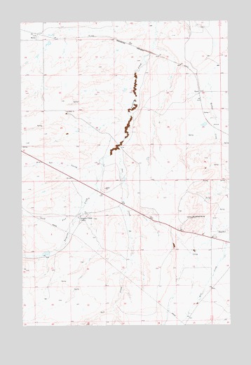
Merino, MT USGS Topographic Map
Click on map above to begin viewing in our Map Viewer.

This topographic map contains these locations and features:
Feature Name Type Latitude Longitude GNIS ID View Map
16N11E02CB__01 WellWellN47.1733°W110.3022°821228View Map
16N11E02DD__01 SpringSpringN47.1697°W110.2863°821213View Map
16N11E04BB__01 SpringSpringN47.1805°W110.3447°821279View Map
16N11E04CD__01 WellWellN47.1719°W110.3388°821223View Map
16N11E04CD__02 WellWellN47.1697°W110.3394°821214View Map
16N11E04CDDC01 WellWellN47.1702°W110.3388°821216View Map
16N11E10AC__01 WellWellN47.1625°W110.3127°821153View Map
16N11E12AA__01 WellWellN47.1661°W110.2652°821189View Map
16N11E12AD__01 WellWellN47.1625°W110.2652°821152View Map
16N11E13A___01 WellWellN47.1497°W110.2677°821036View Map
16N11E13BB__01 WellWellN47.1516°W110.2810°821059View Map
16N11E13CC__01 WellWellN47.1408°W110.2810°820980View Map
16N11E16AC__01 SpringSpringN47.1480°W110.3341°821023View Map
16N11E16CB__01 SpringSpringN47.1444°W110.3447°821002View Map
16N11E17BA__01 SpringSpringN47.1516°W110.3605°821060View Map
16N11E17BB__01 SpringSpringN47.1516°W110.3658°821061View Map
16N11E20BD__01 WellWellN47.1333°W110.3605°820934View Map
16N11E23AD__01 SpringSpringN47.1333°W110.2863°820933View Map
16N11E23CA__01 SpringSpringN47.1297°W110.2969°820920View Map
16N11E24____01 WellWellN47.1316°W110.2730°820930View Map
16N11E24A___01 WellWellN47.1352°W110.2677°820945View Map
16N12E07BB__01 WellWellN47.1655°W110.2610°821183View Map
16N12E07BB__02 WellWellN47.1655°W110.2610°821184View Map
16N12E07CA__01 SpringSpringN47.1583°W110.2558°821115View Map
16N12E07CB__01 SpringSpringN47.1583°W110.2610°821116View Map
16N12E07CB__02 SpringSpringN47.1583°W110.2610°821117View Map
16N12E07DC__01 WellWellN47.1547°W110.2505°821083View Map
16N12E07DC__02 WellWellN47.1547°W110.2505°821084View Map
16N12E18BA__01 WellWellN47.1511°W110.2558°821055View Map
16N12E18CC__01 SpringSpringN47.1402°W110.2610°820975View Map
17N11E07DD__01 WellWellN47.2436°W110.3666°821651View Map
17N11E08DA__01 WellWellN47.2472°W110.3455°821670View Map
17N11E12DB__01 WellWellN47.2472°W110.2660°821669View Map
17N11E18AA__01 WellWellN47.2400°W110.3666°821626View Map
17N11E18DA__01 SpringSpringN47.2333°W110.3647°821593View Map
17N11E23BD__01 WellWellN47.2227°W110.2899°821533View Map
17N11E25AB__01 SpringSpringN47.2121°W110.2627°821469View Map
17N11E27BA__01 WellWellN47.2108°W110.3135°821465View Map
17N11E27CAAB01 WellWellN47.2064°W110.3102°821432View Map
17N11E28CD__01 SpringSpringN47.2000°W110.3349°821391View Map
17N11E29DB__01 SpringSpringN47.2036°W110.3508°821416View Map
17N11E30AD__01 SpringSpringN47.2066°W110.3645°821435View Map
17N11E33AC__01 WellWellN47.1927°W110.3297°821345View Map
17N11E33DB__01 WellWellN47.1891°W110.3297°821318View Map
17N11E33DD__01 WellWellN47.1855°W110.3244°821302View Map
17N12E19CB__01 WellWellN47.2175°W110.2566°821500View Map
Antelope ButteSummitN47.1700°W110.2733°768273View Map
DoverPopulated PlaceN47.2205°W110.2683°770733View Map
Dover (historical)LocaleN47.2205°W110.2683°1750752View Map
Dover Post Office (historical)Post OfficeN47.2205°W110.2683°1750623View Map
Fox CouleeValleyN47.1939°W110.3269°783664View Map
Longs (historical)LocaleN47.2205°W110.2674°1750738View Map
MerinoPopulated PlaceN47.2439°W110.3660°774109View Map
Merino (historical)LocaleN47.2439°W110.3660°1750749View Map
Merino Post Office (historical)Post OfficeN47.2439°W110.3660°1750621View Map
Merino School (historical)SchoolN47.2439°W110.3660°1750677View Map
North Fork Surprise CreekStreamN47.1736°W110.3391°788256View Map
Sun CreekStreamN47.1983°W110.3180°791676View Map
Surprise Creek ColonyPopulated PlaceN47.1702°W110.3402°801576View Map
Surprise Creek Colony SchoolSchoolN47.1694°W110.3416°1750761View Map
Tobin (historical)LocaleN47.2083°W110.2647°1750730View Map
Wendall Willkie DamDamN47.2083°W110.2658°798637View Map
Wilson DamDamN47.1550°W110.3641°796399View Map

Note: Coordinates in the location and feature list above are referenced to NAD83 datum.


Copyright (C) 2008-2025 Ryan Niemi / Sunset Dynamics ... All Rights Reserved