TopoQuest Logo
Do you find TopoQuest useful?
Help keep TopoQuest running and adding new maps/features by donating!
Bitcoin:  19c7KJd3qBynnjoSw5npx9KScwjBe4ifkT
Litecoin:  LXs6TkuXGGXo1vDsWCkWVdjQX94eUKd6ui
Home View Maps Find Maps Find Places Resources & Links


Windham, Montana Topographic Map

USGS Map Title: Windham, MT
USGS Map MRC: 47110A2
DRG (GeoTIFF) Download: o47110a2.tif


Neighboring USGS Topographic Map Quads:


  Merino, MT  
47110B3
 

  Stanford, MT  
47110B2
 

  Stanford NE, MT  
47110B1
 

  Cayuse Basin, MT  
47110A3
 

  Windham, MT  
47110A2
 

  Benchland, MT  
47110A1
 

  Woodhurst Mountain, MT  
46110H3
 

  Red Hill, MT  
46110H2
 

  Utica, MT  
46110H1


Map MRC Location:

N48°
W111°
N48°
W110°
H8 H7 H6 H5 H4 H3 H2 H1
G8 G7 G6 G5 G4 G3 G2 G1
F8 F7 F6 F5 F4 F3 F2 F1
E8 E7 E6 E5 E4 E3 E2 E1
D8 D7 D6 D5 D4 D3 D2 D1
C8 C7 C6 C5 C4 C3 C2 C1
B8 B7 B6 B5 B4 B3 B2 B1
A8 A7 A6 A5 A4 A3 A2 A1
N47°
W111°
N47°
W110°

Windham, MT USGS 1:24K Topographic Map Preview:
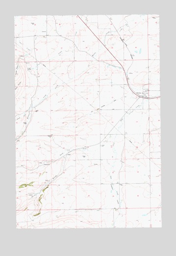
Windham, MT USGS Topographic Map
Click on map above to begin viewing in our Map Viewer.

This topographic map contains these locations and features:
Feature Name Type Latitude Longitude GNIS ID View Map
14N12E01AC__01 SpringSpringN47.0041°W110.1441°820083View Map
14N12E01AC__02 WellWellN47.0041°W110.1441°820084View Map
14N12E02AB__01 WellWellN47.0077°W110.1652°820109View Map
14N12E02AB__02 SpringSpringN47.0077°W110.1652°820110View Map
14N12E02AD__01 SpringSpringN47.0041°W110.1599°820085View Map
14N12E02CA__01 WellWellN47.0005°W110.1705°820052View Map
14N12E02CA__02 WellWellN47.0005°W110.1705°820053View Map
14N12E03BA__01 SpringSpringN47.0077°W110.1916°820111View Map
14N12E03BA__02 SpringSpringN47.0077°W110.1916°820112View Map
14N12E04AA__01 SpringSpringN47.0077°W110.2024°820113View Map
14N12E04AB__01 SpringSpringN47.0077°W110.2077°820114View Map
14N12E04BC__01 WellWellN47.0041°W110.2183°820086View Map
14N12E05BB__01 SpringSpringN47.0077°W110.2394°820115View Map
14N12E05CA__01 WellWellN47.0005°W110.2341°820054View Map
14N12E05CB__01 SpringSpringN47.0005°W110.2394°820055View Map
14N13E06BC__01 SpringSpringN47.0061°W110.1324°820102View Map
15N12E01CB__01 WellWellN47.0872°W110.1555°820654View Map
15N12E01CBAD01 WellWellN47.0900°W110.1516°820674View Map
15N12E02AB__01 WellWellN47.0944°W110.1660°820701View Map
15N12E02AD__01 WellWellN47.0908°W110.1608°820678View Map
15N12E02ADBD01 WellWellN47.0933°W110.1602°820697View Map
15N12E02BBBA01 WellWellN47.0977°W110.1755°820723View Map
15N12E03AA__01 WellWellN47.0944°W110.1819°820702View Map
15N12E03AA__02 WellWellN47.0944°W110.1819°820703View Map
15N12E03AA__03 WellWellN47.0944°W110.1819°820704View Map
15N12E03DD__01 WellWellN47.0836°W110.1819°820633View Map
15N12E04____01 WellWellN47.0891°W110.2108°820668View Map
15N12E04____02 WellWellN47.0891°W110.2108°820669View Map
15N12E04BA__01 WellWellN47.0944°W110.2133°820705View Map
15N12E05BB__01 SpringSpringN47.0964°W110.2391°820714View Map
15N12E05BC__01 SpringSpringN47.0925°W110.2391°820693View Map
15N12E05BC__02 SpringSpringN47.0908°W110.2397°820679View Map
15N12E06DB__01 SpringSpringN47.0889°W110.2499°820667View Map
15N12E10CB__01 SpringSpringN47.0727°W110.1977°820563View Map
15N12E10DD__01 WellWellN47.0691°W110.1819°820543View Map
15N12E11AADC01 WellWellN47.0800°W110.1585°820614View Map
15N12E11CC__01 SpringSpringN47.0691°W110.1766°820542View Map
15N12E12AACA01 WellWellN47.0814°W110.1391°820625View Map
15N12E12AD__01 WellWellN47.0764°W110.1396°820584View Map
15N12E12ADAC01 WellWellN47.0786°W110.1380°820605View Map
15N12E12BD__01 WellWellN47.0764°W110.1502°820585View Map
15N12E12DA__01 WellWellN47.0727°W110.1396°820559View Map
15N12E12DA__02 WellWellN47.0727°W110.1396°820560View Map
15N12E12DB__01 WellWellN47.0727°W110.1449°820561View Map
15N12E12DB__02 WellWellN47.0727°W110.1449°820562View Map
15N12E13BABB01 WellWellN47.0689°W110.1516°820538View Map
15N12E13CADD01 WellWellN47.0591°W110.1469°820491View Map
15N12E14AC__01 WellWellN47.0619°W110.1660°820500View Map
15N12E14CA__01 WellWellN47.0583°W110.1713°820482View Map
15N12E14CA__02 WellWellN47.0583°W110.1713°820483View Map
15N12E15BA__01 SpringSpringN47.0655°W110.1924°820525View Map
15N12E15CB__01 WellWellN47.0583°W110.1977°820484View Map
15N12E15DD__01 WellWellN47.0547°W110.1819°820436View Map
15N12E16CA__01 WellWellN47.0583°W110.2133°820485View Map
15N12E18AA__01 WellWellN47.0655°W110.2449°820526View Map
15N12E20DB__01 SpringSpringN47.0441°W110.2291°820378View Map
15N12E21DB__01 WellWellN47.0441°W110.2080°820377View Map
15N12E22CD__01 WellWellN47.0405°W110.1924°820360View Map
15N12E23____01 WellWellN47.0458°W110.1685°820383View Map
15N12E23BA__01 WellWellN47.0514°W110.1713°820417View Map
15N12E23BA__02 WellWellN47.0514°W110.1713°820418View Map
15N12E23BA__03 WellWellN47.0514°W110.1713°820419View Map
15N12E23BB__01 SpringSpringN47.0514°W110.1766°820420View Map
15N12E23DB__01 SpringSpringN47.0441°W110.1660°820376View Map
15N12E24AD__01 WellWellN47.0477°W110.1396°820390View Map
15N12E25CB__01 SpringSpringN47.0297°W110.1555°820274View Map
15N12E25DA__01 SpringSpringN47.0297°W110.1396°820273View Map
15N12E25DD__01 WellWellN47.0261°W110.1396°820238View Map
15N12E26AA__01 SpringSpringN47.0369°W110.1608°820341View Map
15N12E27DC__01 WellWellN47.0261°W110.1871°820239View Map
15N12E28CA__01 SpringSpringN47.0297°W110.2133°820275View Map
15N12E29AA__01 WellWellN47.0369°W110.2238°820342View Map
15N12E29AA__02 WellWellN47.0369°W110.2238°820343View Map
15N12E29ABDD01 WellWellN47.0366°W110.2263°820334View Map
15N12E29BA__01 WellWellN47.0369°W110.2344°820344View Map
15N12E30DA__01 SpringSpringN47.0297°W110.2449°820276View Map
15N12E32BC__01 SpringSpringN47.0189°W110.2397°820188View Map
15N12E32BD__01 SpringSpringN47.0189°W110.2344°820187View Map
15N12E32CD__01 SpringSpringN47.0116°W110.2344°820132View Map
15N12E33AB__01 SpringSpringN47.0225°W110.2080°820221View Map
15N12E34BA__01 SpringSpringN47.0225°W110.1924°820220View Map
15N12E35AB__01 WellWellN47.0225°W110.1660°820219View Map
15N12E35BD__01 SpringSpringN47.0189°W110.1713°820186View Map
15N12E35CA__01 SpringSpringN47.0152°W110.1713°820159View Map
15N12E35DA__01 WellWellN47.0152°W110.1608°820158View Map
16N12E25BD__01 WellWellN47.1189°W110.1510°820856View Map
16N12E25CB__01 WellWellN47.1152°W110.1563°820832View Map
16N12E26CD__01 WellWellN47.1116°W110.1719°820808View Map
16N12E27CB__01 WellWellN47.1152°W110.1983°820833View Map
16N12E28AB__01 WellWellN47.1225°W110.2085°820882View Map
16N12E28AB__02 WellWellN47.1225°W110.2085°820883View Map
16N12E28CCAA01 WellWellN47.1158°W110.2152°820840View Map
16N12E28CD__01 WellWellN47.1116°W110.2138°820809View Map
16N12E29AA__02 WellWellN47.1225°W110.2244°820884View Map
16N12E29AA__03 WellWellN47.1225°W110.2244°820885View Map
16N12E29BD__01 WellWellN47.1189°W110.2349°820857View Map
16N12E29DD__01 WellWellN47.1116°W110.2244°820810View Map
16N12E30DBDA01 WellWellN47.1172°W110.2499°820849View Map
16N12E31AA__01 WellWellN47.1080°W110.2452°820787View Map
16N12E32AA__01 WellWellN47.1080°W110.2244°820784View Map
16N12E32AA__02 WellWellN47.1080°W110.2244°820785View Map
16N12E32AA__03 WellWellN47.1080°W110.2244°820786View Map
16N12E32BD__01 WellWellN47.1044°W110.2349°820751View Map
16N12E32DD__01 WellWellN47.0972°W110.2244°820719View Map
16N12E33AA__01 WellWellN47.1080°W110.2033°820783View Map
16N12E34BCBA01 WellWellN47.1086°W110.1971°820793View Map
16N12E34DB__01 WellWellN47.1008°W110.1877°820740View Map
16N12E35AC__01 WellWellN47.1044°W110.1666°820750View Map
16N12E35BABB01 WellWellN47.1127°W110.1724°820817View Map
16N12E35CB__01 SpringSpringN47.1008°W110.1771°820739View Map
16N12E35CC__01 WellWellN47.0972°W110.1771°820717View Map
16N12E35CC__02 WellWellN47.0972°W110.1771°820718View Map
16N12E35CCCD01 WellWellN47.0986°W110.1760°820730View Map
16N12E36CA__01 WellWellN47.1008°W110.1510°820738View Map
16N12E36CAAB01 WellWellN47.1050°W110.1485°820758View Map
Coyote SpringSpringN47.0930°W110.2397°770262View Map
Judith Basin Rural Fire District WindhamBuildingN47.0792°W110.1409°2546738View Map
LehighPopulated PlaceN47.0433°W110.2072°773288View Map
Lehigh (historical)LocaleN47.0433°W110.2072°1750739View Map
Lehigh CemeteryCemeteryN47.0480°W110.1774°773289View Map
Lehigh Post Office (historical)Post OfficeN47.0433°W110.2072°1750608View Map
Lehigh School (historical)SchoolN47.0433°W110.2072°1750675View Map
North Fork Sage CreekStreamN47.0591°W110.1608°788241View Map
North Fork Willow CreekStreamN47.0691°W110.2388°788283View Map
Pleasant ValleyValleyN47.0414°W110.1685°775283View Map
Pleasant Valley CemeteryCemeteryN47.0446°W110.2007°1750764View Map
ScholtztownPopulated PlaceN47.0377°W110.2269°776270View Map
Sifton Post Office (historical)Post OfficeN47.1000°W110.1813°1750597View Map
Spring BranchStreamN47.0458°W110.2002°791196View Map
WindhamLocaleN47.0786°W110.1405°1750591View Map
WindhamPopulated PlaceN47.0786°W110.1405°778583View Map
Windham Post Office (historical)Post OfficeN47.0786°W110.1405°1750590View Map
Windham School (historical)SchoolN47.0786°W110.1405°1750674View Map

Note: Coordinates in the location and feature list above are referenced to NAD83 datum.


Copyright (C) 2008-2025 Ryan Niemi / Sunset Dynamics ... All Rights Reserved