TopoQuest Logo
Do you find TopoQuest useful?
Help keep TopoQuest running and adding new maps/features by donating!
Bitcoin:  19c7KJd3qBynnjoSw5npx9KScwjBe4ifkT
Litecoin:  LXs6TkuXGGXo1vDsWCkWVdjQX94eUKd6ui
Home View Maps Find Maps Find Places Resources & Links


Geyser, Montana Topographic Map

USGS Map Title: Geyser, MT
USGS Map MRC: 47110C4
DRG (GeoTIFF) Download: o47110c4.tif


Neighboring USGS Topographic Map Quads:


  Arrow Peak, MT  
47110D5
 

  Palisade Butte, MT  
47110D4
 

  Jiggs Flat, MT  
47110D3
 

  Byrne Creek, MT  
47110C5
 

  Geyser, MT  
47110C4
 

  Leiberg Coulee, MT  
47110C3
 

  The Arch, MT  
47110B5
 

  Wolf Butte NW, MT  
47110B4
 

  Merino, MT  
47110B3


Map MRC Location:

N48°
W111°
N48°
W110°
H8 H7 H6 H5 H4 H3 H2 H1
G8 G7 G6 G5 G4 G3 G2 G1
F8 F7 F6 F5 F4 F3 F2 F1
E8 E7 E6 E5 E4 E3 E2 E1
D8 D7 D6 D5 D4 D3 D2 D1
C8 C7 C6 C5 C4 C3 C2 C1
B8 B7 B6 B5 B4 B3 B2 B1
A8 A7 A6 A5 A4 A3 A2 A1
N47°
W111°
N47°
W110°

Geyser, MT USGS 1:24K Topographic Map Preview:
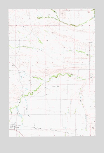
Geyser, MT USGS Topographic Map
Click on map above to begin viewing in our Map Viewer.

This topographic map contains these locations and features:
Feature Name Type Latitude Longitude GNIS ID View Map
17N10E01AB__01 SpringSpringN47.2705°W110.3924°821841View Map
17N10E01AB__02 SpringSpringN47.2705°W110.3924°821842View Map
17N10E01BA__01 SpringSpringN47.2697°W110.3966°821838View Map
17N10E01DD__01 WellWellN47.2597°W110.3872°821754View Map
17N10E02BD__01 SpringSpringN47.2669°W110.4191°821810View Map
17N10E02CC__01 WellWellN47.2597°W110.4244°821755View Map
17N10E03AC__01 SpringSpringN47.2669°W110.4349°821811View Map
17N10E03BA__01 WellWellN47.2705°W110.4402°821843View Map
17N10E03CD__01 SpringSpringN47.2597°W110.4402°821757View Map
17N10E03DC__01 SpringSpringN47.2597°W110.4349°821756View Map
17N10E04DC__01 WellWellN47.2597°W110.4563°821759View Map
17N10E04DD__01 SpringSpringN47.2597°W110.4510°821758View Map
17N10E05BC__01 WellWellN47.2669°W110.4883°821812View Map
17N10E05CCD_01 WellWellN47.2572°W110.4872°821736View Map
17N10E05CD__01 WellWellN47.2597°W110.4830°821761View Map
17N10E05CD__02 WellWellN47.2597°W110.4830°821762View Map
17N10E05CD__03 WellWellN47.2597°W110.4830°821763View Map
17N10E05DCDB01 WellWellN47.2580°W110.4758°821741View Map
17N10E05DD__01 WellWellN47.2597°W110.4722°821760View Map
17N10E06AC__01 WellWellN47.2669°W110.4988°821813View Map
17N10E06AC__02 WellWellN47.2669°W110.4988°821814View Map
17N10E06DD__01 WellWellN47.2597°W110.4935°821764View Map
17N10E08BA__01 SpringSpringN47.2561°W110.4830°821727View Map
17N10E09AB__01 SpringSpringN47.2561°W110.4563°821726View Map
17N10E12BA__01 SpringSpringN47.2561°W110.3977°821725View Map
17N10E31DA__01 WellWellN47.3527°W110.4191°822396View Map
18N10E01BC__01 WellWellN47.3527°W110.4030°822395View Map
18N10E01BD__01 WellWellN47.3527°W110.3977°822392View Map
18N10E01BD__02 SpringSpringN47.3527°W110.3977°822393View Map
18N10E01BD__03 SpringSpringN47.3527°W110.3977°822394View Map
18N10E01DD__01 WellWellN47.3455°W110.3872°822356View Map
18N10E01DD__02 SpringSpringN47.3461°W110.3863°822359View Map
18N10E02BD__02 WellWellN47.3527°W110.4191°822397View Map
18N10E05BB__01 SpringSpringN47.3564°W110.4880°822423View Map
18N10E06AC__01 SpringSpringN47.3527°W110.4988°822398View Map
18N10E07DD__02 SpringSpringN47.3311°W110.4935°822261View Map
18N10E13CA__01 WellWellN47.3202°W110.3977°822186View Map
18N10E13CA__02 WellWellN47.3202°W110.3977°822187View Map
18N10E18AD__01 SpringSpringN47.3239°W110.4935°822210View Map
18N10E22CD__01 SpringSpringN47.3019°W110.4402°822069View Map
18N10E22DA__01 SpringSpringN47.3055°W110.4297°822097View Map
18N10E23DA__01 SpringSpringN47.3055°W110.4085°822096View Map
18N10E24CB__01 SpringSpringN47.3055°W110.4030°822095View Map
18N10E25BA__01 SpringSpringN47.2983°W110.3977°822048View Map
18N10E28AD__01 SpringSpringN47.2947°W110.4510°822010View Map
18N10E29CDDC01 WellWellN47.2866°W110.4819°821959View Map
18N10E32B___01 WellWellN47.2822°W110.4855°821928View Map
18N10E32B___02 WellWellN47.2822°W110.4855°821929View Map
18N10E32CC__01 WellWellN47.2730°W110.4880°821862View Map
18N10E32CCCA01 WellWellN47.2727°W110.4877°821858View Map
18N10E32D___01 WellWellN47.2750°W110.4749°821879View Map
18N10E34CC__01 SpringSpringN47.2730°W110.4455°821861View Map
18N10E35CD__01 WellWellN47.2730°W110.4191°821860View Map
18N10E35CDCD01 WellWellN47.2719°W110.4185°821850View Map
18N10E35DD__01 SpringSpringN47.2730°W110.4085°821859View Map
18N11E30CC__01 WellWellN47.2864°W110.3802°821957View Map
18N11E31CB__01 WellWellN47.2755°W110.3802°821885View Map
18N11E31CB__02 WellWellN47.2755°W110.3802°821886View Map
19N10E32CB__01 SpringSpringN47.3644°W110.4877°822461View Map
19N10E32CD__01 SpringSpringN47.3608°W110.4824°822443View Map
19N10E33BD__01 SpringSpringN47.3680°W110.4613°822482View Map
19N10E35AD__01 WellWellN47.3680°W110.4083°822481View Map
19N11E31BD__01 SpringSpringN47.3675°W110.3752°822477View Map
Arrow Creek SpringSpringN47.2989°W110.4333°768351View Map
Big Flat SpringSpringN47.2992°W110.4315°768789View Map
Crow CouleeValleyN47.2752°W110.4991°781920View Map
Dipping Vat CreekStreamN47.3061°W110.3899°782389View Map
Dordrecht DamDamN47.2700°W110.4841°798638View Map
Doukhobors DamDamN47.2766°W110.4891°798640View Map
Draco DamDamN47.3083°W110.4824°798639View Map
Dramamine DamDamN47.2966°W110.4741°798641View Map
GeyserPopulated PlaceN47.2591°W110.4933°771749View Map
GeyserLocaleN47.2591°W110.4933°1750747View Map
Geyser Census Designated PlaceCensusN47.2633°W110.4927°2629756View Map
Geyser Community Presbyterian ChurchChurchN47.2591°W110.4933°1750694View Map
Geyser ElevatorLocaleN47.2591°W110.4933°1750703View Map
Geyser Post OfficePost OfficeN47.2608°W110.4946°1750618View Map
Geyser Public SchoolsSchoolN47.2572°W110.4924°1750687View Map
Geyser Volunteer Fire CompanyBuildingN47.2604°W110.4962°1750688View Map
Hay CreekStreamN47.3044°W110.4485°784649View Map
Lone Tree CreekStreamN47.2900°W110.4794°767981View Map
Martin CreekStreamN47.3633°W110.4272°786880View Map
McCarthy CreekStreamN47.2797°W110.4902°786992View Map
Rose CreekStreamN47.3352°W110.4438°789773View Map
Saint Cyril ChurchChurchN47.2591°W110.4933°1750695View Map

Note: Coordinates in the location and feature list above are referenced to NAD83 datum.


Copyright (C) 2008-2025 Ryan Niemi / Sunset Dynamics ... All Rights Reserved